Ambikapur, Chhattisgarh
Ambikapur is the headquarters city of Surguja district in the Indian state of Chhattisgarh. It is one of the oldest cities in the state, in east-central India. Ambikapur is also the divisional headquarters of Surguja Division which consists of the five districts of Surguja, Koriya, Balrampur, Surajpur and Jashpur.
Ambikapur | |
|---|---|
 Ambikapur Location in Chhattisgarh  Ambikapur Ambikapur (India) | |
| Coordinates: 23.12°N 83.2°E | |
| Country | |
| District | Surguja |
| Named for | Mahamaya Temple |
| Government | |
| • Body | Nagar Nigam Ambikapur |
| • Mayor | Ajay Tirkey (INC) |
| Area | |
| • City | 1,983 km2 (766 sq mi) |
| Elevation | 623 m (2,044 ft) |
| Population (2011)[1] | |
| • City | 264,575 |
| • Rank | 5th (In Chhattisgarh) |
| • Density | 130/km2 (350/sq mi) |
| • Metro | 343,173 |
| Demonym(s) | Ambikapurian |
| Languages | |
| • Official | Hindi, Chhattisgarhi |
| Time zone | UTC+5:30 (IST) |
| PIN | 497001 |
| Area code(s) | 7774 |
| Vehicle registration | CG-15 |
| Website | surguja |
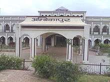
Ambikapur was the capital of the Princely state of Surguja before Indian Independence. The name of the city is derived from the Hindu goddess Ambika (Mahamaya) Devi, who is the central figure of worship in the area.[3] Ambikapur is the 8th largest city in Chhattisgarh. This city is also Cleanest cities of India (2020)
Geography
Ambikapur is located at 23°12′N 83°2′E.[4] It has an average elevation of 623 metres (2078 feet). The district is spread over a forest-rich area of 22,237 km². Most of the district's terrain is forested and hilly. Natural resources include bauxite, forest products and paddy crops.
Tourism
Major tourist attractions include:
- Mahamaya Temple
- Tiger Point Waterfall and a Buddha Temple,
- Fish point,
- Chendra waterfall (picnic spot),
- Ramgarh in Surajpur District,
- Kudargarh in Surajpur District (Bagheshwari Devi Temple)
- Bhaiyathan in Surajpur District (Patal Bhairav Mandir)
- Dipadih (Ancient Sculptors),
- Rakasganda,
- Sitabengara,
- Tattapani (hot spring)
- Semarsot.
- Maa Vaneshwari Devi temple
Climate
| Climate data for Ambikapur, Chhattisgarh (1981–2010, extremes 1951–2012) | |||||||||||||
|---|---|---|---|---|---|---|---|---|---|---|---|---|---|
| Month | Jan | Feb | Mar | Apr | May | Jun | Jul | Aug | Sep | Oct | Nov | Dec | Year |
| Record high °C (°F) | 30.5 (86.9) |
34.8 (94.6) |
39.7 (103.5) |
43.8 (110.8) |
44.8 (112.6) |
44.9 (112.8) |
38.4 (101.1) |
36.1 (97.0) |
35.7 (96.3) |
34.5 (94.1) |
32.4 (90.3) |
29.5 (85.1) |
44.9 (112.8) |
| Average high °C (°F) | 23.2 (73.8) |
26.7 (80.1) |
32.2 (90.0) |
37.3 (99.1) |
39.4 (102.9) |
35.5 (95.9) |
29.8 (85.6) |
29.4 (84.9) |
29.8 (85.6) |
29.3 (84.7) |
26.2 (79.2) |
23.5 (74.3) |
30.2 (86.4) |
| Average low °C (°F) | 9.1 (48.4) |
11.8 (53.2) |
16.1 (61.0) |
21.2 (70.2) |
24.8 (76.6) |
24.8 (76.6) |
23.2 (73.8) |
23.0 (73.4) |
22.2 (72.0) |
18.1 (64.6) |
12.9 (55.2) |
9.0 (48.2) |
18.0 (64.4) |
| Record low °C (°F) | 0.9 (33.6) |
2.5 (36.5) |
7.8 (46.0) |
10.6 (51.1) |
16.1 (61.0) |
17.2 (63.0) |
16.4 (61.5) |
19.8 (67.6) |
15.7 (60.3) |
9.4 (48.9) |
4.2 (39.6) |
1.7 (35.1) |
0.9 (33.6) |
| Average rainfall mm (inches) | 25.8 (1.02) |
20.1 (0.79) |
19.5 (0.77) |
13.6 (0.54) |
21.3 (0.84) |
235.0 (9.25) |
411.2 (16.19) |
352.2 (13.87) |
227.0 (8.94) |
48.4 (1.91) |
14.0 (0.55) |
11.2 (0.44) |
1,399.2 (55.09) |
| Average rainy days | 2.1 | 1.9 | 1.8 | 1.3 | 2.6 | 10.0 | 17.5 | 15.7 | 11.2 | 3.4 | 1.0 | 0.8 | 69.4 |
| Average relative humidity (%) (at 17:30 IST) | 50 | 40 | 29 | 23 | 28 | 55 | 81 | 83 | 79 | 64 | 57 | 54 | 54 |
| Source: India Meteorological Department[5][6] | |||||||||||||
Land
The land is classified into six categories. About 41.67% is under agriculture, while about 5.70% remains fallow. A further 11.44% of the land could be brought under cultivation by improvements in farming techniques and reclamation of marginal areas . A further 1.27% is barren and uncultivated while 33.09% is forest cover and 6.83% is covered by buildings, roads and other infrastructure.
This distribution of cultivated land reflects the patterns and intensity of early agricultural practices and the extent of the population, combined with physical factors. Areas with a high concentration of cultivated land are generally those with longer histories of settlement and agricultural use. In the Ambikapur block 74.51% of the total geographical area is cultivated.
Demographics
As per the 2011 census, Ambikapur municipal corporation had a population of 264,575 and the urban agglomeration had a population of 343,173. The municipality had a sex ratio of 920 females per 1,000 males and 11.3% of the population was under six years old.[1] Effective literacy was 88.20%; male literacy was 92.73% and female literacy was 83.29%.[1]
Ambikapur is inhabited by people from across India. Moderate weather makes it an attractive place for settlement. Unlike the capital, the district population comprises aboriginal populations including the Pandos and Korwas, who still live in rural areas.
Ambikapur is home to a large number of Tibetan migrants who took refuge in India after the Chinese annexation of Tibet in 1959.
Transport
Rail
Ambikapur is connected to the Anuppur railway junction, a bordering town in Madhya Pradesh, by a broad gauge railway. Trains reach Ambikapur from Katni, Satna, Jabalpur, Durg, Bhopal and the state capital Raipur. More destinations, such as New Delhi, can be reached from Anuppur railway junction.
Jabalpur - Ambikapur Express, Ambikapur – Shahdol, Ambikapur – Surajpur – Anuppur – Bilaspur – Raipur – Durg Express and Bhopal – Chirmiri Passenger run from major cities Bhopal, Gwalior, Katni, Raipur and Jabalpur.
Road
Ambikapur is well connected by road to other major cities of Chhattisgarh such as Raipur, Bilaspur, Durg, Bhilai, Korba and Raigarh. Daily bus services also runs for Varanasi, Renukoot in U.P (170 km), Raipur (345 km) and Garhwa in Jharkhand (160 km). Bus services from Anuppur to Ambikapur operate via Manendragarh and Surajpur. The bus journeys from Bilaspur and Anuppur take between five and six hours.
Media and communications
State-owned All India Radio has a local station in Ambikapur.
Web portals
| Website name | URL | Notes |
|---|---|---|
| Official Government Portal for the district of Surguja | http://cg.nic.in/surguja// | Official government website for the district. Land records and other e-governance projects are available from here. |
| District Court Surguja | https://web.archive.org/web/20140914121349/http://ecourts.gov.in/surguja | Official website of the district court of Surguja |
| Official website of Nagar Nigam Ambikapur | http://nagarnigamambikapur.co.in/ | Official website of Nagar Nigam Ambikapur |
University
References
- "Provisional Population Totals, Census of India 2011; Cities having population 1 lakh and above" (pdf). Office of the Registrar General & Census Commissioner, India. Retrieved 27 March 2012.
- "Provisional Population Totals, Census of India 2011; Urban Agglomerations/Cities having population 3 lakh and above" (pdf). Office of the Registrar General & Census Commissioner, India. Retrieved 27 March 2012.
- "Surguja". Archived from the original on 7 January 2013. Retrieved 28 January 2013.
- Falling Rain Genomics, Inc – Ambikapur
- "Station: Ambikapur Climatological Table 1981–2010" (PDF). Climatological Normals 1981–2010. India Meteorological Department. January 2015. pp. 37–38. Archived from the original (PDF) on 5 February 2020. Retrieved 19 February 2020.
- "Extremes of Temperature & Rainfall for Indian Stations (Up to 2012)" (PDF). India Meteorological Department. December 2016. p. M39. Archived from the original (PDF) on 5 February 2020. Retrieved 19 February 2020.