Babindol
Babindol (Hungarian: Babindál) is a village and municipality in the Nitra District in western centralSlovakia, in the Nitra Region.
Babindol | |
|---|---|
Village | |
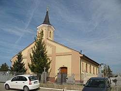 | |
 Babindol Location in Slovakia | |
| Coordinates: 48°17′21″N 18°14′29″E | |
| Country | |
| Region | Nitra |
| District | Nitra |
| First mentioned | 1271 |
| Area | |
| • Total | 5.41 km2 (2.09 sq mi) |
| Elevation | 195 m (640 ft) |
| Population (2018) | |
| • Total | 790 |
| • Density | 150/km2 (380/sq mi) |
| Time zone | UTC+1 (CET) |
| • Summer (DST) | UTC+2 (CEST) |
| Postal code | 951 53 |
| Area code(s) | +421-37 |
| Car plate | NR |
| Website | Babindol.sk |
History
In historical records the village was first mentioned in 1271.
Ethnicity
The village is approximately 69% Slovak and 31% Magyar.
Facilities
The village has a public library and football pitch.
Genealogical resources
The records for genealogical research are available at the state archive "Statny Archiv in Nitra, Slovakia"
- Roman Catholic church records (births/marriages/deaths): 1749-1895
- Census records 1869 of Babindol are available at the state archive.
gollark: There's the "wash your hands" campaigns and apparently the government's trying to deal with the economic impact later, but we're doing horribly on testing (better than the US...) and seemingly not actually doing much to stop the spread preemptively.
gollark: I'm worried that the UK appears to not actually be doing much about coronavirus.
gollark: https://twitter.com/ScottGottliebMD/status/1224042220665307137
gollark: Apparently hospitals could test for coronavirus cheaply with stuff they generally already had available, but the FDA only allowed the CDC's tests to be used. But those had a broken component. Hospitals also had replacements for that broken bit, but the way the tests were licensed didn't allow them to be replaced. So they just limited testing to those returning from China, so they have no idea of spread.
gollark: The whole thing with the FDA/CDC managing to horribly mess up testing.
External links
- https://www.webcitation.org/5QjNYnAux?url=http://www.statistics.sk/mosmis/eng/run.html
- Surnames of living people in Babindol
This article is issued from Wikipedia. The text is licensed under Creative Commons - Attribution - Sharealike. Additional terms may apply for the media files.