Babbtown, Missouri
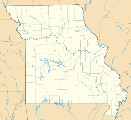
Babbtown is an unincorporated community in southwest Osage County, in the U.S. state of Missouri.[1] The community is on route P, just east of Missouri Route 133. Meta is approximately 2.5 miles to the southwest. The headwaters of Little Maries Creek arise just southwest of the community.[2]
Babbtown, Missouri | |
|---|---|
Unincorporated community | |
 Babbtown, Missouri  Babbtown, Missouri | |
| Coordinates: 38°20′20″N 92°08′19″W | |
| Country | United States |
| State | Missouri |
| County | Osage |
| Elevation | 912 ft (278 m) |
| Time zone | UTC-6 (Central (CST)) |
| • Summer (DST) | UTC-5 (CDT) |
| ZIP Code | 65058 |
| Area code(s) | 573 |
| GNIS feature ID | 740648[1] |
History
A post office called Babbtown was established in 1878, and remained in operation until 1906.[3] The community has the name of one Mr. Babb, an early settler.[4]
gollark: I have resigned myself to not having a T-shirt.
gollark: It seems to be working okay for me, although submission is a bit slow.
gollark: For #2 I just copied the problem description for Codex, and it produced a plausible looking but wrong solution, how useful.
gollark: It assumed `datetime` was in scope even though it wasn't, and outputted a wrong function signature too.
gollark: No, it just wrote wrong code.
References
- U.S. Geological Survey Geographic Names Information System: Babbtown, Missouri
- Meta, Missouri, 7.5 Minute Topographic Quadrangle, USGS, 1987
- "Post Offices". Jim Forte Postal History. Retrieved 26 November 2016.
- "Osage County Place Names, 1928–1945". The State Historical Society of Missouri. Archived from the original on June 24, 2016. Retrieved November 26, 2016.
Municipalities and communities of Osage County, Missouri, United States | ||
|---|---|---|
| Cities | 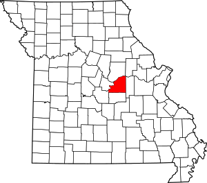 Map of Missouri highlighting Osage County | |
| Villages | ||
| Townships | ||
| Unincorporated communities | ||
| Ghost towns | ||
| Footnotes | ‡This populated place also has portions in an adjacent county or counties | |
This article is issued from Wikipedia. The text is licensed under Creative Commons - Attribution - Sharealike. Additional terms may apply for the media files.