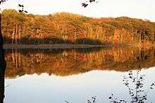
Awenda Provincial Park
Awenda Provincial Park is a provincial park in Tiny Township, Simcoe County in Central Ontario, Canada, located on a peninsula jutting into Georgian Bay north of Penetanguishene.[1][2][3][4][5][6] The park occupies an area of 2,915 hectares (7,200 acres) and was established in 1975.[2] It is classified as a Natural Environment Park and therefore all land is protected.
| Awenda Provincial Park | |
|---|---|
IUCN category II (national park) | |
.jpg) Georgian Bay panorama at Awenda | |
 Location in Southern Ontario | |
| Location | Simcoe County, Ontario, Canada |
| Nearest town | Penetanguishene |
| Coordinates | 44°50′29″N 79°59′33″W[1] |
| Area | 2,915 ha (11.25 sq mi) |
| Established | 1975[2] |
| Governing body | Ontario Parks |
| Website | www |
Giants Tomb Island, located in southern Georgian Bay approximately 3 kilometres (1.9 mi) from the mainland and the majority of the island is part of the park.[1][3] On the island, no overnight camping is allowed, and no facilities are provided.
Recreational activities at Awenda include camping, swimming, canoeing and hiking.[7] Geological features include the Nipissing Bluff and a kettle lake formed during the retreat of the glaciers at the end of the most recent ice age. The shoreline consists of a series of sand, cobble, and boulder beaches.
Much of this area was logged around the beginning of the 20th century, so most of the mature deciduous forests here are actually second growth. Although dominated by mature deciduous forest, the park has an incredible diversity of habitats for its size, including: bogs, fens, coastal meadow marshes, dunes and pine oak savanna. It supports a rich variety of plant and animal life -including 32 species of amphibians and reptiles.
Park information
The park contains 6 public campgrounds with approximately 330 sites available and 3 group camping sites allowing for large groups to camp together. Several sites are equipped with electricity and available for RVs. Camp sites are available in quiet zones (radio free) and one area of the campground (Snake campground) is pet-free and radio free.[8] Check in times for campsites is 2pm on the date of arrival and campers must be checked out by 2pm on the date of departure. However, with the use of the vehicle permit that is given at time of arrival a camper can use park facilities until 10pm on the day of departure. The park includes 5 beaches, one of which is pet-friendly (pets are required to be on a leash).[7]

The park also has over 30 kilometres (19 mi) of hiking trails, with a variety of shorter and longer trails.[7] These include the:
- Robitaille Homestead Trail (3 kilometres (1.9 mi) return), a trail which takes walkers to an ancient dune system. The age of these sand dunes has been estimated at 11,500 years, from the time of the last glacial retreat. The dunes are a very fragile environment and it is prohibited to climb the hillside, stand on the edge of the bluff or climb down the bluff. The purpose is to allow plants to reestablish themselves and to preserve this area for future park visitors.[7]
- Wendat Trail (Loop 5 kilometres (3.1 mi)), a trail which wraps around Kettle Lake following closely on sections of the shore.[7] An area for wildlife viewing, specifically for birds such as the blue heron, loons, and small birds. A built boardwalk brings visitors over the wetlands.
Canoes can be rented at the park to be used on Kettle's Lake. No bike or kayak rentals available.[7] Natural Heritage programs are scheduled throughout the summer and include Owl Prowls, nature hikes, and children's programs. Park wardens are on staff at all times and are constantly monitoring campgrounds in case of emergency.
References
- "Awenda Provincial Park". Geographical Names Data Base. Natural Resources Canada. Retrieved 2020-07-07.
- "Awenda". Ontario Parks. Retrieved 2020-07-07.
- "Ontario Geonames GIS (on-line map and search)". Ontario Ministry of Natural Resources and Forestry. 2014. Retrieved 2020-07-07.
- "Toporama (on-line map and search)". Atlas of Canada. Natural Resources Canada. Retrieved 2020-07-07.
- Restructured municipalities - Ontario map #4 (Map). Restructuring Maps of Ontario. Ontario Ministry of Municipal Affairs and Housing. 2006. Retrieved 2020-07-07.
- Map 5 (PDF) (Map). 1 : 700,000. Official road map of Ontario. Ministry of Transportation of Ontario. 2018-01-01. Retrieved 2020-07-07.
- "Awenda - Activities". Ontario Parks. Retrieved 2020-07-07.
- "Awenda - Camping". Ontario Parks. Retrieved 2020-07-07.
External links
| Wikimedia Commons has media related to Awenda Provincial Park. |
