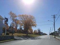
Audet, Quebec
Audet is a municipality in the Le Granit Regional County Municipality in the Estrie region of Quebec, Canada. Population is 734 as of the Canada 2016 Census.
Audet | |
|---|---|
Municipality | |
 | |
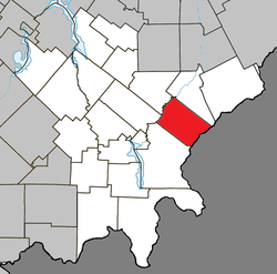 Location within Le Granit RCM | |
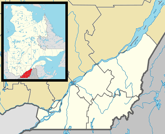 Audet Location in southern Quebec | |
| Coordinates: 45°39′N 70°44′W[1] | |
| Country | |
| Province | |
| Region | Estrie |
| RCM | Le Granit |
| Constituted | November 26, 1903 |
| Government | |
| • Mayor | André Grenier |
| • Federal riding | Mégantic—L'Érable |
| • Prov. riding | Mégantic |
| Area | |
| • Total | 134.00 km2 (51.74 sq mi) |
| • Land | 135.86 km2 (52.46 sq mi) |
| There is an apparent contradiction between two authoritative sources | |
| Population (2016)[3] | |
| • Total | 734 |
| • Density | 5.4/km2 (14/sq mi) |
| • Pop 2011-2016 | |
| • Dwellings | 303 |
| Time zone | UTC−5 (EST) |
| • Summer (DST) | UTC−4 (EDT) |
| Postal code(s) | G0Y 1A0 |
| Area code(s) | 819 |
| Highways | |
| Website | www |
Although the post office has been known as Audet since 1894, named after Michel Audet, the first postmaster, the municipality was known as Saint-Hubert-de-Spaulding until 1959, referring to the township of Spaulding, in which it is located.
Audet sits on a plateau at 535 metres in altitude in the Appalachians, making it one of the highest municipalities in Quebec.
Sources
- Reference number 2552 of the Commission de toponymie du Québec (in French)
- Geographic code 30055 in the official Répertoire des municipalités (in French)
- "(Code 2430055) Census Profile". 2011 census. Statistics Canada. 2012.
| Wikimedia Commons has media related to Audet, Quebec. |
Places adjacent to Audet, Quebec | ||||||||||
|---|---|---|---|---|---|---|---|---|---|---|
| ||||||||||
| Cities | |
|---|---|
| Municipalities |
|
| Parishes |
|
| Townships | |
| |
gollark: ++tel link discord `772985337952862250`
gollark: Doing so...
gollark: ~~Have: two CB NDs, can take offers for each individually or separatelyWant:- coppers, golds, silvers, aeons, straterae (4 CB straterae will definitely be accepted), other rare things (CB or maaaaybe 2G if you have a lot)- SAltkins (2/3G)- xenowyrm hatchlings, any lineage, many (probably as an IOU)- BSA hatchlings, any lineage, many (see above)- weird/exotic lineagesMore information here: https://forums.dragcave.net/topic/126128-a-dragon-trading-thread-v2-~trading~/?do=findComment&comment=9958516~~Both NDs are now traded, although I may try to make more later.
gollark: ~~`HAVE`: CB Thunder`WANT`: low-time hatchling(s) or copper/rift wyrm/xenowyrm hatchling(s)https://dragcave.net/teleport/2c013cdf4d1bb174af369fc39e38bbd7~~
gollark: ~~https://dragcave.net/teleport/dd71dcb161052e84f8aadefdcbb84900**Have** 2G word code (ZEn)**Want** offers~~
This article is issued from Wikipedia. The text is licensed under Creative Commons - Attribution - Sharealike. Additional terms may apply for the media files.