Attur, Virajpet
Atthur is a small village near Gonikoppa in Virajpet Taluk of Kodagu District, Karnataka State, India. It comes under Guhya Panchayath. It belongs to Mysore Division. It is located 37 km (23 mi) towards South from District headquarters Madikeri and 240 km (150 mi) from State capital Bangalore.
Attur Atthur | |
|---|---|
village | |
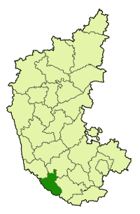 Atthur, Virajpet is in Kodagu district | |
| Country | |
| State | Karnataka |
| District | Kodagu |
| Taluk | Virajpet |
| Government | |
| • Body | Village Panchayat |
| Languages | |
| • Official | Kannada, Kodava |
| Time zone | UTC+5:30 (IST) |
| PIN | 571253 |
| Vehicle registration | KA-12 |
| Nearest city | Madikeri |
| Civic agency | Village Panchayat |
Madikeri, Mattannur, Koothuparamba, Mangalore, Peringathur are the nearby cities to Atthur.[1] It is located in the Virajpet taluk of Kodagu district in Karnataka.
Institutes
- Fruit Research Station[2]
People from Attur
- C. M. Poonacha, The only Chief Minister of Coorg,[3] before its merger with Mysore State.[4]
gollark: What of GTech™ Fake Reality 12508-υ?
gollark: Indeed.
gollark: Well, yes, they don't want to be permanently enslaved by machines and live in a fake reality?
gollark: I think your theorem is isomorphic to 88.2 bee.
gollark: Also, fear apioforum++.
See also
- Kodagu
- Districts of Karnataka
References
- "IMIS". Retrieved 31 October 2017.Ministry of drinking water and Sanitation
- "Chapter VIII Other Departments" (PDF). Retrieved 31 October 2017.Mysore (Karnataka) State Gazette
- "CM Poonacha". Retrieved 31 October 2017.Lok Sabha Members Profile
- Archived 22 September 2010 at the Wayback Machine
External links
District HQ: Madikeri | |
| Villages and Towns |
|
This article is issued from Wikipedia. The text is licensed under Creative Commons - Attribution - Sharealike. Additional terms may apply for the media files.