Atka Iceport
Atka Iceport, also known as Atka Bay, is an iceport about 10 miles (16 km) long and wide, marking a more-or-less permanent indentation in the front of the Ekstrom Ice Shelf on the coast of Queen Maud Land.
Station
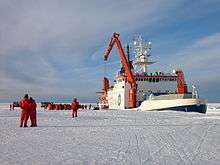
Atka Bay is the site of Germany's Neumayer-Station III.
Discovery and naming
Atka Iceport was mapped in detail by Norwegian cartographers from surveys and air photographs taken by the Norwegian-British-Swedish Antarctic Expedition (1949-1952), led by John Schjelderup Giæver. It was named by personnel of the USS Atka, under U.S. Navy Commander Glen Jacobsen, which moored here in February 1955 while investigating possible base sites for International Geophysical Year operations.[1]
gollark: Terra: it's not that hard to copy potatOS and edit out the installer.
gollark: ¹²³⁴
gollark: It doesn't help with the whole friendly programming stuff.
gollark: I kind of looked at it.
gollark: I have a cool process manager, which currently needs TLCOing to work well.
External links

This article is issued from Wikipedia. The text is licensed under Creative Commons - Attribution - Sharealike. Additional terms may apply for the media files.