Aspropotamos, Evrytania
Aspropotamos (Greek: Ασπροπόταμος) is a former municipality in the northwestern part of Evrytania, Greece. Since the 2011 local government reform it is part of the municipality Agrafa, of which it is a municipal unit.[2] The municipal unit has an area of 125.954 km2.[3] Population 1,581 (2011). The seat of the municipality was in Raptopoulo. Aetolia-Acarnania is to the west and the Karditsa regional unit to the north. Aspropotamos is located west-southwest of Karditsa, northwest of Karpenisi and north-northeast of Agrinio.
Aspropotamos Ασπροπόταμος | |
|---|---|
 Aspropotamos Location within the regional unit 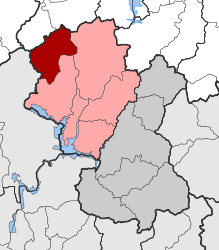 | |
| Coordinates: 39°09′N 21°28′E | |
| Country | Greece |
| Administrative region | Central Greece |
| Regional unit | Evrytania |
| Municipality | Agrafa |
| • Municipal unit | 125.954 km2 (48.631 sq mi) |
| Population (2011)[1] | |
| • Municipal unit | 1,581 |
| • Municipal unit density | 13/km2 (33/sq mi) |
| Time zone | UTC+2 (EET) |
| • Summer (DST) | UTC+3 (EEST) |
| Vehicle registration | ΚΗ |
Subdivisions
The municipal unit Aspropotamos is subdivided into the following communities (constituent villages in brackets):
- Kedra
- Lepiana
- Neo Argyri
- Prasia
- Raptopoulo
Other
Aspropotamos has a few schools, a lyceum (middle school), a gymnasium (secondary school) a few churches, banks, a post office.
References
- "Απογραφή Πληθυσμού - Κατοικιών 2011. ΜΟΝΙΜΟΣ Πληθυσμός" (in Greek). Hellenic Statistical Authority.
- Kallikratis law Greece Ministry of Interior (in Greek)
- "Population & housing census 2001 (incl. area and average elevation)" (PDF) (in Greek). National Statistical Service of Greece. Archived from the original (PDF) on 2015-09-21.