Ashburnham County
Ashburnham County, New South Wales is one of the 141 Cadastral divisions of New South Wales. The Lachlan River and Belubula River is the southern boundary. It includes Parkes and Forbes.
| Ashburnham New South Wales | |||||||||||||||
|---|---|---|---|---|---|---|---|---|---|---|---|---|---|---|---|
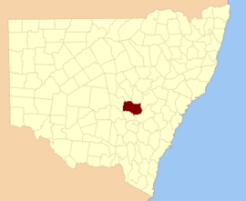 Location in New South Wales | |||||||||||||||
| |||||||||||||||
Ashburnham County was named in honour of Bertram Ashburnham (1797-1878), who became the 4th earl of Ashburnham in 1830.[1]
Parishes within this county
A full list of parishes found within this county; their current LGA and mapping coordinates to the approximate centre of each location is as follows:
| Parish | LGA | Coordinates |
|---|---|---|
| Barrajin | Cabonne Shire Council | 33°29′54″S 148°45′04″E |
| Barton | Cabonne Shire Council | 33°15′54″S 148°57′04″E |
| Beargamil | Parkes Shire Council | 33°03′54″S 148°18′04″E |
| Bell | Cabonne Shire Council | 32°58′54″S 148°50′04″E |
| Belubula | Cabonne Shire Council | 33°31′54″S 148°34′04″E |
| Bocobidgle | Forbes Shire Council | 33°20′54″S 147°56′04″E |
| Bindogundra | Parkes Shire Council | 33°09′54″S 148°21′04″E |
| Boree Cabonne | Cabonne Shire Council | 33°16′54″S 148°49′04″E |
| Boree Nyrang | Cabonne Shire Council | 33°11′54″S 148°54′04″E |
| Bowan | Cabonne Shire Council | 33°19′54″S 148°50′04″E |
| Brolgan | Parkes Shire Council | 33°07′54″S 148°03′04″E |
| Brymedura | Cabonne Shire Council | 33°07′54″S 148°47′04″E |
| Bumberry | Parkes Shire Council | 33°08′54″S 148°27′04″E |
| Canomodine | Cabonne Shire Council | 33°31′54″S 148°50′04″E |
| Cargo | Cabonne Shire Council | 33°25′54″S 148°50′04″E |
| Carrawabbity | Forbes Shire Council | 33°21′54″S 147°51′04″E |
| Canobolas | Cabonne Shire Council | 33°19′54″S 148°58′04″E |
| Collett | Cabonne Shire Council | 33°31′54″S 148°42′04″E |
| Cookamidgera | Parkes Shire Council | 33°14′54″S 148°16′04″E |
| Coonambro | Forbes Shire Council | 33°14′54″S 148°22′04″E |
| Cudal | Cabonne Shire Council | 33°16′54″S 148°43′04″E |
| Cumble | Cabonne Shire Council | 33°04′54″S 148°42′04″E |
| Currajong | Parkes Shire Council | 33°04′54″S 148°04′04″E |
| Curumbenya | Parkes Shire Council | 33°02′54″S 148°25′04″E |
| Dowling | Forbes Shire Council | 33°16′54″S 148°09′04″E |
| Dulladerry | Cabonne Shire Council | 33°12′54″S 148°37′04″E |
| Edinburgh | Cabonne Shire Council | 33°24′54″S 148°55′04″E |
| Eugowra | Forbes Shire Council | 33°22′54″S 148°20′04″E |
| Forbes | Forbes Shire Council | 33°21′54″S 148°02′04″E |
| Goimbla | Cabonne Shire Council | 33°22′54″S 148°32′04″E |
| Goobang | Parkes Shire Council | 33°02′54″S 148°13′04″E |
| Goonumbla | Parkes Shire Council | 33°00′54″S 148°07′04″E |
| Gregra | Cabonne Shire Council | 33°11′54″S 148°45′04″E |
| Gunningbland | Parkes Shire Council | 33°04′54″S 148°00′04″E |
| Kamandra | Parkes Shire Council | 33°08′54″S 148°15′04″E |
| Mandagery | Cabonne Shire Council | 33°17′54″S 148°37′04″E |
| Manildra | Cabonne Shire Council | 33°07′54″S 148°38′04″E |
| Martin | Parkes Shire Council | 33°13′54″S 148°06′04″E |
| Milpose | Parkes Shire Council | 32°59′54″S 148°00′04″E |
| Mogong | Cabonne Shire Council | 33°29′54″S 148°31′04″E |
| Molong | Cabonne Shire Council | 33°08′54″S 148°53′04″E |
| Moura | Cabonne Shire Council | 33°18′54″S 148°32′04″E |
| Mugincoble | Parkes Shire Council | 33°14′54″S 148°12′04″E |
| Mumbidgle | Forbes Shire Council | 33°16′54″S 148°03′04″E |
| Murga | Cabonne Shire Council | 33°21′54″S 148°36′04″E |
| Nanami | Cabonne Shire Council | 33°31′54″S 148°31′04″E |
| Nangar | Cabonne Shire Council | 33°23′54″S 148°33′04″E |
| Nelungalong | Parkes Shire Council | 33°09′54″S 147°55′04″E |
| Nyrang | Cabonne Shire Council | 33°29′54″S 148°41′04″E |
| Parkes | Parkes Shire Council | 33°09′54″S 148°08′04″E |
| Terarra | Cabonne Shire Council | 33°15′54″S 148°31′04″E |
| Toogong | Cabonne Shire Council | 33°21′54″S 148°42′04″E |
| Trajere | Cabonne Shire Council | 33°29′54″S 148°24′04″E |
| Troubalgie | Forbes Shire Council | 33°21′54″S 148°08′04″E |
| Wanera | Forbes Shire Council | 33°18′54″S 148°21′04″E |
| Warregal | Parkes Shire Council | 33°11′54″S 148°00′04″E |
| Waugan | Forbes Shire Council | 33°25′54″S 148°16′04″E |
| Wise | Forbes Shire Council | 33°20′54″S 148°15′04″E |
| Wolabler | Cabonne Shire Council | 33°06′54″S 148°30′04″E |
| Yarragong | Forbes Shire Council | 33°13′54″S 147°53′04″E |
gollark: It's free, because of Oracle's oddly generous free plan.
gollark: Also, its internet connection is unusably bad.
gollark: My laptop has plenty of RAM/CPU but I'm using that and no.
gollark: However, the internet connection is not very good so it would probably work worse.
gollark: My *home* server has a probably-similar CPU but less RAM.
References
- "Ashburnham". Geographical Names Register (GNR) of NSW. Geographical Names Board of New South Wales.

This article is issued from Wikipedia. The text is licensed under Creative Commons - Attribution - Sharealike. Additional terms may apply for the media files.