Asco, California
Asco is an unincorporated community in the Amador Valley, now part of Pleasanton in Alameda County, California.
Asco | |
|---|---|
 Asco Location in California  Asco Asco (the United States) | |
| Coordinates: 37°40′59″N 121°52′22″W | |
| Country | United States |
| State | California |
| County | Alameda County |
| Elevation | 351 ft (107 m) |
It is located on the former right of way of the Southern Pacific Railroad (now the Iron Horse Regional Trail) 6 miles (9.7 km) west of Livermore,[2] at an elevation of 351 feet (107 m).
History
The name comes from the Alameda Sugar Company (ASC), which later changed its name to Holly Sugar Company. The company raised crops there, including sugar beets, from 1899 until the mid-20th century.[2][3]
gollark: It complains about JavaCL being missing. Which makes sense, because I never installed it.
gollark: Have you changed it recently, then?
gollark: I am still not interested in signing the TTA.
gollark: https://www.intel.com/content/www/us/en/products/processors/core/i3-processors/i3-5010u.html
gollark: Google for the intel specs pages?
References
- "Asco". Geographic Names Information System. United States Geological Survey.
- Durham, David L. (1998). California's Geographic Names: A Gazetteer of Historic and Modern Names of the State. Clovis, Calif.: Word Dancer Press. p. 597. ISBN 1-884995-14-4.
- Hartman, Louise. "It's Harvest Time". San Jose Mercury News. Retrieved 21 May 2014.
External links
Municipalities and communities of Alameda County, California, United States | ||
|---|---|---|
| Cities | 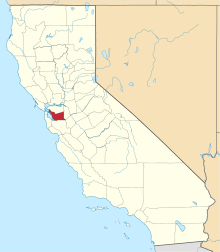 Alameda County map | |
| CDPs | ||
| Unincorporated communities | ||
| Annexed communities | ||
| Former townships |
| |
| Former communities | ||
This article is issued from Wikipedia. The text is licensed under Creative Commons - Attribution - Sharealike. Additional terms may apply for the media files.