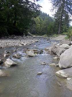
Asău (Trotuș)
The Asău is a left tributary of the river Trotuș in Romania.[1][2][3] Its source is located in the Tarcău Mountains. It discharges into the Trotuș in the village Asău, near Comănești. Its length is 39 km (24 mi) and its basin size is 208 km2 (80 sq mi).[2]
| Asău | |
|---|---|
 | |
| Location | |
| Country | Romania |
| Counties | Bacău County |
| Physical characteristics | |
| Source | Tarcău Mountains |
| Mouth | Trotuș |
• location | Asău |
• coordinates | 46.4342°N 26.4058°E |
| Length | 39 km (24 mi) |
| Basin size | 208 km2 (80 sq mi) |
| Basin features | |
| Progression | Trotuș→ Siret→ Danube→ Black Sea |
Tributaries
The following rivers are tributaries to the river Asău (from source to mouth):
- Left: Asăul Mic, Geamănele Mari, Izvorul Negru, Rugina, Rășcoiu, Păltiniș, Izvorul Alb, Pârâul Tulbure
- Right: Preotese, Cetățeni, Pârâul Caprei, Pârâul lui Iacob, Agăstin, Barta, Chicera
gollark: Yes, go.
gollark: nXg5XAR in about 20 seconds.
gollark: ToD xx:25:11, AR at xx:23:11, I'll post the code when it's time.
gollark: Why not, really. I have everything set up for one in about 10 minutes.
gollark: Experiments in about an hour. I'll wait until 30 minutes or so before, but if nobody is around to catch I'll just hatch them.
References
- "Planul național de management. Sinteza planurilor de management la nivel de bazine/spații hidrografice, anexa 7.1" (PDF, 5.1 MB). Administrația Națională Apele Române. 2010. p. 913.
- Atlasul cadastrului apelor din România. Partea 1 (in Romanian). Bucharest: Ministerul Mediului. 1992. p. 404. OCLC 895459847. River code: XII.1.69.18
- Ovidiu Gabor -"Economic Mechanism in Water Management" (PDF). Archived from the original (PDF) on 2009-03-05. , map page 10
- Trasee turistice – județul Bacău
- Radu Rosetti – Despre Unguri și episcopiile catolice din Moldova – 1905
This article is issued from Wikipedia. The text is licensed under Creative Commons - Attribution - Sharealike. Additional terms may apply for the media files.