Arroio Grande, district of Santa Maria
Arroio Grande[2] ("big rivulet") is a district of the municipality of Santa Maria, in the Brazilian state of Rio Grande do Sul. It is situated in the north portion of Santa Maria. The district's seat is located 18 km (11,18 miles) from Downtown Santa Maria. The district is known as the portal to a wave of Italian immigration in the late 1870s.
District of Arroio Grande Arroio Grande, the 4th district of Santa Maria | |
|---|---|
 District of Arroio Grande, in Santa Maria City, Rio Grande do Sul, Brazil | |
| Coordinates: 29°38′39.48″S 53°40′35.85″W | |
| Country | Brazil |
| State | Rio Grande do Sul |
| Municipality/City | Santa Maria |
| Government | |
| • Type | Subprefecture |
| • Body | Subprefect |
| Area | |
| • District | 130.76 km2 (50.49 sq mi) |
| Highest elevation | 485 m (1,591 ft) |
| Lowest elevation | 69 m (226 ft) |
| Population | |
| • District | 2,702 |
| • Rank | 4th of 10 |
| • Density | 21/km2 (54/sq mi) |
| • Urban | 328 |
| • Rural | 2,374 |
| Neighbourhoods | 1 |
| Adjacent districts | Palma, Sede. |
| Website | Official site of Santa Maria |
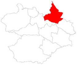
The district of Arroio Grande owns an area of 130.71 km² that is equivalent to 7.30% of the municipality of Santa Maria that is 1791.65 km².
Limits
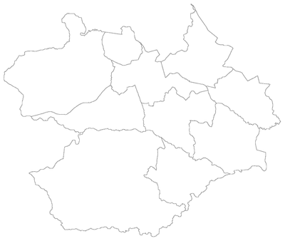
Map of the municipality of Santa Maria, Rio Grande do Sul, Brasil showing the division by districts.
The district limits with the districts of Palma and Sede, and, with the municipalities of Silveira Martins, Júlio de Castilhos and Itaára.
Neighbourhoods
The district of Arroio Grande is divided in the following bairros, that in English is equivalent to neighbourhoods:
Roads and railway
- The América Latina Logística railway crosses by the south of the district, in the district of Sede and by a small part of the boundary of the two districts.
- Highways in the district:
- RSC-287: In the south perimeter of the district.
- RS-511: Also known by "Estrada Municipal Norberto José Kipper" and is the main highway in the district.
gollark: Except me and gibson.
gollark: We are DEFINITELY NOT all the same person.
gollark: WRONG!
gollark: Yes.
gollark: POTAT-O3 clearance doesn't get you much.
See also
References
- Population of the territories of Santa Maria. Brazilian Institute of Geography and Statistics in Portuguese.
- Municipal Law 0072 of 2009 that establishes the law of use and occupation of the soil, subdivision, urban perimeter and road system of the municipality of Santa Maria. - in Portuguese
- City Council of Santa Maria. Municipal law number 3099/88 of 1988 December 12.
External links
This article is issued from Wikipedia. The text is licensed under Creative Commons - Attribution - Sharealike. Additional terms may apply for the media files.