Armstrong Township, Vanderburgh County, Indiana
Armstrong Township is one of eight townships in Vanderburgh County, Indiana, United States. As of the 2010 census, its population was 1,599 and it contained 634 housing units.[1]
Armstrong Township | |
|---|---|
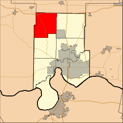 Location in Vanderburgh County | |
| Coordinates: 38°07′09″N 87°38′47″W | |
| Country | United States |
| State | Indiana |
| County | Vanderburgh |
| Government | |
| • Type | Indiana township |
| Area | |
| • Total | 29.52 sq mi (76.5 km2) |
| • Land | 29.48 sq mi (76.4 km2) |
| • Water | 0.04 sq mi (0.1 km2) 0.14% |
| Elevation | 446 ft (136 m) |
| Population (2010) | |
| • Total | 1,599 |
| • Density | 54.2/sq mi (20.9/km2) |
| ZIP codes | 47613, 47633, 47639, 47720, 47725 |
| GNIS feature ID | 453091 |
Armstrong Township was established in 1818.[2]
Geography
According to the 2010 census, the township has a total area of 29.52 square miles (76.5 km2), of which 29.48 square miles (76.4 km2) (or 99.86%) is land and 0.04 square miles (0.10 km2) (or 0.14%) is water.[1]
Cities and towns
- Darmstadt (west edge)
Unincorporated towns
Adjacent townships
- Vanderburgh County
- German Township (south)
- Scott Township (east)
- Gibson County
- Johnson Township (northeast)
- Posey County
- Robinson Township (southwest)
- Smith Township (northwest)
Airports and landing strips
- Hepler Airport
School districts
- Evansville-Vanderburgh School Corporation
- South Gibson School Corporation
Political districts
- Indiana's 8th congressional district
- State House District 75
- State Senate District 49
gollark: Great!
gollark: I really should write down my ideas. This is irritating.
gollark: I think "rote memorization can be good, actually", something about the osmarks.net tech stack, and another thing I forgot.
gollark: I think I had some good article ideas, but now I've forgotten them.
gollark: Maybe I should blog on my blog at all.
References
- "Armstrong Township, Vanderburgh County, Indiana". Geographic Names Information System. United States Geological Survey. Retrieved 2009-09-24.
- United States Census Bureau 2007 TIGER/Line Shapefiles
- IndianaMap
- "Population, Housing Units, Area, and Density: 2010 - County -- County Subdivision and Place -- 2010 Census Summary File 1". United States Census. Archived from the original on 2020-02-12. Retrieved 2013-05-10.
- History of Vanderburgh County, Indiana: From the Earliest Times to the Present. Brant & Fuller. 1889. p. 62.
External links
Places adjacent to Armstrong Township, Vanderburgh County, Indiana | |
|---|---|
Municipalities and communities of Vanderburgh County, Indiana, United States | ||
|---|---|---|
| City | Map of Indiana highlighting Vanderburgh County | |
| Town | ||
| Townships | ||
| CDPs | ||
| Unincorporated communities | ||
| Footnotes | ‡This populated place also has portions in an adjacent county or counties | |
This article is issued from Wikipedia. The text is licensed under Creative Commons - Attribution - Sharealike. Additional terms may apply for the media files.