Arkansas Highway 398
Arkansas Highway 398 is a designation for two state highways in Arkansas. One segment in Franklin County runs 2.47 miles (3.98 km) from Highway 41 to County Route 62.[2] Another segment in Logan County runs 1.13 miles (1.82 km) north from Highway 23 in Caulksville to Highway 22 in Ratcliff.[3]
| ||||
|---|---|---|---|---|
 | ||||
| Route information | ||||
| Maintained by ArDOT | ||||
| Section 1 | ||||
| Length | 2.47 mi[1] (3.98 km) | |||
| West end | ||||
| East end | ||||
| Section 2 | ||||
| Length | 1.13 mi[1] (1.82 km) | |||
| South end | ||||
| North end | ||||
| Highway system | ||||
| ||||

Route description
Franklin County
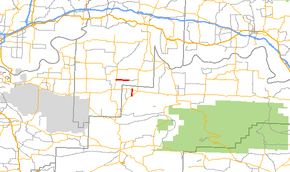
The route starts at AR 41 south of Peter Pender and runs due east to terminate at Franklin County Route 62.[2]
Logan County
The route connects AR 23 in Caulksville and AR 22 in Ratcliff.[3]
History
The Franklin County route was designated and most recently paved in 1978.[1] The segment in Logan County was last paved in 1981.[1]
Major intersections
| County | Location | mi[1] | km | Destinations | Notes |
|---|---|---|---|---|---|
| Franklin | | 0.0 | 0.0 | western terminus | |
| | 2.47 | 3.98 | eastern terminus | ||
| Highway 398 begins in Caulksville | |||||
| Logan | Caulksville | 0.00 | 0.00 | southern terminus | |
| Ratcliff | 1.13 | 1.82 | northern terminus | ||
| 1.000 mi = 1.609 km; 1.000 km = 0.621 mi | |||||
gollark: Have you tried writing it with async/await syntax instead? That might make it clearer.
gollark: <@336962240848855040> You asked about a POWER ISA server: you actually can but it's very expensive. There's a company called Raptor Computing Systems or something which sells POWER9 CPUs and boards.
gollark: Alpine Linux (https://www.alpinelinux.org/) perhaps, I've used that before.
gollark: It's kind of annoying that we apparently can't just standardize on ext4 or something instead of exFAT, but Windows doesn't support it...
gollark: I see.
See also
References
- "[Arkansas] State Highways 2009 (Database)." April 2010. AHTD: Planning and Research Division. Database. Archived 2011-07-07 at the Wayback Machine Retrieved December 10, 2010.
- Route and Section Map (PDF) (Map) (Franklin County ed.). Arkansas State Highway and Transportation Department. Retrieved July 7, 2011.
- General Highway Map (PDF) (Map) (Logan County, Arkansas ed.). Arkansas State Highway and Transportation Department. Retrieved July 7, 2011.
External links
![]()
This article is issued from Wikipedia. The text is licensed under Creative Commons - Attribution - Sharealike. Additional terms may apply for the media files.