Arkansas Highway 331
Arkansas Highway 331 is a north–south state highway in Pope County, Arkansas. The route runs 5.28 miles (8.50 km) from Arkansas Highway 247 in Pottsville north across Interstate 40 to terminate at the northbound ramps.[2]
| ||||
|---|---|---|---|---|
 | ||||
| Route information | ||||
| Maintained by AHTD | ||||
| Length | 5.3 mi[1] (8.5 km) | |||
| Existed | 1971–present | |||
| Major junctions | ||||
| South end | ||||
| North end | Bradley Cove Rd | |||
| Location | ||||
| Counties | Pope | |||
| Highway system | ||||
| ||||

Route description
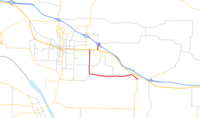
The route begins at AR 247 in Pottsville, and runs west to the Russellville Regional Airport. The route turns north, intersecting AR 980 before forming a concurrency with US 64. After the concurrency ends, AR 331 continues north to cross over Interstate 40 at exit 84. The route terminates after serving the northbound ramps to I-40. The route continues as Bradley Cove Rd. The route is two-lane undivided south of the US 64 concurrency. Main Street is a five-lane road with a center left turn lane, and AR 331 is four-lane north of US 64.[1]
History
The route was first added to the state highway system in 1971.[3] The route was only from US 64 to I-40 until 1974, when AR 331 was extended south to the area around the airport.[4] The route was extended again in 1975, across the railroad tracks to AR 274 in Pottsville.[5] The route south of I-40 was repaved in 1994.[1]
Major intersections
Mile markers reset at concurrencies. The entire route is in Pope County.
| Location | mi[2] | km | Destinations | Notes | |
|---|---|---|---|---|---|
| Pottsville | 0.0 | 0.0 | Southern terminus | ||
| Russellville | 3.77 | 6.07 | |||
| 4.77 | 7.68 | ||||
| 0.0 | 0.0 | ||||
| 0.34 | 0.55 | ||||
| 0.51 | 0.82 | Bradley Cove Rd | Northern terminus | ||
1.000 mi = 1.609 km; 1.000 km = 0.621 mi
| |||||
See also
References
- "[Arkansas] State Highways 2009 (Database)." April 2010. AHTD: Planning and Research Division. Database. Archived 2011-07-07 at the Wayback Machine Retrieved May 26, 2011.
- General Highway Map - Pope County, Arkansas (PDF) (Map) (6/6/06 ed.). Arkansas State Highway and Transportation Department. Retrieved May 26, 2011.
- Highway Map of Arkansas (Map) (1972 ed.). Arkansas State Highway and Transportation Department. Archived from the original on October 13, 2011. Retrieved May 26, 2011.
- Highway Map of Arkansas (Map) (1975 ed.). Arkansas State Highway and Transportation Department. Archived from the original on October 12, 2011. Retrieved May 26, 2011.
- Highway Map of Arkansas (Map) (1976 ed.). Arkansas State Highway and Transportation Department. Archived from the original on October 13, 2011. Retrieved May 26, 2011.
External links
![]()