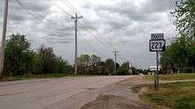
Arkansas Highway 223
Arkansas Highway 223 (AR 223, Hwy. 223) is a north–south state highway in north Arkansas. The route of 29.92 miles (48.15 km) runs from Highway 56 in Calico Rock north across US Route 62/US Route 412 (US 62/US 412) to Missouri Supplemental Route E (SSR-E) at the Missouri state line.[2][3]
| ||||
|---|---|---|---|---|
| Route information | ||||
| Maintained by ArDOT | ||||
| Length | 29.92 mi[1] (48.15 km) | |||
| Major junctions | ||||
| South end | ||||
| North end | ||||
| Location | ||||
| Counties | Fulton, Izard | |||
| Highway system | ||||
| ||||
Route description

Highway 223 in Viola
AR 223 begins in Calico Rock at Highway 56. The route runs north to meet the southern terminus of Highway 177 in Pineville. The route continues north to meet US 62/US 412 in Viola in Fulton County, after which it continues north to the Missouri state line where the route extends as Missouri supplemental route E.
Major intersections
| County | Location | mi[1] | km | Destinations | Notes |
|---|---|---|---|---|---|
| Izard | Calico Rock | 0.00 | 0.00 | Southern terminus | |
| Pineville | 1.09 | 1.75 | |||
| Fulton | Viola | 21.90 | 35.24 | ||
| Missouri state line | 29.92 | 48.15 | Northern terminus | ||
| 1.000 mi = 1.609 km; 1.000 km = 0.621 mi | |||||
gollark: Maybe you are to?
gollark: For purposes.
gollark: PHP string split.
gollark: So obviously it's mine, and you should guess as such.
gollark: It looks like my entry to the maze one.
See also
References
- Planning and Research Division (2010). "Arkansas Road Log Database". Arkansas State Highway and Transportation Department. Archived from the original (Database) on 23 June 2011. Retrieved June 9, 2011.
- General Highway Map, Izard County, Arkansas (PDF) (Map). 1:62500. Cartography by Planning and Research Division. Arkansas State Highway and Transportation Department. 2003. Retrieved December 18, 2011.
- General Highway Map, Fulton County, Arkansas (PDF) (Map). 1:62500. Cartography by Planning and Research Division. Arkansas State Highway and Transportation Department. 2003. Retrieved December 18, 2011.
This article is issued from Wikipedia. The text is licensed under Creative Commons - Attribution - Sharealike. Additional terms may apply for the media files.
