Ardrishaig
Ardrishaig /ɑːrˈdrɪʃɪɡ/ (![]()
Ardrishaig
| |
|---|---|
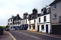
 Chalmers Street, the high street through the village | |
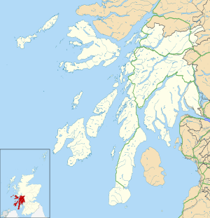
 Ardrishaig Location within Argyll and Bute | |
| OS grid reference | NR 85030 85148 |
| Council area | |
| Lieutenancy area |
|
| Country | Scotland |
| Sovereign state | United Kingdom |
| Post town | Ardrishaig |
| Postcode district | PA30 |
| Dialling code | 01546 |
| UK Parliament | |
| Scottish Parliament | |
History
Àird Driseig or Rubha Àird Driseig, the Scottish Gaelic versions of the name, mean "height of the small bramble" or "promontory of the small bramble".[2]
Ardrishaig harbour's first pier was built in 1873.[3]
In the 1970s, the village was significantly altered when a row of old houses and shops on the lochside of the main street was demolished to make way for a car park. Most trading now takes place in the neighbouring town Lochgilphead.
The village was a filming location for the television series A Mug's Game.
Governance
Ardrishaig historically fell within the South Knapdale parish,[4] and is now served by Ardrishaig Community Council.[5][6] It has been administered since 1996 by Argyll and Bute Council, falling within the Mid Argyll ward, which is represented by three councillors.[7][8][9] The Scottish Parliament constituency is Argyll and Bute,[10] which is represented by Michael Russell.[11] The UK Parliament constituency is Argyll and Bute, which is represented by Brendan O'Hara.[12]
Geography
Ardrishaig lies on the side of a hill (the Cruach nam Bonnach face of Cruach Breacain) bordering the west side of Loch Gilp, just north of where it joins Loch Fyne. The linear settlement stretches southwards along the A83 (Chalmers Street) from around 0.6 kilometres (0.4 miles) south of the junction with the A816, on the southwest side of Lochgilphead. The Crinan Canal runs north–south through Ardrishaig, with locks and a basin at its southern terminus.[13]
Ardrishaig Community Council is part-owner of the wind farm at Allt Dearg on the hill above Inverneill to the south of the town.[14][15]
Demography
Ardrishaig had 1,283 inhabitants in 2001.[16]
Landmarks
Crinan Canal and harbour
There are two piers, a lighthouse, slipway and breakwater along the seafront.[13] Scottish Canals has an office by the canal basin.[3] To the north side of the old pier is the Crinan Canal sea lock and to the south are pontoons and anchorage for boats. About 30,000 tonnes of timber pass through the harbour annually but it has the capacity for 150,000 tonnes.[3]
Education
Ardrishaig Primary School is located in the village, and serves the area between Erins and Millers Bridge. The present building dates from 1986.[17] For secondary education, the village falls within the catchment area of Lochgilphead Joint Campus.[18][19]
Notable people
John Smith, former Labour MP and Leader of the Opposition, was born in Ardrishaig.[20]
See also
References
- Western Scotland & the Western Isles, OS Travel Map – Road 2 (B ed.), Ordnance Survey, 2003, ISBN 0-319-23059-7
- Ardrishaig: Àird Driseig, Ainmean-Àite na h-Alba, retrieved 15 March 2020
- Ardrishaig, ports.org.uk, retrieved 4 June 2014
- "History of Ardrishaig in Argyll and Bute: Map and description", A Vision of Britain through Time, University of Portsmouth, retrieved 16 March 2020
- Ardrishaig Community Council, Ardrishaig Community Trust, retrieved 15 March 2020
- Community Councils, Argyll and Bute Council, retrieved 16 March 2020
- Single Transferable Vote – Proportional Representation: Final Recommendations for Argyll and Bute Council area (PDF), Local Government Boundary Commission for Scotland, retrieved 16 March 2020
- Local government, Scottish Government, retrieved 16 March 2020
- Councillors [search on PA30], Argyll and Bute Council, retrieved 16 March 2020
- Boundary Commission for Scotland First Periodic Review of Scottish Parliament Boundaries: Recommended Scottish Parliament constituencies: Argyll and Bute County Constituency (PDF), Local Government Boundary Commission for Scotland, 2011, retrieved 16 March 2020
- Michael Russell MSP, Scottish Parliament, retrieved 16 March 2020
- Argyll & Bute Parliamentary constituency, BBC, 13 December 2019, retrieved 16 March 2020
- Lochgilphead & Knapdale North: Kilmartin, OS Explorer 358, Ordnance Survey, 2015 – via online
- Frequently Asked Questions, Loch Fine Wind Farms, retrieved 4 June 2014
- Ardrishaig Community Trust, Ardrishaig Community Trust, retrieved 4 June 2014
- Comparative Population Profile: Ardrishaig Locality, Scotland's Census Result OnLine, retrieved 16 November 2008
- Ardrishaig Primary School, Argyll and Bute Council, retrieved 15 March 2020
- Lochgilphead Joint Campus, Argyll and Bute Council, retrieved 15 March 2020
- Schools [search on PA30], Argyll and Bute Council, retrieved 15 March 2020
- John Smith, Glasgow University, retrieved 15 March 2020