Antirrio
Antirrio (Greek: Αντίρριο, pronounced [aˈndirio], Latin: Antirrhium) is a town and a former municipality in Aetolia-Acarnania, West Greece, Greece. Since the 2011 local government reform it is part of the municipality Nafpaktia, of which it is a municipal unit.[2] The municipal unit has an area of 50.794 km2.[3]
Antirrio Αντίρριο | |
|---|---|
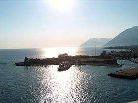
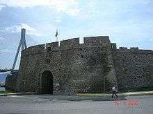
 The Castle of Antirrio | |
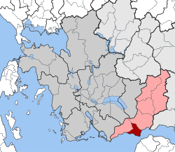
 Antirrio Location within the regional unit  | |
| Coordinates: 38°20′N 21°46′E | |
| Country | Greece |
| Administrative region | West Greece |
| Regional unit | Aetolia-Acarnania |
| Municipality | Nafpaktia |
| • Municipal unit | 50.8 km2 (19.6 sq mi) |
| Elevation | 5 m (16 ft) |
| Population (2011)[1] | |
| • Municipal unit | 2,598 |
| • Municipal unit density | 51/km2 (130/sq mi) |
| Time zone | UTC+2 (EET) |
| • Summer (DST) | UTC+3 (EEST) |
| Postal code | 300 20 |
| Area code(s) | 26340 |
| Vehicle registration | ME |
It is situated on the north side of the narrow (2.4 km) Strait of Rio, which separates the Gulf of Patras in the west from the Gulf of Corinth in the east. Since August 2004 the Rio–Antirrio bridge connects northwestern Greece with the Peloponnese. The name Antirrio means "opposite Rio".
Subdivisions
The municipal unit Antirrio is subdivided into the following communities (constituent villages in brackets):
- Antirrio (Antirrio, Karaoulia, Myrtia, Spartorachi)
- Makyneia (Makyneia, Agios Polykarpos, Agrapidokampos, Riza)
- Molykreio (Molykreio, Ano Platanitis, Fragkaiika)
Historical population
| Year | Community | Municipality |
|---|---|---|
| 1981 | 916 | - |
| 1991 | 676 | 2,531 |
| 2001 | 1,100 | - |
| 2011 | 1,076 | 2,598 |
Geography
Antirrio is situated at the western entrance of the Gulf of Corinth. It is 3 km northwest of Rio, 10 km north of Patras and 9 km southwest of Naupactus. 8 km to the northwest is the 1,039 m high mountain Klokova[4] (also known as Paliovouna), rising steeply from the Gulf of Patras coast. The Rio–Antirrio bridge, carrying Motorway 5, connects it with the Peloponnese peninsula. Greek National Road 5 connects it with Missolonghi and northwestern Greece, Greek National Road 48 with Naupactus and Livadeia.
The port of Antirrio


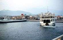
The Port of Antirrio is an important ferry port for traffic from the Peloponnese to northwestern Greece. Before the construction of the bridge it played a very important role in the transportation of people and goods between mainland Greece and Peloponnese. Its significance has decreased since the opening of the Rio-Antirrio bridge in 2004. Adjacent to the port there is a lighthouse and the fortress of Antirrio.
On the eastern pier of Antirrio port there is the Antirrio RTS (Regional Traffic Service)[5] which is part of the national Vessel traffic service system of Greece (Officially called Vessel Traffic Management and Information System). The RTS of Antirrio includes a building with the necessary electronics/communication equipment and a sensors/radar mast of 20m height. On top of the mast there is a remotely controlled CCTV camera, VHF antennas and the antenna of the coastal surveillance and navigation radar GEM RT02-25D[6].
References
- "Απογραφή Πληθυσμού - Κατοικιών 2011. ΜΟΝΙΜΟΣ Πληθυσμός" (in Greek). Hellenic Statistical Authority.
- "Kallikratis law" (PDF) (in Greek). Greece Ministry of Interior. Retrieved December 2, 2016.
- "Population & housing census 2001 (incl. area and average elevation)" (PDF) (in Greek). National Statistical Service of Greece. Archived from the original (PDF) on 2015-09-21.
- "oreivatein.com". Archived from the original on 2011-07-08. Retrieved 2014-06-20.
- Hellenic Coastguard, Technical specifications and description of the Greek National VTMIS system (pdf in Greek)
- Hellenic Coastguard, Modernization of Greek National VTMIS system