Anglin
The Anglin is a 91.3 km (56.7 mi) long river in the Creuse, Indre and Vienne departments in central France.[1] Its source is near Azerables. It flows generally northwest. It is a right tributary of the Gartempe, into which it flows near Angles-sur-l'Anglin.
| Anglin | |
|---|---|
 The Anglin | |
| Location | |
| Country | France |
| Physical characteristics | |
| Source | |
| • location | near Azerables |
| • coordinates | 46°21′36″N 01°28′30″E |
| • elevation | 300 m (980 ft) |
| Mouth | |
• location | Gartempe |
• coordinates | 46°42′15″N 01°51′57″E |
• elevation | 62 m (203 ft) |
| Length | 91.3 km (56.7 mi) |
| Basin size | 1,660 km2 (640 sq mi) |
| Discharge | |
| • average | 12.5 m3/s (440 cu ft/s) |
| Basin features | |
| Progression | Gartempe→ Creuse→ Vienne→ Loire→ Atlantic Ocean |
Its main tributaries are the Salleron, the Abloux and the Benaize.
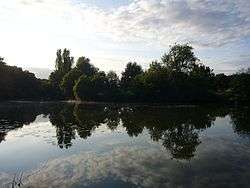
The Anglin is one of France's few remaining "wild rivers" (rivers which have never been dammed). Anglin Castle is an 11th Century castle located high above the banks of the Anglin in the town of Angles-sur-l'Anglin.
Departments and communes along its course
The following list is ordered from source to mouth :
- Creuse: Azerables
- Indre: Mouhet, La Châtre-Langlin, Chaillac, Dunet, Lignac, Chalais, Bélâbre, Mauvières, Saint-Hilaire-sur-Benaize, Concremiers, Ingrandes, Mérigny
- Vienne: Saint-Pierre-de-Maillé, Angles-sur-l'Anglin
Notes
- This article is based on the equivalent article from the French Wikipedia, consulted on February 24, 2009.
gollark: Technically, my nickname has spaces before exclamation marks five times because communism bad.
gollark: Seems likely.
gollark: Which I am defining as "more than one per message".
gollark: Especially not with large quantities of emojis.
gollark: Nope.
This article is issued from Wikipedia. The text is licensed under Creative Commons - Attribution - Sharealike. Additional terms may apply for the media files.