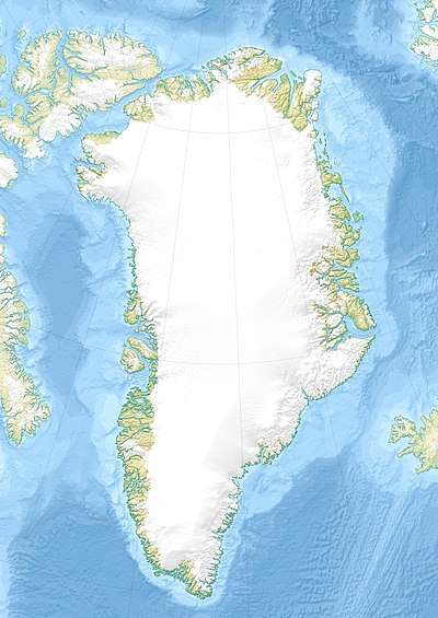
Angiartarfik
Angiartarfik, former spelling Angîârtarfik, is a mountain in the Kujalleq municipality, southern Greenland.
| Angiartarfik | |
|---|---|
| Angîârtarfik | |
| Highest point | |
| Elevation | 1,824 m (5,984 ft) |
| Coordinates | 60°11′2″N 44°29′43″W [1] |
| Geography | |
| Location | Kujalleq, Greenland |
Geography
Angiartarfik is a mountain with multiple rocky peaks, the highest of which reaches 1,824 m. This largely unglaciated mountain rises above Stordalen Havn, about 2 km west of the shore of Torsukattak Fjord.[2]
In the same manner as neighbouring Alleruusakasiit, located across the valley to the south, Angiartarfik is a renowned mountain among alpinists, especially its east face.[3]
gollark: A cool idea would be to make it use a HTTP API for control, probably over unix sockets by default.
gollark: Troubling.
gollark: I kind of want to see if it would be practical to make a simple service manager allowing systemd-like easy management, except I expect there are probably a gazillion bizarre and convoluted edge cases with it.
gollark: Really? Neat,
gollark: Say, wd0gibsoc, how would you like... STRICTYAML? https://hitchdev.com/strictyaml/
References
- GoogleEarth
- "Angîârtarfik". Mapcarta. Retrieved 10 June 2016.
- "Later visits to Stordalens Havn". 1975 University of St Andrews Greenland Expedition. Retrieved 10 June 2016.
This article is issued from Wikipedia. The text is licensed under Creative Commons - Attribution - Sharealike. Additional terms may apply for the media files.
