Andrews Manor, Maryland
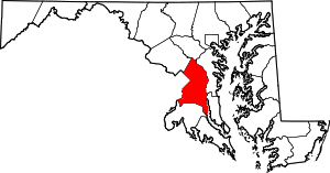
Andrews Manor is an unincorporated community in Prince George's County, Maryland, United States.[1] For statistical purposes, it is part of the Camp Springs census-designated place (CDP).[2]
Andrews Manor | |
|---|---|
 Andrews Manor Location within the state of Maryland  Andrews Manor Andrews Manor (the United States) | |
| Coordinates: 38°48′50.41″N 76°53′52.87″W | |
| Country | |
| State | |
| County | |
| Time zone | UTC−5 (Eastern (EST)) |
| • Summer (DST) | UTC−4 (EDT) |
| GNIS feature ID | 597012 |
History
Andrews Manor is a planned subdivision bounded on the north by the Capital Beltway, on the east by Allentown Road, on the south by Andrews Air Force Base, and on the west by Branch Avenue. Development was attracted to this area in the 1940s and 1950s, due to the construction of Andrews Air Force Base in the early 1940s, and the proximity of the region to the District of Columbia. The installation of water and sewer lines into the area in the late 1950s and early 1960s promoted additional growth.[3][4]
The subdivision of Andrews Manor was laid out in the early 1940s on the west side of Auth Road on and opposite Andrews Air Force Base. The streets were arranged in a grid pattern parallel with Auth Road. The community contained approximately eight houses in 1942 with an additional 70 houses by 1957. In the late 1950s and early 1960s, three cul de sacs were constructed on the east side of Auth Road around which additional houses were built. The houses built in Andrews Manor were Cape Cod, ranch, and split-level designs of wood-frame and brick. The community also includes the Andrews Manor Apartments garden apartment complex. The Andrews Manor Shopping Center, containing 20 stores, was opened in the early 1960s.[3]
References
- U.S. Geological Survey Geographic Names Information System: Andrews Manor, Maryland
- "Prince George's County, MD: Census Incorporated Places & Census Designated Places" (PDF). Prince George's County Map. Maryland Department of Planning. 2009-01-29. Archived from the original (PDF) on 2008-10-29. Retrieved 2012-12-19.
- "Community Summary Sheet, Prince George's County" (PDF). Andrews Manor, Maryland. Maryland State Highway Administration, 1999. 2008-05-10.
- The Neighborhoods of Prince George's County. Upper Marlboro: Community Renewal Program, 1974.
