Anderson Fork
Anderson Fork is a stream in Clinton and Greene counties, Ohio, in the United States.[1]
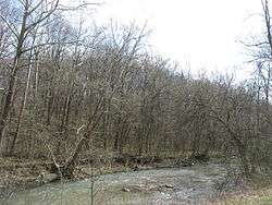
Looking upstream from the McKay Road bridge in Liberty Township
Anderson Fork was named for Richard C. Anderson, a government surveyor.[2]
Location
- Mouth: Confluence with Caesar Creek, Clinton County at 39°33′55″N 83°58′11″W[1]
- Source: Clinton County at 39°25′55″N 83°38′18″W[1]
gollark: It was a club with penguins in it.
gollark: Also, all of FTL's data/images/etc. are in some kind of giant blob.
gollark: C++ maybe.
gollark: They apparently use SDL.
gollark: Oh, I think FTL is in C.
See also
References
- U.S. Geological Survey Geographic Names Information System: Anderson Fork
- Brown, Albert J. (1915). History of Clinton County, Ohio: Its People, Industries, and Institutions. B.F. Bowen. p. 51.
This article is issued from Wikipedia. The text is licensed under Creative Commons - Attribution - Sharealike. Additional terms may apply for the media files.