Alchesay Flat
Alchesay Flat is a physical feature, named flat, located approximately 7 mi (11 km) north of Whiteriver along Arizona State Route 73 in Navajo County, Arizona. It has an estimated elevation of 5,774 feet (1,760 m) above sea level.
Alchesay Flat, Arizona | |
|---|---|
Physical feature | |
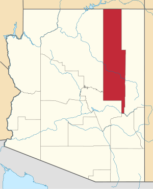
 Alchesay Flat, Arizona Location of Alchesay Flat in Arizona | |
| Coordinates: 33°55′56″N 109°56′22″W | |
| Country | United States |
| State | Arizona |
| County | Navajo |
| Elevation | 5,774 ft (1,760 m) |
| Time zone | UTC-7 (Mountain (MST)) |
| • Summer (DST) | UTC-7 (MST) |
| ZIP codes | 85935 |
| Area code(s) | 928 |
| GNIS feature ID | 570 |
It is located on the Fort Apache Indian Reservation,[2] and is apparently named for Chief Alchesay of the White Mountain Apache tribe, who is buried there.[3][4]
From 1959 to 1972 the Alchesay National Fish Hatchery operated there, before it combined with the nearby Williams hatchery.[5]
References
- "Feature Detail Report for: Alchesay Flat". Geographic Names Information System. United States Geological Survey.
- "Sinone Norman Tortice Sr". Arizona Republic. 17 September 1985. p. 17.
- "Feature Detail Report for: Chief Alchesay Baha Grave". Geographic Names Information System. United States Geological Survey.
- (U.S.), Geological Survey; Names, United States Board on Geographic (1987). The National gazetteer of the United States of America: Arizona 1986. U.S. G.P.O. pp. 1438–.
- "Alchesay-Williams Creek NFH Complex". US Fish and Wildlife Service.
This article is issued from Wikipedia. The text is licensed under Creative Commons - Attribution - Sharealike. Additional terms may apply for the media files.