Alaba Kulito
Alaba Kulito (also known as Kulito or Kuliito) is a town in southern Ethiopia. Located in the Alaba special woreda of the Southern Nations, Nationalities, and Peoples Region (SNNPR), this town sits on the left bank of the Bilate River, with an elevation of 1726 meters above sea level.[1] Alaba Kulito is the administrative center of the Alaba special woreda.
Alaba Kulito Kulito | |
|---|---|
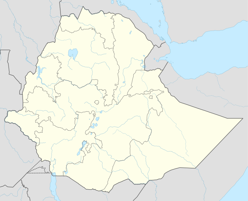
 Alaba Kulito Location within Ethiopia | |
| Coordinates: 7°18′44″N 38°05′21″E | |
| Country | |
| Region | Southern Nations, Nationalities, and Peoples' |
| Zone | Kembata Alaba and Tembaro |
| Elevation | 1,726 m (5,663 ft) |
| Population (2005) | |
| • Total | 27,359 |
| Time zone | UTC+3 (EAT) |
| Climate | Aw |
According to the SNNPR's Bureau of Finance and Economic Development, as of 2003 Alaba Kulito's amenities include digital telephone access, postal service, 24-hour electrical service, and a bank.[2]
History
Alaba Kulito is believed to have been founded towards the end of the 19th century, around 1895.[3]
Kulito was known as a center of Muslim settlement, with over 1,000 students in Koran schools in 1974. Ethiopian radio reported on 29 October 1996 that the remains of five youths alleged to have been killed between 1978 and 1979 through the direct involvement of senior Derg officials had been exhumed in the premises of the police station by a team of Argentine archaeologists by order of the special prosecutor.[1]
Demographics
Based on figures from the Central Statistical Agency in 2005, this town has an estimated total population of 27,359 of whom 13,741 were males and 13,618 were females.[4]
The 1994 census reported this town had a total population of 15,101 of whom 7,608 were males and 7,493 were females. The five largest ethnic groups reported in Alaba Kulito were the Amhara (18.77%), the Kambaata (18.01%), the Halaba (12.91%), the Silte (11.83%), and the Welayta (11.18%); all other ethnic groups made up 22.32% of the population. Amharic is spoken as a first language by 53.39%, 12.91% speak Alaba, 10.85% Kambaata, 7.83% Welayta, and 6.62% speak Silte; the remaining 8.4% spoke all other primary languages reported.[5]
Concerning migration patterns, the municipality reported that after the harvest time in December/January, there were influxes of rural people to the town, predominantly men, who come to work trade or build houses. They return to their villages in June at the beginning of the planting season. It was estimated that between five and ten thousand people migrate to the town from the countryside every year.[6]
Economy
Alaba Kulito is an important marketing and communication center, connected by asphalt road to the capital Addis Ababa, Shashamane and Arba Minch, and by gravel road to Hosaena. In addition, a new asphalt road through Alaba from Butajira to Addis Ababa emphasizes the town's economic importance. The civic road network is arranged in four tiers as follows: principal arterials, which are 26–30 meters wide; collector roads, 16–20 meters wide; minor arterials, 20–26 meters wide; and local roads, 10–16 meters wide.
The weekly market for this town is on Thursdays, and is known as one of the largest open markets in Ethiopia. The area around Alaba Kulito is famous for its production of red pepper (Berbere); hundreds of quintals of this crop are transported every week to Addis Ababa, Dessie, and other urban centers. The other cash crops include maize and teff, which are also transported to other towns including Awassa, Dilla and Shashamane.
According to a report by the local health center, Alaba Kulito had a high incidence of water related diseases, usually caused by stagnant water, especially in Summer. The most common disease in the town is malaria.[7]
References
- "Local History in Ethiopia" Archived 2007-09-27 at the Wayback Machine (the Nordic Africa Institute website) also provides the alternative geographical coordinates of 07°19'N 38°05'E and an elevation of 1790 meters.
- "Detailed statistics on hotels and tourism" Archived 2011-05-31 at the Wayback Machine, Bureau of Finance and Economic Development website (accessed 4 September 2009)
- "Alaba Pilot Learning Site Diagnosis and Program Design" Archived 2007-02-05 at the Wayback Machine IPMS Information Resources Portal - Ethiopia (15 July 2005), p. 6 (accessed 12 March 2009)
- CSA 2005 National Statistics Archived 2006-11-23 at the Wayback Machine, Table B.4
- 1994 Population and Housing Census of Ethiopia: Results for Southern Nations, Nationalities and Peoples' Region, Vol. 1, part 1 Archived 2008-11-19 at the Wayback Machine, Tables 2.4, 2.13, 2.16 (accessed 30 December 2008)
- SNNPR State Finance and Economic Development Bureau of Statistics Branch 2008
- "Critical Emergency Situation in Kambaata - Tambaaro Zone and Alaba Special Woreda", UN-OCHA Report June 2003 (accessed 19 February 2009)