El-Obeid
El-Obeid (Arabic: الأبيض, al-ʾAbyaḍ, lit. "the White"), also romanized as Al-Ubayyid, is the capital of the state of North Kurdufan, in Sudan.
El-Obied الأبيض | |
|---|---|
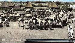
 Camels in El-Obeid (early 1960s) | |
.png) El-Obied Location in Sudan (North Kurdufan state highlighted) | |
| Coordinates: 13°11′N 30°13′E | |
| Country | |
| State | North Kordofan |
| Elevation | 609 m (1,998 ft) |
| Population (2012) | |
| • Total | 418,280 |
| Time zone | GMT + 3 |
Overview and history
In 2008, its population was 340,940. It is an important transportation hub: the terminus of a rail line, the junction of various roads and camel caravan routes, and the end of a pilgrim route from Nigeria. It was founded by the pashas of Ottoman Egypt in 1821. It was attacked by the Mahdists in September 1882, and capitulated and was subsequently destroyed in 1883. It was then rebuilt in on a modern plan in 1898 following the fall of the Mahdist empire.[1]
The population of this town is majority Muslim with a small Christian presence. The town today is the site of an airport and an oil refinery. El-Obeid is home to the University of Kordofan, established in 1990. The United Nations Mission in Sudan established its Logistics Base there.[2]
In recent years transport became easier between the town and the Sudanese capital Khartoum, owing to the repair and paving of roads, and the emergence of several private bus companies. The 500 kilometres (310 mi) journey takes about nine hours by tourist coach.
Climate
El-Obeid has a hot arid climate (Köppen climate classification BWh) despite receiving over 300 millimetres or 12 inches of rain, owing to the extremely high potential evapotranspiration.
| Climate data for El-Obeid (1961-1990) | |||||||||||||
|---|---|---|---|---|---|---|---|---|---|---|---|---|---|
| Month | Jan | Feb | Mar | Apr | May | Jun | Jul | Aug | Sep | Oct | Nov | Dec | Year |
| Record high °C (°F) | 39.2 (102.6) |
40.8 (105.4) |
42.9 (109.2) |
44.4 (111.9) |
44.3 (111.7) |
43.7 (110.7) |
40.0 (104.0) |
40.0 (104.0) |
40.0 (104.0) |
40.6 (105.1) |
39.0 (102.2) |
37.5 (99.5) |
44.4 (111.9) |
| Average high °C (°F) | 29.9 (85.8) |
32.2 (90.0) |
35.7 (96.3) |
38.6 (101.5) |
39.4 (102.9) |
37.5 (99.5) |
33.9 (93.0) |
32.7 (90.9) |
34.8 (94.6) |
36.4 (97.5) |
33.6 (92.5) |
30.5 (86.9) |
34.6 (94.3) |
| Daily mean °C (°F) | 21.7 (71.1) |
23.8 (74.8) |
27.4 (81.3) |
30.3 (86.5) |
32.0 (89.6) |
31.0 (87.8) |
28.5 (83.3) |
27.5 (81.5) |
28.3 (82.9) |
29.4 (84.9) |
25.9 (78.6) |
22.3 (72.1) |
27.3 (81.1) |
| Average low °C (°F) | 13.5 (56.3) |
15.4 (59.7) |
19.1 (66.4) |
21.9 (71.4) |
24.6 (76.3) |
24.5 (76.1) |
23.1 (73.6) |
22.4 (72.3) |
21.8 (71.2) |
22.4 (72.3) |
18.3 (64.9) |
14.1 (57.4) |
20.1 (68.2) |
| Record low °C (°F) | 6.5 (43.7) |
7.5 (45.5) |
10.4 (50.7) |
13.0 (55.4) |
16.0 (60.8) |
19.0 (66.2) |
17.3 (63.1) |
16.0 (60.8) |
17.0 (62.6) |
12.5 (54.5) |
9.2 (48.6) |
7.0 (44.6) |
6.5 (43.7) |
| Average rainfall mm (inches) | 0.0 (0.0) |
0.0 (0.0) |
0.4 (0.02) |
1.4 (0.06) |
8.4 (0.33) |
22.5 (0.89) |
98.2 (3.87) |
110.6 (4.35) |
61.7 (2.43) |
14.5 (0.57) |
0.3 (0.01) |
0.0 (0.0) |
318 (12.53) |
| Average rainy days | 0.0 | 0.0 | 0.2 | 0.4 | 1.7 | 4.5 | 9.5 | 9.7 | 6.0 | 2.4 | 0.1 | 0.0 | 34.5 |
| Average relative humidity (%) | 23 | 17 | 14 | 14 | 26 | 42 | 61 | 68 | 59 | 37 | 24 | 25 | 34.2 |
| Mean monthly sunshine hours | 319.3 | 288.4 | 313.1 | 303.0 | 294.5 | 249.0 | 226.3 | 226.3 | 243.0 | 288.3 | 315.0 | 325.5 | 3,391.7 |
| Percent possible sunshine | 90 | 88 | 81 | 83 | 75 | 65 | 55 | 59 | 67 | 79 | 91 | 92 | 77 |
| Source: NOAA[3] | |||||||||||||
Sports
As of 2015, the Sudanese Premier League team Al-Hilal SC (Al-Ubayyid) plays in El-Obeid.
Religion
The town is predominantly Muslim however, the town is the seat of a Catholic and an Anglican Bishopric.
See also
- Railway stations in Sudan
- Battle of El Obeid
References
- Chisholm, Hugh, ed. (1911). . Encyclopædia Britannica. 9 (11th ed.). Cambridge University Press. p. 297.
- UNMIS homepage
- "El Obeid Climate Normals 1961–1990". National Oceanic and Atmospheric Administration. Retrieved January 18, 2016.