Agios Mamas, Chalkidiki
Agios Mamas (Greek: ΄Αγιος Μάμας [ˈaʝios ˈmamas]) is a village in the Chalkidiki peninsula in northern Greece. It is in the municipal unit of Moudania, within the Municipality of Nea Propontida.
Agios Mamas Άγιος Μάμας | |
|---|---|
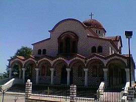 Agios Mamas Church | |
 Agios Mamas | |
| Coordinates: 40°15′N 23°21′E | |
| Country | Greece |
| Administrative region | Central Macedonia |
| Regional unit | Chalkidiki |
| Municipality | Nea Propontida |
| Municipal unit | Moudania |
| Highest elevation | 20 m (70 ft) |
| Lowest elevation | 10 m (30 ft) |
| Community | |
| • Population | 1,059 (2011) |
| Time zone | UTC+2 (EET) |
| • Summer (DST) | UTC+3 (EEST) |
| Postal code | 632 00 |
| Area code(s) | +30 23730 |
| Vehicle registration | ΧΚ |
| Website | http://www.interalex.net/search?q=agios+mamas |
Location
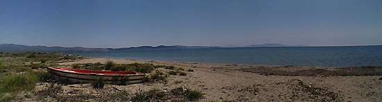
It is located on the gulf of Torone, 3 km from the beach (Papa Aloni), between the two fingers (smaller peninsulas) of Kassandra and Sithonia, 68 km southeast of Thessaloniki and 9 km east of Nea Moudania.
Economy
It is famous for its trade fair in the first days of September commemorating its patron saint Saint Mamas on 2 September.
The inhabitants are involved in olive farming for green table olives and olive oil as the rest of the villages of the area Olynthus, Kalyves Polygyrou and Yerakini.
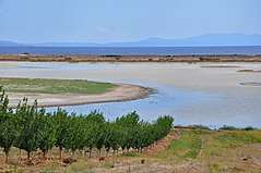
Its seaside is the continuation of Kalyves Polygyrou's with a very long sandy beach, after the river Olynthios delta, including Papa Aloni beach and Portes before Nea Potidea.
References
- "Απογραφή Πληθυσμού - Κατοικιών 2011. ΜΟΝΙΜΟΣ Πληθυσμός" (in Greek). Hellenic Statistical Authority.
External links

