Ceraunian Mountains
The Ceraunian Mountains (Albanian: Malet e Vetëtimës,[1] "Thunderbolt mountains"; Greek: Κεραύνια Όρη, Keravnia ori; Latin: Cerauni Montes), also commonly Akroceraunian Mountains (Ancient Greek: Ἀκροκεραύνια, Albanian: Malet Akrokeraune[1]), are a coastal mountain range in southwestern Albania, within the county of Vlorë. The range rises on the northeastern bank of the Ionian Sea. It extends for approximately 100 km (62 mi) in a southeast-northwest direction near Sarandë along the Albanian Riviera nearby to Orikum. Geologically, the Karaburun Peninsula belongs to the mountain range, forming the eastern Akroceraunian Mountains. The mountains are about 24 km (15 mi) long and about 4–7 km (2.5–4.3 mi) wide.[2]
| Ceraunian Mountains | |
|---|---|
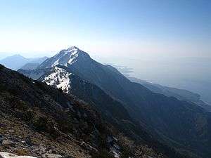
 View from the Maja e Çikës | |
| Highest point | |
| Elevation | 2,044 to 2,046 m (6,706 to 6,713 ft) |
| Coordinates | 40°11′53″N 19°38′20.27″E |
| Geography | |
| Location | Vlorë County, Albania |
| Geology | |
| Age of rock | Triassic |
| Mountain type | Limestone |
The highest peak is Maja e Çikës with an elevation of 2,044 metres (6,706 ft).[3][4] The Llogara Pass (1,027 metres (3,369 ft)) divides the mountains into a western and the Akroceraunian Mountains within the Karaburun Peninsula.
History
The Ceraunian mountain range is located in the northernmost part of the wider geographical region of Epirus.[5] According to Greek Mythology the Abantes from Euboea who had previously joined the Greek army in Trojan War settled in the Ceraunian Mountains. They were later expelled by the forces of the Greek city-state of Apollonia.[6]
The Ceraunian Mountains have been described by ancient writers such as Ptolemy, Strabo and Pausanias. Consequently, the mountains are still known under its classical name. Julius Caesar first set foot on Llogara Pass and rested his legion at Palasë on the Ionian coast during his pursuit of Pompey. The name is derived from Ancient Greek Κεραύνια ὄρη,[7][8] meaning "thunder-split peaks".[9]
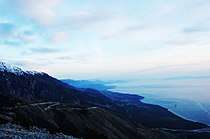
 The coastline of Himara seen from the pass of Llogara. |
 View from Maja e Çikës |
References
- Basha, Nermin (2012). "Epiri dhe Botailire ne veprën e Jul Cezarit, "Mbi Luftën Civile" [Epirus and the Illyrian world in the work of Julius Cesar, "On the Civil War"]". Studime Historike (3–4): 5.CS1 maint: ref=harv (link) "malet Akrokeraune, sot Malet e Vetëtimës"
- "Management Plan Llogora-Rreza e Kanalit-Dukat -Orikum-TragjasRadhime-Karaburun Complex Site" (PDF). vinc.s.free.fr (in Albanian). p. 23.
- "Maja e Çikës". Geonames.org. Retrieved 2012-01-26.
- The Finest Peaks - Prominence and Other Mountain Measures (Adam Helman ed.). Trafford Publishing. ISBN 9781412059954.
- Shrimpton, Gordon S. (1991). [9780773562912 Theopompus the historian] Check
|url=value (help). McGill-Queen's University Press. p. 391. ISBN 978-0-7735-6291-2. - Joaquim Carvalho. Religion, Ritual and Mythology: Aspects of Identity Formation in Europe, Pisa University Press, p. 148
- Strabo, Geography, Book VI, 3.5 at LacusCurtius
- Strabo, Geography Book VII, 5.1 LacusCurtius
- Keraunia Archived December 2, 2009, at the Wayback Machine, Henry George Liddell, Robert Scott, A Greek-English Lexicon, at Perseus
