Abul-Samsari Range
Abul-Samsari Range (Georgian: აბულ-სამსარის ქედი) is a volcanic range in southern Georgia, 120 km (75 mi) to the southwest of Tbilisi. It is a part of the Lesser Caucasus Mountains and rises above the Javakheti and Tsalka Plateaus. The range itself is 40 km (25 mi) long and runs north to south from the Ktsia to the Paravani River Gorges.
| Abul-Samsari Range | |
|---|---|
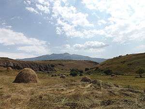 View from Samsari Monastery. | |
| Highest point | |
| Peak | Didi Abuli |
| Elevation | 3,301 m (10,830 ft) |
| Dimensions | |
| Length | 40 km (25 mi) N-S |
| Geography | |
 | |
| Country | |
| Range coordinates | 41°31′30″N 43°41′00″E |
| Parent range | Caucasus Mountains |
Mountains
The highest mountain is Didi Abuli at an elevation of 3,301 m (10,830 ft) above sea level. Other notable peaks include Mt. Tavkvetili (2,583 m or 8,474 ft), Shavnabada (2,929 m or 9,610 ft), and Samsari (3,285 m or 10,778 ft). Mount Samsari has a fairly large caldera, the floor of which is covered by the rocks from the mountain's last eruption.
Vegetation
The slopes of the Abul-Samsari Range are mainly covered with alpine meadows and grasslands. Forests are less common and are usually found at the lowest elevations of the Range (below1,900 m or 6,234 ft above sea level).
There are numerous small and medium-sized lakes in and around the Abul-Samsari Range.
.jpg)