1996 Oakfield tornado outbreak
The 1996 Oakfield tornado outbreak was a small, but destructive outbreak of 12 tornadoes that struck Wisconsin on July 18, 1996. The worst event was an F5 tornado that severely damaged the village of Oakfield, Wisconsin.[2] The outbreak killed one and injured 13.[1]
Part of tornado outbreaks of 1996 | |
 Chase photograph of the Oakfield tornado. (Courtesy Cailyn Lloyd) | |
| Type | Tornado Outbreak |
|---|---|
| Duration | July 18, 1996 |
| Tornadoes confirmed | 12 |
| Max. rating1 | F5 tornado |
| Duration of tornado outbreak2 | 3 hours, 8 minutes[1] |
| Damage | ≥$40 million (1996 USD) |
| Casualties | 1 fatality, 13 injuries |
| Areas affected | Wisconsin |
| 1Most severe tornado damage; see Fujita scale 2Time from first tornado to last tornado | |
Meteorlogical Synopsis
Strong thunderstorms brought heavy rains, lightning, and gusty winds to the south east central region of Wisconsin. All of these elements resulted from the passage of a strong upper level disturbance over an extremely unstable airmass.[2]
Tornado table
| FU | F0 | F1 | F2 | F3 | F4 | F5 | Total |
|---|---|---|---|---|---|---|---|
| 0 | 6 | 4 | 1 | 0 | 0 | 1 | 12 |
| F# | Location | County | State | Time (UTC) | Path length | Max Width | Damage |
|---|---|---|---|---|---|---|---|
| F1 | SW of Tomahawk to W of Gilbert | Lincoln | WI | 22:20-? | 3 miles (4.8 km) | 100 yards (91 m) | Three cottages, one home and a tavern were damaged. A garage was removed from its foundation and two boats were flipped.[3] |
| F1 | NE of Princeton | Green Lake | WI | 23:15-? | 2 miles (3.2 km) | 125 yards (114 m) | Damage was limited to trees.[4] |
| F2 | S of Jericho to Marytown | Calumet, Fond du Lac | WI | 00:05-? | 6.4 miles (10.3 km) | 200 yards (180 m) | 1 death - North of Marytown a couple dozen barns, sheds and homes were damaged or destroyed. In Marytown a house trailer, three homes and a machine shed were destroyed. In rural Calumet County two barns, trees, crops were damaged and calf houses were thrown 1,000 feet (300 m). One person was injured.[5] |
| F5 | Oakfield to N of Marblehead | Fond du Lac | WI | 00:05-? | 13.3 miles (21.4 km) | 400 yards (370 m) | See section on this tornado – Four homes were swept from their foundations, and automobiles were carried 400 feet (120 m) through the air and mangled beyond recognition. Some of the homes were anchor-bolted to their foundations, and rebar supports along the perimeter of one home were bent over at a 90-degree angle. A total of 60 homes, six businesses, a canning company, two churches, 18 barns, several and several sheds were destroyed while 150 homes and businesses were also damaged. 500 acres (2.0 km2) of crops were also wiped away with only 1-inch stubble left. Damage totals reached $39.5 million (1996 USD) and 12 people were injured. A weaker tornado also hit the area 20 minutes later.[6][7] |
| F0 | Marytown | Fond du Lac | WI | 00:07-? | 1.2 miles (1.9 km) | 75 yards (69 m) | A second tornado struck Marytown, damaging farm crops.[8] |
| F0 | S of Charlesburg | Calumet | WI | 00:10-? | 0.1 miles (0.16 km) | 25 yards (23 m) | Brief tornado flattened two wheat fields.[9] |
| F0 | Oakfield | Fond du Lac | WI | 00:25-? | 0.6 miles (0.97 km) | 50 yards (46 m) | Second tornado moved through portions of the damage path of the F5 tornado, picking up debris from the ground but did not cause any additional structural damage.[10] |
| F0 | NW of North Fond du Lac | Fond du Lac | WI | 00:27-? | 0.2 miles (0.32 km) | 50 yards (46 m) | A barn, machinery and crops were damaged or destroyed.[11] |
| F0 | NE of Lomira | Fond du Lac | WI | 00:55-? | 0.1 miles (0.16 km) | 50 yards (46 m) | Brief tornado flattened portions of a corn field.[12] |
| F1 | S of Beechwood | Sheboygan | WI | 01:10-? | 0.9 miles (1.4 km) | 150 yards (140 m) | Several homes and a few barns were damaged, along with crops.[13] |
| F1 | Fredonia to Holy Cross to ESE of Decker | Ozaukee | WI | 01:18-? | 7.6 miles (12.2 km) | 125 yards (114 m) | Four barns, three machine sheds and a one-car garage were destroyed while six homes, a barn, three machine sheds and a garage were damaged. Several vehicles were also damaged or destroyed, as well as 500 acres (2.0 km2) of crops.[14] |
| F0 | E of Knellsville | Ozaukee | WI | 01:28-? | 0.8 miles (1.3 km) | 75 yards (69 m) | This tornado spent most of its lifetime over Lake Michigan, causing little to no damage.[15] |
Oakfield, Wisconsin
| F5 tornado | |
|---|---|
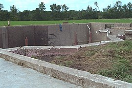
 A home that was leveled and completely swept away by the Oakfield F5 tornado with severly bent anchor bolts and rebar supports visible. (Courtesy of NWS Milwaukee, Wisconsin) | |
| Max. rating1 | F5 tornado |
| Damage | $39.5 million (1996 USD) |
| Casualties | 12 injuries |
| 1Most severe tornado damage; see Fujita scale | |
At 6:05 p.m., The violent tornado developed outside of town and moved eastward across Fond du Lac County, directly through Oakfield. At 7:15 p.m. the large tornado struck the village (pop: 1,012), injuring 12 people and causing $39.5 million (1996 USD) in damage.[6] Out of the 327 homes in Oakfield, 47 were destroyed and an additional 56 homes, as well as numerous businesses and churches, suffered heavy damage. A state of emergency was declared by then-Wisconsin Governor Tommy Thompson allowing National Guard soldiers to be called in to aid victims and clear debris.
The tornado was strong enough to level the Friday Canning Company, sweeping up millions of empty cans and leaving them scattered over a 50 miles (80 km) radius. Besides structural damage to buildings the tornado was very costly to farmers: Crops, livestock, and farm equipment were also destroyed. The original National Weather Service report from Milwaukee/Sullivan categorized the tornado to be an F3 to F4 tornado on the Fujita scale. It was later upgraded to an F5, the most intense category tornado possible. It would be the only F5 tornado to hit the United States that year. The tornado was documented by at least three experienced storm chasers.[16]
References
- http://www.tornadohistoryproject.com/tornado/1996/7/18/table
- "Tornado! The Oakfield, Wisconsin Case Study". University of Wisconsin-Madison Cooperative Institute for Meteorological Satellite Studies. Retrieved February 27, 2018.
- http://www.tornadohistoryproject.com/tornado/19960718.55.6
- http://www.tornadohistoryproject.com/tornado/19960718.55.7
- http://www.tornadohistoryproject.com/tornado/19960718.55.9
- http://www.tornadohistoryproject.com/tornado/19960718.55.8
- http://cimss.ssec.wisc.edu/oakfield/nwsoak.html
- http://www.tornadohistoryproject.com/tornado/19960718.55.10
- http://www.tornadohistoryproject.com/tornado/19960718.55.11
- http://www.tornadohistoryproject.com/tornado/19960718.55.12
- http://www.tornadohistoryproject.com/tornado/19960718.55.13
- http://www.tornadohistoryproject.com/tornado/19960718.55.14
- http://www.tornadohistoryproject.com/tornado/19960718.55.15
- http://www.tornadohistoryproject.com/tornado/19960718.55.16
- http://www.tornadohistoryproject.com/tornado/19960718.55.17
- Renee Geiser. "Wisconsin Tornado Outbreak of July 18, 1996: Formation of Tornadic Supercells. Retrieved February 27, 2018.
External links
- Oakfield Tornado write-up from the National Weather Service
- Photographs of tornado from storm chaser
- Aerial photographs from a day and a half later
- Map of July 18, 1996 tornadoes