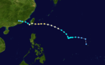
1975 Pacific typhoon season
The 1975 Pacific typhoon season was one of the deadliest tropical cyclone seasons on record, with nearly 230,000 fatalities occurring during the season. It had no official bounds; it ran year-round in 1975, but most tropical cyclones tend to form in the northwestern Pacific Ocean between June and December. These dates conventionally delimit the period of each year when most tropical cyclones form in the northwestern Pacific Ocean.
| 1975 Pacific typhoon season | |
|---|---|
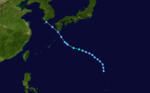
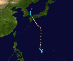
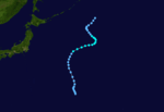
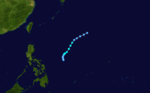
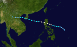
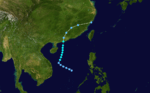
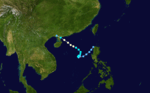
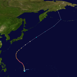
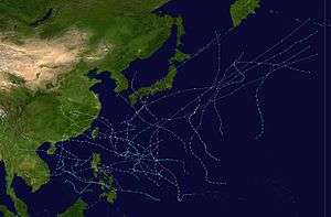 Season summary map | |
| Seasonal boundaries | |
| First system formed | January 21, 1975 |
| Last system dissipated | December 30, 1975 |
| Strongest storm | |
| Name | June |
| • Maximum winds | 295 km/h (185 mph) (1-minute sustained) |
| • Lowest pressure | 875 hPa (mbar) |
| Seasonal statistics | |
| Total depressions | 25 |
| Total storms | 20 |
| Typhoons | 14 |
| Super typhoons | 3 (unofficial) |
| Total fatalities | >229,160 |
| Total damage | > $1.2 billion (1975 USD) |
| Related articles | |
Tropical Storms formed in the entire west pacific basin were assigned a name by the Joint Typhoon Warning Center. Tropical depressions in this basin have the "W" suffix added to their number. Tropical depressions that enter or form in the Philippine area of responsibility are assigned a name by the Philippine Atmospheric, Geophysical and Astronomical Services Administration or PAGASA. This can often result in the same storm having two names.
Some of the notable storms here are Typhoon Nina, which caused the Banqiao Dam flood, which resulted in approximately 229,000 people dead, and Super Typhoon June, which was the strongest storm on record with a pressure of 875 mbar, until beaten by Typhoon Tip in 1979 with 870 mbar.
Systems
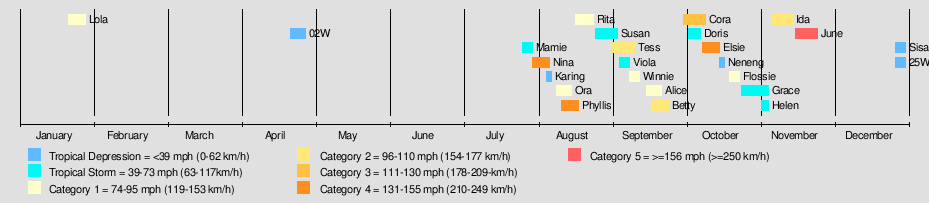
25 tropical depressions formed this year in the Western Pacific, of which 20 became tropical storms. 14 storms reached typhoon intensity, of which 3 reached super typhoon strength.[1]
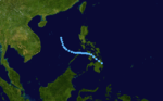
Typhoon Lola (Auring)
| Typhoon (JMA) | |
| Category 1 typhoon (SSHWS) | |
 | |
| Duration | January 21 – January 28 |
|---|---|
| Peak intensity | 130 km/h (80 mph) (1-min) 975 hPa (mbar) |
Typhoon Lola (Auring) was a very early typhoon. It made landfall on Mindanao as a minimal typhoon on January 24 and transversed the southern Philippines as a tropical storm. Lola crossed the South China Sea before stalling in the open sea and dissipating on January 28. The typhoon caused 30 casualties from mudslides and heavy rain.
Tropical Depression 02W
| Tropical depression (JMA) | |
| Tropical depression (SSHWS) | |
 | |
| Duration | April 22 – April 28 |
|---|---|
| Peak intensity | 45 km/h (30 mph) (1-min) 1005 hPa (mbar) |
2W formed near the Philippines and hit it.
Tropical Storm Mamie
| Tropical storm (JMA) | |
| Tropical storm (SSHWS) | |
 | |
| Duration | July 26 – July 30 |
|---|---|
| Peak intensity | 75 km/h (45 mph) (1-min) 992 hPa (mbar) |
Mamie skirted Japan and Korea.
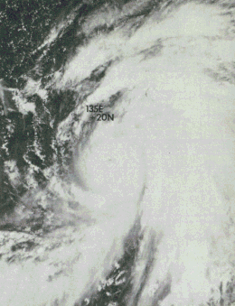
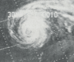
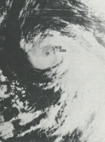
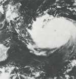
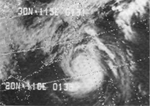
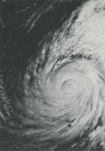
Super Typhoon Nina (Bebeng)
| Typhoon (JMA) | |
| Category 4 typhoon (SSHWS) | |
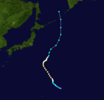
_Ex._Deepening.JPG) 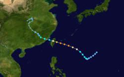 | |
| Duration | July 30 – August 6 |
|---|---|
| Peak intensity | 250 km/h (155 mph) (1-min) 900 hPa (mbar) |
Nina was a short-lived but rapidly intensifying typhoon. After forming on July 30, it struck Taiwan at super typhoon intensity. It stayed a typhoon during its passage over the island, causing 25 fatalities and widespread damage. It emerged into the Formosa Strait and weakened to a tropical storm. Nina headed inland. Its moisture interacted with a cold front, causing a huge amount of rainfall. The rainfall contributed to the bursting of the Banqiao Dam, causing the deaths of at least 229,000 people.
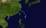
Tropical Depression 05W (Karing)
| Tropical depression (PAGASA) | |
| Tropical depression (SSHWS) | |
 | |
| Duration | August 5 – August 7 |
|---|---|
| Peak intensity | 55 km/h (35 mph) (10-min) |
5W lasted two days.
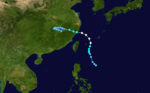
Typhoon Ora (Diding)
| Typhoon (JMA) | |
| Category 1 typhoon (SSHWS) | |
 | |
| Duration | August 9 – August 15 |
|---|---|
| Peak intensity | 120 km/h (75 mph) (1-min) 970 hPa (mbar) |
Ora hit China.
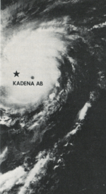
Typhoon Phyllis (Etang)
| Typhoon (JMA) | |
| Category 4 typhoon (SSHWS) | |
  | |
| Duration | August 11 – August 18 |
|---|---|
| Peak intensity | 220 km/h (140 mph) (1-min) 920 hPa (mbar) |
Phyllis struck the southern part of Japan on August 17 as a minimal typhoon, having weakened from a peak of 140 mph winds. Phyllis caused over 60 casualties, with landslides and flooding causing moderate to heavy damage.
Typhoon Rita
| Typhoon (JMA) | |
| Category 1 typhoon (SSHWS) | |
  | |
| Duration | August 17 – August 24 |
|---|---|
| Peak intensity | 150 km/h (90 mph) (1-min) 965 hPa (mbar) |
Rita formed August 17 and erratically headed north and affected the Ryūkyū Islands. Rita then made landfall on Shikoku as a moderately strong Category 1 typhoon. It moved along the entire length of Japan, weakening to a depression. Rita strengthened back into a tropical storm over the Kuril Islands— an unusually northerly location— before dissipating on August 24. At least 26 deaths can be attributed to this typhoon from the heavy flooding— the worst in 10 years.
Severe Tropical Storm Susan
| Severe tropical storm (JMA) | |
| Tropical storm (SSHWS) | |
 | |
| Duration | August 25 – September 3 |
|---|---|
| Peak intensity | 95 km/h (60 mph) (1-min) 985 hPa (mbar) |
Susan moved generally north.
Typhoon Tess
| Typhoon (JMA) | |
| Category 2 typhoon (SSHWS) | |
  | |
| Duration | September 1 – September 10 |
|---|---|
| Peak intensity | 175 km/h (110 mph) (1-min) 945 hPa (mbar) |
Tess followed Susan's footsteps.
Tropical Storm Viola (Gening)
| Tropical storm (JMA) | |
| Tropical storm (SSHWS) | |
  | |
| Duration | September 4 – September 8 |
|---|---|
| Peak intensity | 85 km/h (50 mph) (1-min) 995 hPa (mbar) |
Viola did not affect land.
Typhoon Winnie
| Typhoon (JMA) | |
| Category 1 typhoon (SSHWS) | |
  | |
| Duration | September 8 – September 12 |
|---|---|
| Peak intensity | 120 km/h (75 mph) (1-min) 980 hPa (mbar) |
Winnie did not affect land either.
Typhoon Alice (Herming)
| Typhoon (JMA) | |
| Category 1 typhoon (SSHWS) | |
  | |
| Duration | September 15 – September 21 |
|---|---|
| Peak intensity | 140 km/h (85 mph) (1-min) 970 hPa (mbar) |
Alice hit the Philippines, China, Vietnam and Thailand.
Typhoon Betty (Ising)
| Typhoon (JMA) | |
| Category 2 typhoon (SSHWS) | |
  | |
| Duration | September 17 – September 24 |
|---|---|
| Peak intensity | 175 km/h (110 mph) (1-min) 950 hPa (mbar) |
Betty hit Taiwan and China.
Typhoon Cora (Luding)
| Typhoon (JMA) | |
| Category 3 typhoon (SSHWS) | |
  | |
| Duration | September 30 – October 9 |
|---|---|
| Peak intensity | 195 km/h (120 mph) (1-min) 945 hPa (mbar) |
Cora re-curved east of Japan.
Severe Tropical Storm Doris
| Severe tropical storm (JMA) | |
| Tropical storm (SSHWS) | |
 | |
| Duration | October 2 – October 7 |
|---|---|
| Peak intensity | 100 km/h (65 mph) (1-min) 985 hPa (mbar) |
Doris hit China as a high-end tropical storm.
Super Typhoon Elsie (Mameng)
| Typhoon (JMA) | |
| Category 4 typhoon (SSHWS) | |
  | |
| Duration | October 8 – October 15 |
|---|---|
| Peak intensity | 250 km/h (155 mph) (1-min) 900 hPa (mbar) |
This storm ultimately hit Hong Kong.
Tropical Depression 18W (Neneng)
| Tropical depression (PAGASA) | |
| Tropical depression (SSHWS) | |
 | |
| Duration | October 15 – October 17 |
|---|---|
| Peak intensity | 45 km/h (30 mph) (10-min) 1002 hPa (mbar) |
18W dissipated near the Philippines.
Typhoon Flossie
| Typhoon (JMA) | |
| Category 1 typhoon (SSHWS) | |
 | |
| Duration | October 19 – October 23 |
|---|---|
| Peak intensity | 130 km/h (80 mph) (1-min) 970 hPa (mbar) |
Flossie struck the extreme southern part of China at Category 1 intensity. 44 people were lost from 2 freighters sinking.
Severe Tropical Storm Grace (Oniang)
| Severe tropical storm (JMA) | |
| Tropical storm (SSHWS) | |
 | |
| Duration | October 24 – November 4 |
|---|---|
| Peak intensity | 110 km/h (70 mph) (1-min) 985 hPa (mbar) |
Grace moved northwest away from the Philippines.
Tropical Storm Helen (Pepang)
| Tropical storm (JMA) | |
| Tropical storm (SSHWS) | |
 | |
| Duration | November 1 – November 4 |
|---|---|
| Peak intensity | 85 km/h (50 mph) (1-min) 1000 hPa (mbar) |
Helen hit Vietnam and The Philippines.
Typhoon Ida
| Typhoon (JMA) | |
| Category 2 typhoon (SSHWS) | |
 | |
| Duration | November 5 – November 14 |
|---|---|
| Peak intensity | 155 km/h (100 mph) (1-min) 950 hPa (mbar) |
Ida recurved out to sea.
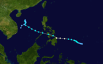
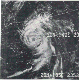
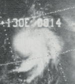
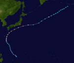
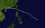
Super Typhoon June (Rosing)
| Typhoon (JMA) | |
| Category 5 super typhoon (SSHWS) | |
  | |
| Duration | November 15 – November 25 |
|---|---|
| Peak intensity | 295 km/h (185 mph) (1-min) 875 hPa (mbar) |
Typhoon June was the strongest storm of the season, but it had no effect on land. At the time, June was the strongest typhoon on record, and tropical cyclone worldwide, with a minimum central pressure of 875 millibars. June was also the first recorded case of a typhoon with triple eyewalls.[2]
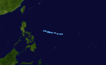
Tropical Depression 24W (Sisang)
| Tropical depression (PAGASA) | |
| Tropical depression (SSHWS) | |
 | |
| Duration | December 26 – December 30 |
|---|---|
| Peak intensity | 55 km/h (35 mph) (10-min) |
A late season tropical depression affected the Philippines before turning back toward the ocean and dissipated out at sea.
Storm names
International
Western North Pacific tropical cyclones were named by the Joint Typhoon Warning Center. The first storm of 1975 was named Lola and the final one was named June.
|
|
|
|
Philippines
| Auring | Bebeng | Karing | Diding | Etang |
| Gening | Herming | Ising | Luding | Mameng |
| Neneng | Oniang | Pepang | Rosing | Sisang |
| Trining (unused) | Uring (unused) | Warling (unused) | Yayang (unused) | |
| Auxiliary list | ||||
|---|---|---|---|---|
| Ading (unused) | ||||
| Barang (unused) | Krising (unused) | Dadang (unused) | Erling (unused) | Goying (unused) |
The Philippine Atmospheric, Geophysical and Astronomical Services Administration uses its own naming scheme for tropical cyclones in their area of responsibility. PAGASA assigns names to tropical depressions that form within their area of responsibility and any tropical cyclone that might move into their area of responsibility. Should the list of names for a given year prove to be insufficient, names are taken from an auxiliary list, the first 6 of which are published each year before the season starts. Names not retired from this list will be used again in the 1979 season. This is the same list used for the 1971 season. PAGASA uses its own naming scheme that starts in the Filipino alphabet, with names of Filipino female names ending with "ng" (A, B, K, D, etc.). Names that were not assigned/going to use are marked in gray.
References
- 1975 ATCR TABLE OF CONTENTS Archived 2011-06-06 at the Wayback Machine
- Shanmin, Chen (1987). "Preliminary analysis on the structure and intensity of concentric double-eye typhoons". Advances in Atmospheric Sciences. 4 (1): 113–118. Bibcode:1987AdAtS...4..113C. doi:10.1007/BF02656667.
External links
- Japan Meteorological Agency
- Joint Typhoon Warning Center.
- China Meteorological Agency
- National Weather Service Guam
- Hong Kong Observatory
- Macau Meteorological Geophysical Services
- Korea Meteorological Agency
- Philippine Atmospheric, Geophysical and Astronomical Services Administration
- Taiwan Central Weather Bureau
- Digital Typhoon - Typhoon Images and Information
- Typhoon2000 Philippine typhoon website