West Fourth Street–Washington Square station
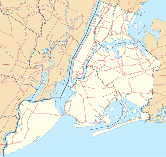
West Fourth Street–Washington Square is an express station and transfer stop on the IND Sixth Avenue and IND Eighth Avenue Lines of the New York City Subway, located at the intersection of West Fourth Street and Sixth Avenue (Avenue of the Americas) in Greenwich Village, Manhattan. It is served by:
- A, D, E, and F trains at all times;
- B and M trains on weekdays;
- C train at all times except late nights; and
- <F> train during rush hours in the peak direction.
West 4 Street– Washington Square | |||||||||||||||
|---|---|---|---|---|---|---|---|---|---|---|---|---|---|---|---|
 IND Eighth Avenue Line platforms | |||||||||||||||
| Station statistics | |||||||||||||||
| Address | West Third Street & Sixth Avenue New York, NY 10014 (main station entrance) | ||||||||||||||
| Borough | Manhattan | ||||||||||||||
| Locale | Greenwich Village | ||||||||||||||
| Coordinates | 40.731682°N 74.000945°W | ||||||||||||||
| Division | B (IND) | ||||||||||||||
| Line | IND Sixth Avenue Line IND Eighth Avenue Line | ||||||||||||||
| Services | A B C D E F M | ||||||||||||||
| Transit connections | |||||||||||||||
| Structure | Underground | ||||||||||||||
| Levels | 2 | ||||||||||||||
| Platforms | 4 island platforms (2 on each level) cross-platform interchange | ||||||||||||||
| Tracks | 8 (4 on each level) | ||||||||||||||
| Other information | |||||||||||||||
| Opened | September 10, 1932[1] (upper level) January 1, 1936 (lower level) | ||||||||||||||
| Station code | 167[2] | ||||||||||||||
| Accessible | |||||||||||||||
| Wireless service | |||||||||||||||
| Opposite-direction transfer available | Yes | ||||||||||||||
| Traffic | |||||||||||||||
| Passengers (2019) | 14,063,633[4] | ||||||||||||||
| Rank | 19 out of 424[4] | ||||||||||||||
| Station succession | |||||||||||||||
| Next north | 34th Street–Herald Square (6th Ave express): B 14th Street (8th Ave): A 14th Street (6th Ave local): F | ||||||||||||||
| Next | 34th Street–Herald Square (6th Ave): B 14th Street (8th Ave): A | ||||||||||||||
| Next south | Broadway–Lafayette Street (6th Ave): B Spring Street (8th Ave local): A Canal Street (8th Ave express): A | ||||||||||||||
| Next | Broadway–Lafayette Street (6th Ave): B World Trade Center (8th Ave local): E Fulton Street: A | ||||||||||||||
| |||||||||||||||
| |||||||||||||||
| |||||||||||||||
West 4th Street Subway Station (IND) | |||||||||||||||
| MPS | New York City Subway System MPS | ||||||||||||||
| NRHP reference No. | 05000223[5] | ||||||||||||||
| Added to NRHP | March 30, 2005 | ||||||||||||||

History
West Fourth Street opened on September 10, 1932, as part of the city-operated Independent Subway System (IND)'s initial segment, the Eighth Avenue Line between Chambers Street and 207th Street.[1][6] At the time, only the upper level was used, with service on the lower level beginning on December 15, 1940 with the opening of the Sixth Avenue local tracks.[7] The Sixth Avenue express tracks were built later and were put into through service on November 27, 1967; prior to then, the express tracks here and at 34th Street–Herald Square were used as terminal tracks only.[8]
The station was named "West Fourth Street" as opposed to merely "Fourth Street" because the planners of the Independent Subway System believed there would be confusion between this station and "South Fourth Street", a proposed transfer station on the never-built IND Second System in Williamsburg, Brooklyn.[9]


Station layout
| G | Street level | Exit/entrance |
| B1 | Mezzanine | Fare control, station agents |
| B2 | Northbound local | ← ← ← |
| Island platform | ||
| Northbound express | ← | |
| Southbound express | | |
| Island platform | ||
| Southbound local | | |
| B3 | Mezzanine | Connection between platform levels |
| B4 | Northbound local | ← ← |
| Island platform | ||
| Northbound express | ← ← | |
| Southbound express | | |
| Island platform | ||
| Southbound local | | |
West Fourth Street station was built by the IND as the major transfer point between its two Manhattan trunk lines. It can be considered the "heart" of the IND system as it is the location of the zero point on the IND chaining. It is a bi-level station with a connecting concourse between the two platform levels. The Eighth Avenue Line occupies the upper level, while the Sixth Avenue Line uses the lower level. Both levels use identical platform arrangements–two island platforms between four tracks, allowing for cross-platform interchanges between local and express trains in each direction.
There are three fare control areas - two at the northern end of the station, and one at the southern end. All lead directly to the Eighth Avenue Line on the upper level platforms; access to the Sixth Avenue Line on the lower level is via stairs and elevators from the upper level and/or the full-length mezzanine between the two levels. Several escalators are present, which go directly between one of the lower level platforms to its corresponding upper level platform. The elevators, added in April 2005 to make the station ADA-accessible, provide access to both levels and to the mezzanine.[10]
Exits

The station does not have an exit to Fourth Street itself anymore, though an exit formerly existed there.[11] The northern exits are on the northern side of 6th Avenue and Waverly Place. Two staircases go up to the northeast corner, both built into alcoves of stores, and one to the northwest corner. The southern exits are at West Third Street, on the east and west sides of 6th Avenue.[12]
- Two to the northwest corner (within building), one to the northeast corner (within building) of Sixth Avenue and Waverly Place[12]
- One to the east side of Sixth Avenue north of Waverly Place[12]

- One on the west side of Sixth Avenue at West Third Street[12]
There are also four additional closed exits that directly led to the mezzanine. Two went to Washington Place, and the other two went to West 4th Street itself.[11] There is a fifth closed exit at one northern fare control area; it led to the southwestern corner of Greenwich Avenue and Sixth Avenue.
Nearby points of interest
References
- "List of the 28 Stations on the New 8th Av. Line". The New York Times. September 10, 1932. p. 6. ISSN 0362-4331. Retrieved April 21, 2020.
- "Station Developers' Information". Metropolitan Transportation Authority. Retrieved June 13, 2017.
- "NYC Subway Wireless – Active Stations". Transit Wireless Wifi. Retrieved November 13, 2019.
- "Facts and Figures: Annual Subway Ridership 2014–2019". Metropolitan Transportation Authority. 2020. Retrieved May 26, 2020.
- "NPS Focus". National Register of Historic Places. National Park Service. Retrieved January 25, 2012.
- Crowell, Paul (September 10, 1932). "Gay Midnight Crowd Rides First Trains In The New Subway: Throngs at Station an Hour Before Time, Rush Turnstiles When Chains are Dropped" (PDF). New York Times. Retrieved November 8, 2015.
- "NEW SUBWAY LINE ON 6TH AVE. OPENS AT MIDNIGHT FETE; Mayor and 2,000 Guests Jam Two 'First Trains'--Supper and Show Mark Event WORK COST $59,500,000 2-Mile Link in City System to Ease Bottleneck, Make New Express Services Possible". The New York Times. Retrieved June 27, 2018.
- Raskin, Joseph B. (2013). The Routes Not Taken: A Trip Through New York City's Unbuilt Subway System. New York, New York: Fordham University Press. doi:10.5422/fordham/9780823253692.001.0001. ISBN 978-0-82325-369-2.
- Pollak, Michael (September 12, 2008). "F. Y. I." The New York Times. Retrieved August 5, 2009.
- Chan, Sewell (October 29, 2005). "New Elevators in Subways Are Delayed". The New York Times. Retrieved September 13, 2015.
- Review of the A and C Lines (PDF) (Report). Metropolitan Transportation Authority. December 11, 2015. Archived from the original (PDF) on February 3, 2020. Retrieved January 19, 2016.
- "MTA Neighborhood Maps: West VIllage" (PDF). Metropolitan Transportation Authority. 2015. Retrieved September 13, 2015.
External links
| Wikimedia Commons has media related to West Fourth Street – Washington Square (New York City Subway). |
nycsubway.org
- nycsubway.org – IND 8th Avenue: West Fourth Street/Washington Square
- nycsubway.org – IND 6th Avenue: West Fourth Street/Washington Square
Station Reporter
- Station Reporter – A Lefferts
- Station Reporter – A Rockaway
- Station Reporter – B Train
- Station Reporter — C Train
- Station Reporter – D Train
- Station Reporter – E Train
- Station Reporter — F Train
- Station Reporter – M Train
Google Maps Street View
| Sixth Ave. Line |
| ||||||||||
|---|---|---|---|---|---|---|---|---|---|---|---|
| Eighth Ave. Line |
| ||||||||||
| |||||||||||
| Topics |  | |
|---|---|---|
| Lists by county |
| |
| Lists by city | ||
| Other lists | ||
| ||