Verdikal Gap
Verdikal Gap (Bulgarian: Вердикалска седловина, ‘Verdikalska Sedlovina’ \ver-di-'kal-ska se-dlo-vi-'na\) is the flat ice-covered saddle of elevation over 750 m on Trinity Peninsula in Graham Land, Antarctica, part of the ice divide between Bransfield Strait and Prince Gustav Channel. It is extending 5.3 km between Louis-Philippe Plateau to the north and Mount Canicula and Trakiya Heights to the south, and overlooking Russell West Glacier to the west and Russell East Glacier to the southeast.
The gap is named after the settlement of Verdikal in Western Bulgaria.
Location
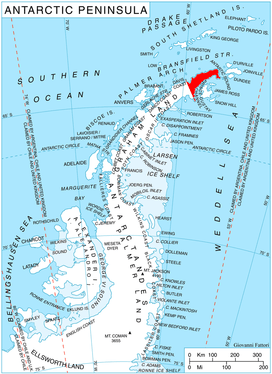
Verdikal Gap is centred at 63°41′00″S 58°30′30″W. German-British mapping in 1996.
Maps
- Trinity Peninsula. Scale 1:250000 topographic map No. 5697. Institut für Angewandte Geodäsie and British Antarctic Survey, 1996.
- Antarctic Digital Database (ADD). Scale 1:250000 topographic map of Antarctica. Scientific Committee on Antarctic Research (SCAR). Since 1993, regularly updated.
References
- Verdikal Gap. SCAR Composite Antarctic Gazetteer.
- Bulgarian Antarctic Gazetteer. Antarctic Place-names Commission. (details in Bulgarian, basic data in English)
External links
- Verdikal Gap. Copernix satellite image
This article includes information from the Antarctic Place-names Commission of Bulgaria which is used with permission.