Takayama, Gunma
Takayama (高山村, Takayama-mura) is a village located in Gunma Prefecture, Japan. As of February 2015, the village had an estimated population of 3,698, and a population density of 57.6 persons per km². Its total area is 64.18 km².
Takayama 高山村 | |
|---|---|
Village | |
 Takayama village office | |
 Flag  Seal | |
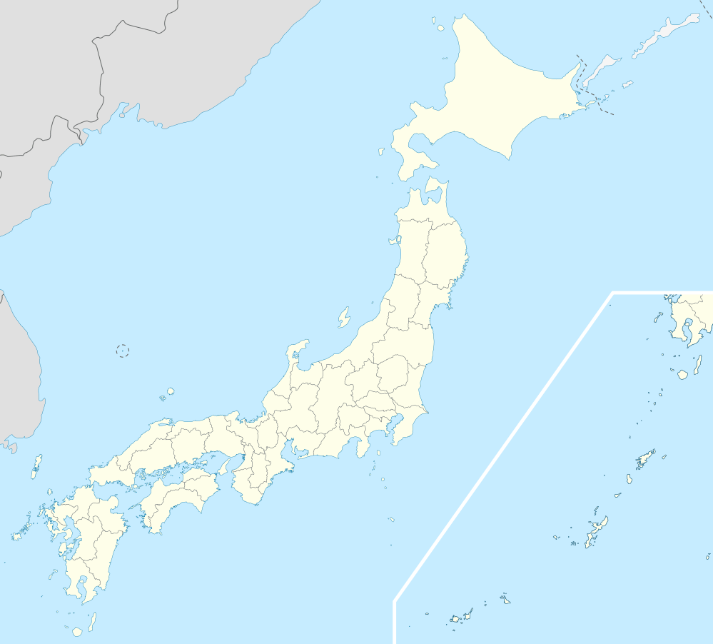
 Location of Takayama in Gunma Prefecture | |
 Takayama | |
| Coordinates: 36°37′4.7″N 138°56′36.9″E | |
| Country | Japan |
| Region | Kantō |
| Prefecture | Gunma Prefecture |
| District | Agatsuma |
| Area | |
| • Total | 64.18 km2 (24.78 sq mi) |
| Population (February 2015) | |
| • Total | 3,698 |
| • Density | 57.6/km2 (149/sq mi) |
| Time zone | UTC+9 (Japan Standard Time) |
| - Tree | Oak |
| - Flower | Japanese Gentian |
| - Bird | Copper pheasant |
| Phone number | 0279-63-2111 |
| Address | 2856-1 Ōaza Nakayama, Takayama-mura, Agatsuma-gun, Gunma-ken 377-0702 |
| Website | http://www.vill.takayama.gunma.jp/ |
Geography
Located at the easternmost point of Agatsuma District, Takayama is surrounded by mountains at all cardinal directions. The Gunma Telescope is located on Mount Komochi in the south.
- Mountains: Mount Onoko (1208m), Junigadake (1200.9m), Mount Komochi (1296m)
- Rivers: Agatsuma River
Surrounding municipalities
History
During the Edo period, the area around Takayama was part of the hatamoto-administered territory within Kōzuke Province. With the creation of the municipalities system after the Meiji Restoration on April 1, 1889, the village of Takayama was created within Agatsuma District of Gunma Prefecture.
Economy
The economy of Takayama is primarily agricultural.
Education
- Gumma Paz College – Takayama Campus
- Takayama Middle School
- Takayama Elementary School
Transportation
Takayama is served by train from Nagoya. The travel takes about 2h and 15 minutes
Local attractions
- Marble Village Lockheart Castle
- Gunma Prefectural Astronomical Observatory
External links
| Wikimedia Commons has media related to Takayama, Gunma. |
- Official Website (in Japanese)
Maebashi (capital) | ||
| Core cities |
| |
| Special cities | ||
| Cities | ||
| Districts | ||
| Authority control |
|
|---|