Knight Street Bridge
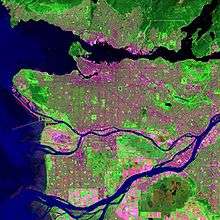
The Knight Street Bridge is a crossing over the north arm of the Fraser River, the Canadian National Railway (CNR) line, and several roads, in Metro Vancouver.
Knight Street Bridge | |
|---|---|
 | |
| Coordinates | 49°12′15″N 123°04′39″W |
| Carries | 4–6 lanes of Knight Street, and pedestrians/bicycles |
| Crosses | North Arm Fraser River |
| Locale | Richmond Vancouver |
| Maintained by | TransLink |
| Preceded by | Fraser Street Bridge |
| Characteristics | |
| Design | girder bridge |
| Total length | 1436 m |
| History | |
| Construction start | 1969 |
| Opened | January 15, 1974 |

| |
History
Infrastructure
The 1929 Vancouver Major Streets Plan designated the Clark-Knight corridor as a six-lane arterial road. The upgrade delayed for decades, Knight St. was never a streetcar route, and experienced less commercial and lower intensity development than nearby arterials.[1] A late 1950s metropolitan highway planning committee recommendation included a proposed 1970s crossing in the vicinity, to relieve the Oak Street Bridge.[2]
Constructed 1969–1974, the structure was the second cast-in-place segmental cantilever bridge built in North America, the first being Quebec in 1964. For many years, the 109.7-metre (360 ft) main span held the world record for this design.[3] Each drop-in span, which joins the two separate parallel cantilever spans from the main piers, is an arched post-tensioned concrete girder, resting on rubber bearings at each end.[4] Like Knight Street, the bridge was named after Robert Knight, a property owner in South Vancouver in the late 19th and early 20th centuries.[5]
During the planning stage, the project was known as the Fraser Street Bridge Replacement. At the official opening ceremony in January 1974, Graham Lea, provincial Minister of Highways, cut the ribbon. On hand were Gil Blair, mayor of Richmond, and Art Phillips, mayor of Vancouver.[6] Totalling about $15M, including $3M for roadways, the province funded the scheme.[7] On formation in 1999, TransLink assumed ownership and maintenance responsibilities.[8]
The configuration comprises an overpass of Marine Drive, the 238-metre (781 ft) Knight Street Bridge North, and the 1,198-metre (3,930 ft) Knight Street Bridge South. The six-lane medium-level bridge reduces to four lanes over Mitchell Island, the outside lanes becoming the off and on ramps for the island. The electrically heated deck minimizes winter de-icing.[9] On the underside of the deck, the western spans carry a maintenance walkway, above which are a water pipe, gas pipe, and electrical lines. The navigational clearance is 19–23 metres (62–75 ft) at the apex, depending upon the tide.[4]
Upgrading Knight St., and eliminating the load weight restrictions associated with the previous structure, this Vancouver–Richmond link eased congestion,[10] and connected to Highway 99, and since 1989, Highway 91. Averaging over 100,000 vehicle crossings daily, the bridge is the second busiest in the Lower Mainland.[11] Cyclists are legally required to ride on the sidewalks.[12]
Maintenance, upgrades and incidents
On January 15, 2000 the boom of a mobile crane transported on a barge named T.L. Sharpe, towed by the Sea Cap XII, struck the underside of the Knight Street Bridge at 1:45 PM, damaging the bridge and the fixtures secured underneath its deck. The impact caused the boom to bend and the crane to slide off the barge and sink, and the bridge was closed to traffic for about 48 hours.[4] Water supply to Mitchell Island via the bridge was shut down for 25 days, and an emergency bypass water supply from Vancouver was installed.[13] The incident prompted the City of Richmond to install a second water main to Mitchell Island in 2002.[14]

In 2011, the bridge underwent a seismic retrofit of three abutments, which were vulnerable to settlement or collapse from movements during soil liquefaction. The subsurface conditions comprise dense till-like soils for the north bridge, but potentially liquefiable deltaic sediments for the south bridge. The north abutments and piers rest upon spread footings, whereas the south ones rest upon timber and steel-pipe piles. To densify the ground, 105 injection boreholes were drilled to a depth of 12.3 metres (40 ft) around one abutment, and filled at pressure with a low mobility grout up to the surface. Timber compaction piles were used for densification in other areas. Steel-pipe piles were installed at a pier adjacent to the riverbank.[15]
Ranking first in Vancouver, the bridge was the scene of more than 2,500 car accidents during 2013–2017, of which nearly half resulted in injuries or fatalities.[16] The Marine Dr. on and off ramps have rated among Canada's most dangerous intersections.[17] In 2017, the city made design and signalling changes to enhance safety, which included a new turn bay for westbound vehicles on SE Marine Dr. turning north, and a new shared walking and cycling path.[18]
During early 2020, the bridge underwent extensive rehabilitation that required overnight single lane closures in each direction. The work included lighting upgrades, pier repairs, and the replacement of crash cushions, signage, and bearing and expansion joints.[11]
Land developments
Formerly, transport planning had not been coordinated with land use planning. However, the establishment of the Agricultural Land Reserve in 1973 encouraged the development of the Surrey plateau, and reduced encroachment upon the agricultural lowland of Richmond.[19] If land use had been determined by market forces alone, development along the Knight St. extension south of the bridge would have created the largest industrial park in region.[20] The initial zoning proposal was for a broader footprint south to Cambie Rd., but the final version provided the present narrower corridor south to Westminster Hwy.[21]
Transit
In 2014, improvements to the Mitchell Island interchange included extended loading bays to aid bus manoeuvering, widening passenger walkways, installing over 60 metres (197 ft) of safety barriers, new traffic islands, and new signage.[22]
The following TransLink services continue to use the bridge:[23]
- 22 Knight (Mar 1982 limited service extended into Richmond)[24]
- 405 Five Road / Cambie (Aug 2001 when 405 and 421 combined)[25]
- 407 Gilbert / Bridgeport (Apr 2002 when replaced 402)[26]
- 430 Metrotown / Richmond-Brighouse Station (since Sep 2009)[27]
430 Metrotown / Richmond (Dec 2004–Sep 2009)[28]
The following routes once used the bridge:
- 69 No. 5 Rd-Cambie (probably after Fraser Street Bridge closure; Aug 1977 possibly renumbered 421)
- 402 Two Road / Bridgeport (Aug 2001 when 402 and 420 combined;[25] Apr 2002 Richmond Centre eastern terminus)[26]
- 420 Bridgeport / Richmond Exchange (pre-May 1984;[29][30] Aug 2001 discontinued)[25]
- 421 Cambie Road / Richmond Exchange (possibly former 69; pre-May 1984;[29][30] Aug 2001 discontinued)[25]
The following bus stops are on Mitchell Island:[23]
- 22 Knight (see above)
- 405 Five Road / Cambie (see above)
- 407 Gilbert / Bridgeport (see above)
- 430 Metrotown / Richmond-Brighouse Station (see above)
The following bus stops, at the Knight Street–Marine Drive terminus on the north and south sides of SE Marine Dr., are closest:[23]
- N20 Downtown / Victoria (Jun 2016 extended from Harrison Loop)[31]
- 22 Knight (see above)
- 100 22nd Street Station / Marpole Loop (since Sep 2009)[27]
100 22nd Street Station / Airport Station (Aug 2001–Sep 2009)[32]
100 New Westminster Station/Airport (Oct 1984–Apr 2001)[33]
100/800 Midway Connector (renumbered by 1979)[34]
800 Midway Connector (1970s)[35] - 405 Five Road / Cambie (see above)
- 407 Gilbert / Bridgeport (see above)
- 430 Metrotown / Richmond-Brighouse Station (see above)
The following bus stops on or near Bridgeport Rd., south of the bridge, are closest:[23]
- 405 Five Road / Cambie (see above)
- 407 Gilbert / Bridgeport (see above)
- 430 Metrotown / Richmond-Brighouse Station (see above)
Footnotes
- "Clark-Knight Corridor Whole Route Analysis". www.vancouver.ca. 2003.
- Levesque 1974, p. 6.
- "Knight Street Bridge". www.linkedin.com.
- "Marine Investigation Report M00W0005". www.tsb.gc.ca. 2000.
- Walker, Elizabeth (1999). Street Names of Vancouver. Vancouver Historical Society. p. 67. ISBN 0-9692378-7-1.
- Dawe 1996, pp. 53–54.
- Dawe 1996, p. 55.
- "Buzzer blog, 17 May 2016". www.translink.ca. TransLink.
- "Vancouver history". www.vancouverhistory.ca. 1974.
- Levesque 1974, p. 4.
- "TransLink maintenance program". www.translink.ca.
- "Cycling: Bridge Crossings". www.richmond.ca.
- "City of Richmond: Report to Committee re: Knight Street Bridge Watermain" (PDF). www.richmond.ca.
- "City of Richmond: 2002 Annual Report" (PDF). www.richmond.ca. p. 7.
- "Seismic Assessment and Retrofit of the Knight Street Bridge". www.klohn.com.;
"Seismic Retrofit of the Knight Street Bridge". www.klohn.com.;
"Seismic Retrofit of the Knight Street Bridge". www.southwestcontracting.ca. - "Top 5 most dangerous intersections in Vancouver, B.C." www.callkleinlawyers.com.
- "Vancouver history, Knight Street Bridge". www.miss604.com.;
"Canada's most dangerous intersections". www.markhammitsubishi.ca. - "The Georgia Straight, 21 Jul 2017". www.straight.com.
- Levesque 1974, p. 8.
- Levesque 1974, p. 89.
- Levesque 1974, pp. 100 & 102.
- "Buzzer blog, 3 Jan 2014". www.translink.ca. TransLink.
- "Bus routes". www.translink.ca.
- "The Buzzer, 19 Mar 1982" (PDF). www.translink.ca. Metro Transit.
- "The Buzzer, 8 Aug 2001" (PDF). www.translink.ca. TransLink.
- "The Buzzer, 5 Apr 2002" (PDF). www.translink.ca. TransLink.
- "The Buzzer, Canada Line opening, 4 Sep 2009". www.translink.ca. TransLink.
- "The Buzzer, 24 Dec 2004". www.translink.ca. TransLink.
- "The Buzzer, 25 May 1984" (PDF). www.translink.ca. BC Transit.
- "The Buzzer, 15 Dec 1989" (PDF). www.translink.ca. BC Transit.
- "The Buzzer, 17 Jun 2016" (PDF). www.translink.ca. TransLink.
- "The Buzzer, 30 Mar 2001" (PDF). www.translink.ca. TransLink.
Bus strike Apr–Aug
- "The Buzzer, 12 Oct 1984" (PDF). www.translink.ca. Metro Transit.
- "The Buzzer, 9 Feb 1979" (PDF). www.translink.ca. BC Hydro.
- "The Buzzer, 24 Sep 1976" (PDF). www.translink.ca. BC Hydro.
References
- Dawe, Alan (1996). Richmond and its Bridges. City of Richmond Archives. ISBN 0-9690031-2-9.CS1 maint: ref=harv (link)
- Levesque, Ernest R.. (1974). "The impact of the Knight Street Bridge on the allocation of industrial land". www.open.library.ubc.ca.CS1 maint: ref=harv (link)