Karimpur
Karimpur is a small township area near the bank of river Jalangi in Nadia district in the Indian state of West Bengal.[1]
Karimpur | |
|---|---|
Census Town | |
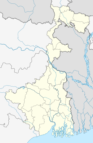 Karimpur Location in West Bengal, India  Karimpur Karimpur (India) | |
| Coordinates: 23.97°N 88.62°E | |
| Country | |
| State | West Bengal |
| District | Nadia |
| Elevation | 15 m (49 ft) |
| Population (2011) | |
| • Total | 9,661 |
| Languages | |
| • Official | Bengali, English |
| Time zone | UTC+5:30 (IST) |
| PIN | 741152 |
| Vehicle registration | WB |
| Lok Sabha constituency | Murshidabad |
| Vidhan Sabha constituency | Karimpur, Tehatta |
Geography
Karimpur is located at 23.97°N 88.62°E.[2] It has an average elevation of 15 metres (49 feet). It is at the bank of River Khare.
Demographics
Karimpur area has two local rural administration houses or Panchayets (পঞ্চায়েত in Bengali). Those are Karimpur-1 and Karimpur-2 Panchayet. Both the panchayets have one census town (CT). Karimpur CT (9661) is within Karimpur-1 and Uttampur CT (13000) is within Karimpur-2. As per the 2011 Census of India Total population of both of these two urban area was 22661. Both the Panchayets have number of villages with rural population of above 16000 in total. Karimpur-1 panchayet consists of village areas excluding Karimpur (CT) are Abhaypur (2071), Gabrudanga (4365), Madhaya Gopalpur (2377), Malintala (1392), Senpara (5432), Gopalpara (2891). And Karimpur-2 consists of rural areas excluding Uttampur(CT) are Kalabaria (1288), Chak Natna (199), Majlispur (1782), Natna (1092), Pattabuka (8933). So Karimpur area has a population of almost 400000 (In total). Karimpur Town area is within Karimpur-1 CD Block which had a total population of 183556. 51% of urban population of Karimpur City was male (11557) and 49% was female (11104). Population below 6 years was 1888. Total number of literates in Karimpur was 17,076 (82.64% of the population over 6 years)
Police station
Karimpur police station has jurisdiction over a portion of Karimpur I CD Block.[4][5]The total area covered by the police station is 116.796 km2 and the population covered is 117,879 (2001 census). 4 km of the Bangladesh-India border is within the PS area.[6]
Economy
The local commerce is based on export of jute, banana, cucumber, brinjal, onion, with other vegetables, grain & beetel leaves. The town boasts nearly 3000+ shops, 120 small industrial units (SIU). The city is home to large number of Marwari population who control the jute business traditionally. Apart from this, Transportation business is also on the roll. There is a regulated market near karimpur bajar.
Education
Karimpur has 3 high schools; Karimpur Jagannath High School, Karimpur Girls High School & Jamsherpur B.N High School. One undergraduate college named Karimpur Pannadevi College is there. Many B.Ed Colleges, Primary Teacher Training Institute and other study centres of open universities and management studies are there. And many kinder garden schools of both Bengali and English medium and Primary schools are also there.
Culture
Like any other town of new settlers, people in general are more liberal than orthodox. Throughout the year, cultural and religious festivals are celebrated. Nou Byich (Boat racing and sailing) on Vijaya Dashami (Last day of Durga Puja) is the most famous and unique celebration in Karimpur (It has been stopped now). More than four hundred river boats participate in this unique festival. Other festivals like Saraswati puja, Kali Puja are celebrated in great enthusiasm. One of the earliest scholarly studies of Karimpur social and cultural life was undertaken in the 1920s by William and Charlotte Wiser and published in 1930 by the University of California under the title 'Behind Mud Walls' which was then enlarged and revised in a second edition in 1963, and a third in 1971. The work provides fascinating anthropological detail and insight into the lives of Karimpur villagers of the early 20th century[7].
Health
Karimpur has one rural hospital and many dispensaries. Some specialist doctors visit on specific day in a week in different clinics. Emergency health situation is not good. The district hospital is about 70 km away at district Headquarter Krishnanagar.
Communication

The town is situated near the international border of India-Bangladesh (25 km from main town). West Bengal state highway 11 crosses through it. Mainly the communication depends on bus route from Krishnanagar to Karimpur. From other end it can be accessed by Berhampore to Karimpur bus route.
References
- "District Wise List of Statutory Towns". Census of India 2001, Urban Frame. Directorate of Census Operations, West Bengal. Archived from the original on 25 April 2009. Retrieved 6 October 2007.
- Falling Rain Genomics, Inc - Karimpur
- "2011 Census – Primary Census Abstract Data Tables". West Bengal – District-wise. Registrar General and Census Commissioner, India. Retrieved 18 May 2017.
- "District Statistical Handbook 2014 Nadia". Table 2.1. Department of Statistics and Programme Implementation, Government of West Bengal. Archived from the original on 29 July 2017. Retrieved 17 May 2017.
- "Nadia District Police". Police Unit. West Bengal Police. Retrieved 17 May 2017.
- "Karimpur Police Station Details". Nadia Police. Archived from the original on 29 March 2016. Retrieved 17 May 2017.
- William H. Wiser and Charlotte Viall Wiser, Behind Mud Walls 1930-1960, University of California Press, Berkeley, 1971
Cities, towns and locations in Nadia District | |||||||||
|---|---|---|---|---|---|---|---|---|---|
| Cities, municipal and census towns |
| ||||||||
| Locations other than cities and towns |
| ||||||||
| Related topics |
| ||||||||