Colorado City, Colorado
Colorado City is a census-designated place (CDP) and metropolitan district[3] in Pueblo County, Colorado, United States. It is part of the Pueblo Metropolitan Statistical Area. The population was 2,193 at the 2010 census.[4][5] The Colorado City Post Office has the ZIP Code 81019.[2]
Colorado City, Colorado | |
|---|---|
CDP Metropolitan district | |
 Colorado City in late 2014 | |
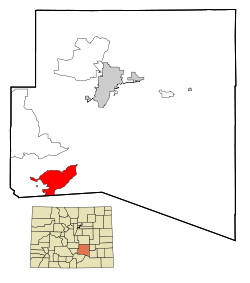 Location in Pueblo County and the State of Colorado | |
| Coordinates: 37°56′43″N 104°50′27″W | |
| Country | |
| State | |
| County | Pueblo County[1] |
| Government | |
| • Type | Metropolitan district |
| Area | |
| • Total | 34.6 sq mi (89.5 km2) |
| • Land | 34.5 sq mi (89.3 km2) |
| • Water | 0.1 sq mi (0.2 km2) |
| Elevation | 5,853 ft (1,784 m) |
| Population (2010) | |
| • Total | 2,193 |
| • Density | 58.3/sq mi (22.5/km2) |
| Time zone | UTC-7 (MST) |
| • Summer (DST) | UTC-6 (MDT) |
| ZIP Code[2] | 81019 |
| Area code(s) | 719 |
| FIPS code | 08-15935 |
| GNIS feature ID | 0204804 |
| Website | www |
Government
Colorado City is a metropolitan district,[3] a type of special district established under Colorado law. It is governed by an elected, five-member board of directors[6] and managed by an appointed district manager.
Geography
Colorado City is located in the Greenhorn Valley[7] at 37°56′43″N 104°50′27″W (37.945237, -104.840885).[8]
According to the United States Census Bureau, the CDP has a total area of 34.6 square miles (90 km2), of which, 34.5 square miles (89 km2) of it is land and 0.1 square miles (0.26 km2) of it (0.23%) is water.
The metropolitan district operates Lake Beckwith, which provides recreational opportunities for residents and visitors. The lake also forms the Lake Beckwith State Wildlife Area, one of several hundred state wildlife areas in Colorado managed by Colorado Parks and Wildlife.[9][10] Colorado City also has a public golf course and club house.[11]
Demographics
| Historical population | |||
|---|---|---|---|
| Census | Pop. | %± | |
| U.S. Decennial Census[12] | |||
As of the census[5] of 2000, there were 2,018 people, 760 households, and 582 families residing in the CDP. The population density was 58.5 people per square mile (22.6/km2). There were 845 housing units at an average density of 24.5 per square mile (9.5/km2). The racial makeup of the CDP was 92.57% White, 0.99% African American, 1.88% Native American, 0.20% Asian, 0.05% Pacific Islander, 2.38% from other races, and 1.93% from two or more races. Hispanic or Latino of any race were 9.17% of the population.
There were 760 households, out of which 36.1% had children under the age of 18 living with them, 64.7% were married couples living together, 8.7% had a female householder with no husband present, and 23.4% were non-families. 18.9% of all households were made up of individuals, and 7.4% had someone living alone who was 65 years of age or older. The average household size was 2.66 and the average family size was 3.04.
In the CDP, the population was spread out, with 28.9% under the age of 18, 6.8% from 18 to 24, 26.8% from 25 to 44, 25.4% from 45 to 64, and 12.0% who were 65 years of age or older. The median age was 37 years. For every 100 females, there were 99.2 males. For every 100 females age 18 and over, there were 92.6 males.
The median income for a household in the CDP was $37,331, and the median income for a family was $44,758. Males had a median income of $32,396 versus $21,000 for females. The per capita income for the CDP was $17,247. About 5.7% of families and 8.9% of the population were below the poverty line, including 7.8% of those under age 18 and 8.9% of those age 65 or over.
References
- "US Board on Geographic Names". United States Geological Survey. 2007-10-25. Retrieved 2008-01-31.
- "ZIP Code Lookup". United States Postal Service. December 14, 2006. Archived from the original (JavaScript/HTML) on September 3, 2007. Retrieved December 14, 2006.
- "Colorado City Metropolitan District, Colorado City, Colorado". State of Colorado. 2019. Retrieved 2019-02-16.
- Colorado Trend Report 2: State and Complete Places (Sub-state 2010 Census Data). Archived 2012-07-11 at Archive.today Missouri Census Data Center. Accessed 2011-02-25.
- "U.S. Census website". United States Census Bureau. Retrieved 2008-01-31.
- "Metro Board". Colorado City Metropolitan District. State of Colorado. 2019. Retrieved 2019-02-16.
- "Colorado City: Greenhorn Valley's scenic hub". The Pueblo Chieftain. 2018-05-19. Retrieved 2019-02-16.
- "US Gazetteer files: 2010, 2000, and 1990". United States Census Bureau. 2011-02-12. Retrieved 2011-04-23.
- "CCPR—Lake Beckwith information". Colorado City Parks and Recreation. 2016. Archived from the original on 2016-10-30. Retrieved 2019-02-16.
- "Lake Beckwith State Wildlife Area" (PDF). Colorado Parks and Wildlife. 2018-01-31. Retrieved 2019-02-16.
- "Hollydot Golf Club". Hollydot Golf Club. 2018. Retrieved 2019-02-16.
- "Census of Population and Housing". Census.gov. Retrieved June 4, 2016.
External links
Municipalities and communities of Pueblo County, Colorado, United States | ||
|---|---|---|
| City |  Map of Colorado highlighting Pueblo County | |
| Towns | ||
| CDPs | ||
| Unincorporated communities | ||
| Ghost towns | ||
| Authority control |
|
|---|