Clayville, Rhode Island
Clayville is a census-designated place in the towns of Foster and Scituate in Providence County, Rhode Island, United States. As of the 2010 census, it had a population of 300.[3] It is the location of the Clayville Historic District.
Clayville, Rhode Island | |
|---|---|
 Post Office | |
 Location of the CDP in Providence County and the state of Rhode Island. | |
| Coordinates: 41°46′37″N 71°40′34″W | |
| Country | United States |
| State | Rhode Island |
| County | Providence |
| Area | |
| • Total | 1.75 sq mi (4.52 km2) |
| • Land | 1.73 sq mi (4.47 km2) |
| • Water | 0.019 sq mi (0.05 km2) |
| Elevation | 446 ft (136 m) |
| Population (2010) | |
| • Total | 300 |
| • Density | 170/sq mi (66/km2) |
| Time zone | UTC-5 (Eastern (EST)) |
| • Summer (DST) | UTC-4 (EDT) |
| ZIP code | |
| Area code(s) | 401 |
| FIPS code | 44-15940[1] |
| GNIS feature ID | 1218580[2] |
| Wikimedia Commons has media related to Clayville, Rhode Island. |
Geography
According to the U.S. Census Bureau, Clayville has a total area of 1.75 square miles (4.52 km2), of which 1.73 square miles (4.47 km2) is land and 0.019 square miles (0.05 km2), or 1.10%, is water.[4]
Clayville is located on Rhode Island Route 14 and 102. Route 14 leads east to Providence and west to Moosup, Connecticut, while Route 102 leads north to Woonsocket and south to Exeter, Rhode Island. Clayville is located near the Westconnaug Reservoir and the Westconnaug Meadows, a wooded area home to various hiking trails that is owned by the Scituate Land Trust.[5]
References
- "U.S. Census website". United States Census Bureau. Retrieved 2008-01-31.
- "US Board on Geographic Names". United States Geological Survey. Retrieved 2020-07-19.
- "Profile of General Population and Housing Characteristics: 2010 Demographic Profile Data (DP-1): Clayville CDP, Rhode Island". United States Census Bureau. Retrieved October 10, 2012.
- "Geographic Identifiers: 2010 Demographic Profile Data (G001): Chepachet CDP, Rhode Island". United States Census Bureau. Retrieved October 10, 2012.
- "Westconnaug Meadows" (PDF). Scituate, RI Land Trust & Conservation Commission. Retrieved July 19, 2020.
Municipalities and communities of Providence County, Rhode Island, United States | ||
|---|---|---|
| Cities | 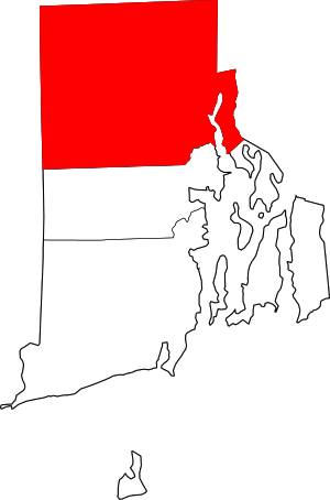 Map of Rhode Island highlighting Providence County | |
| Towns | ||
| CDPs | ||
| Other villages | ||