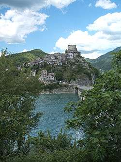
Castel di Tora
Castel di Tora is a comune (municipality) in the Province of Rieti in the Italian region Lazio, located about 50 kilometres (31 mi) northeast of Rome and about 20 kilometres (12 mi) southeast of Rieti.
Castel di Tora | |
|---|---|
| Comune di Castel di Tora | |
 | |
Location of Castel di Tora 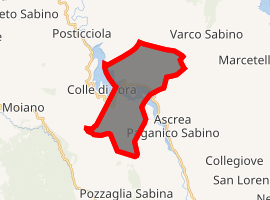
| |
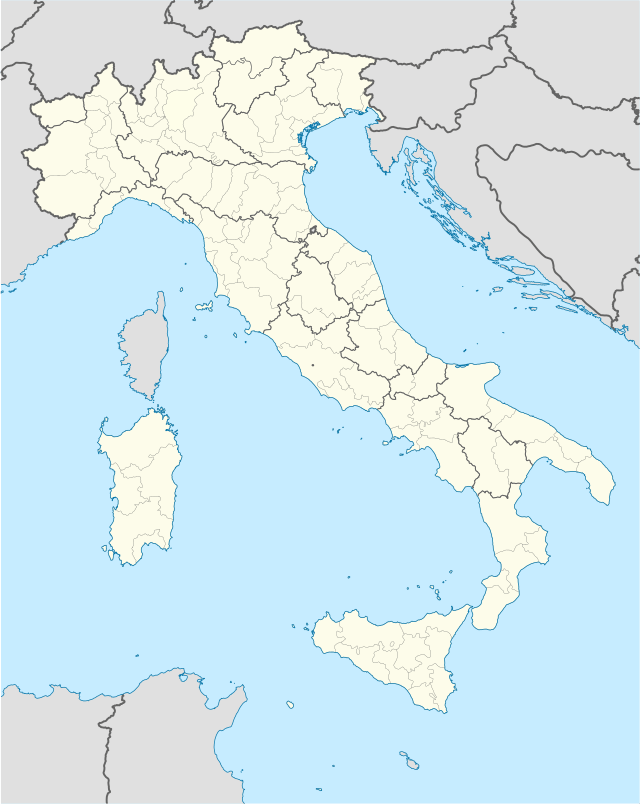 Castel di Tora Location of Castel di Tora in Italy  Castel di Tora Castel di Tora (Lazio) | |
| Coordinates: 42°13′N 12°58′E | |
| Country | Italy |
| Region | Latium |
| Province | Rieti (RI) |
| Government | |
| • Mayor | Cesarina D'Alessandro |
| Area | |
| • Total | 15.49 km2 (5.98 sq mi) |
| Elevation | 607 m (1,991 ft) |
| Population (31 March 2017)[2] | |
| • Total | 278 |
| • Density | 18/km2 (46/sq mi) |
| Demonym(s) | Castelvecchiesi |
| Time zone | UTC+1 (CET) |
| • Summer (DST) | UTC+2 (CEST) |
| Postal code | 02020 |
| Dialing code | 0765 |
| Website | Official website |
Castel di Tora borders the following municipalities: Ascrea, Colle di Tora, Pozzaglia Sabina, Rocca Sinibalda, Varco Sabino. It is located on the shores of Lake Turano.
Sights include the pentagonal tower of the former castle, the hermitage of San Salvatore, and the sanctuary of Santa Anatolia.
References
- "Superficie di Comuni Province e Regioni italiane al 9 ottobre 2011". Istat. Retrieved 16 March 2019.
- All demographics and other statistics: Italian statistical institute Istat.
External links
This article is issued from Wikipedia. The text is licensed under Creative Commons - Attribution - Sharealike. Additional terms may apply for the media files.