Abbott, Texas
Abbott is a town in Hill County, Texas, United States. The population was 356 in 2010.
Abbott | |
|---|---|
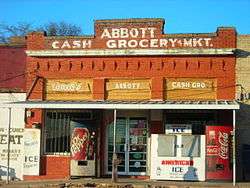 The Abbott grocery store | |
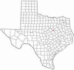 Location of Abbott, Texas | |
 | |
 Abbott Location of Abbott, Texas  Abbott Abbott (the United States) 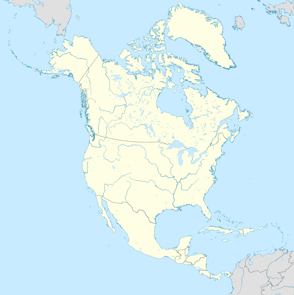 Abbott Abbott (North America) | |
| Coordinates: 31°53′2″N 97°4′32″W | |
| Country | |
| State | |
| County | Hill |
| Area | |
| • Total | 0.59 sq mi (1.54 km2) |
| • Land | 0.59 sq mi (1.53 km2) |
| • Water | 0.00 sq mi (0.00 km2) |
| Elevation | 712 ft (217 m) |
| Population (2010) | |
| • Total | 356 |
| • Estimate (2019)[2] | 369 |
| • Density | 623.31/sq mi (240.74/km2) |
| Time zone | UTC-6 (Central (CST)) |
| • Summer (DST) | UTC-5 (CDT) |
| ZIP code | 76621 |
| Area code(s) | 254 |
| FIPS code | 48-00100[3] |
| GNIS feature ID | 1329165[4] |
History
Abbott was founded in 1871 as a stop for the Missouri-Kansas-Texas Railroad and was named for Joseph Abbott, who represented the area in the Texas legislature at the time. Its population peaked at 713 in 1914 and has declined since.[5] The town was incorporated in 1916.
Geography
Abbott is located on Interstate 35, about 24 miles north of Waco, and is at 31°53′2″N 97°4′32″W (31.883865, −97.075680).[6] According to the United States Census Bureau, the town has a total area of 0.6 square miles (1.6 km2).
Climate
Abbott has a Humid continental cfa, hot-summer Mediterranean climate (Köppen climate classification Csa).
There are mild winters during which moderate rainfall is broken by weeks of cool, sunny weather. It has hot, dry summers with no rainfall in July and August.
Snow is rare in Abbott, averaging only 0.2 inches or 0.005 metres per year, mostly in winter months.[7]
Summers are very hot with 96.6 F. Despite moderate rain during winter months, most rain falls in May, June and October. The Summer months are very dry with only 4-5 days of rain and 6.8 inches of rain from July to September which is a good indicator to harvest crops and grapes vor viticulture.
| Climate data for Abbott, Texas | |||||||||||||
|---|---|---|---|---|---|---|---|---|---|---|---|---|---|
| Month | Jan | Feb | Mar | Apr | May | Jun | Jul | Aug | Sep | Oct | Nov | Dec | Year |
| Daily mean °F (°C) | 46.9 (8.3) |
50.1 (10.1) |
57.8 (14.3) |
61.8 (16.6) |
69.2 (20.7) |
80.4 (26.9) |
84.2 (29.0) |
84.5 (29.2) |
77.6 (25.3) |
67.8 (19.9) |
57.2 (14.0) |
47.9 (8.8) |
65.5 (18.6) |
| Average precipitation inches (mm) | 2.3 (58) |
2.8 (71) |
3.7 (94) |
2.9 (74) |
4.8 (120) |
4.1 (100) |
1.8 (46) |
2.0 (51) |
3.0 (76) |
4.4 (110) |
2.9 (74) |
2.9 (74) |
37.6 (948) |
| Source: Bestplaces.net[8] | |||||||||||||
Demographics
| Historical population | |||
|---|---|---|---|
| Census | Pop. | %± | |
| 1920 | 303 | — | |
| 1930 | 326 | 7.6% | |
| 1940 | 264 | −19.0% | |
| 1950 | 345 | 30.7% | |
| 1960 | 289 | −16.2% | |
| 1970 | 375 | 29.8% | |
| 1980 | 359 | −4.3% | |
| 1990 | 314 | −12.5% | |
| 2000 | 321 | 2.2% | |
| 2010 | 356 | 10.9% | |
| Est. 2019 | 369 | [2] | 3.7% |
| U.S. Decennial Census[9] | |||
As of the census[3] of 2000, there were 300 people, 124 households, and 89 families residing in the town. The population density was 518.0 people per square mile (199.7/km2). There were 144 housing units at an average density of 248.6 per square mile (95.9/km2). The racial makeup of the town was 96.00% White, 1.00% African American, 3.00% from other races. Hispanic or Latino of any race were 5.67% of the population.
There were 124 households, out of which 29.8% had children under the age of 18 living with them, 62.9% were married couples living together, 6.5% had a female householder with no husband present, and 28.2% were non-families. 27.4% of all households were made up of individuals, and 16.9% had someone living alone who was 65 years of age or older. The average household size was 2.42 and the average family size was 2.97.
In the town, the population was spread out, with 21.3% under the age of 18, 6.7% from 18 to 24, 28.3% from 25 to 44, 20.3% from 45 to 64, and 23.3% who were 65 years of age or older. The median age was 40 years. For every 100 females, there were 87.5 males. For every 100 females age 18 and over, there were 88.8 males.
The median income for a household in the town was $37,917, and the median income for a family was $55,625. Males had a median income of $38,750 versus $20,000 for females. The per capita income for the town was $19,062. About 6.0% of families and 8.2% of the population were below the poverty line, including 2.7% of those under the age of 18 and 13.0% of those 65 or over.
In 2010 Abbott had a population of 356. The racial and ethnic makeup was 91.0% non-Hispanic white, 2.0% black or African American, 1.1% Native American, 0.3% Asian, 0.3% reporting two or more races and 6.5% Hispanic or Latino.[10]
Education
The City of Abbott is served by the Abbott independent school District and home to the Abbott High School Panthers. In 2015 there were 300 students in Pre-Kindergarten through 12th grade.[11]
Notable people
Abbott is the birthplace of American singer-songwriter and actor Willie Nelson and his sister, pianist Bobbie Nelson.
References
- "2019 U.S. Gazetteer Files". United States Census Bureau. Retrieved August 7, 2020.
- "Population and Housing Unit Estimates". United States Census Bureau. May 24, 2020. Retrieved May 27, 2020.
- "U.S. Census website". United States Census Bureau. Retrieved January 31, 2008.
- "US Board on Geographic Names". United States Geological Survey. October 25, 2007. Retrieved January 31, 2008.
- Ellis Baily; A History of Hill County, Texas, 1838–1965; Waco, Texas; Texian Press; 1966.
- "US Gazetteer files: 2010, 2000, and 1990". United States Census Bureau. February 12, 2011. Retrieved April 23, 2011.
- "Abbott Climate, TEXAS - Climate Summary". Retrieved July 17, 2020.
- "Abbott,TX". July 2020. Retrieved July 23, 2020.
- "Census of Population and Housing". Census.gov. Retrieved June 4, 2015.
- 2010 census report for Abbott
- "Abbott Independent School System". Abbott Independent School System. Retrieved January 6, 2012.
References
External links
| Wikimedia Commons has media related to Abbott, Texas. |
Municipalities and communities of Hill County, Texas, United States | ||
|---|---|---|
| Cities |  Hill County map | |
| Towns | ||
| Unincorporated communities | ||
| Authority control |
|
|---|