Yamforina Cove
Yamforina Cove (Bulgarian: залив Ямфорина, ‘Zaliv Yamforina’ \'za-liv yam-fo-'ri-na\) is the 4.55 km wide cove indenting for 3.1 km the east coast of Blagoevgrad Peninsula on Oscar II Coast in Graham Land, Antarctica. It is entered south of Daskot Point and north of Kesten Point, and was formed as a result of the break-up of Larsen Ice Shelf in the area in 2002, and subsequent deglaciation.
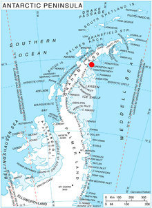
Location of Blagoevgrad Peninsula in Graham Land, Antarctic Peninsula.
The feature is named after the ancient Thracian settlement of Yamforina in southwestern Bulgaria.
Location
Yamforina Cove is located at 65°10′55″S 61°36′30″W. SCAR Antarctic Digital Database mapping in 2012.
Maps
- Antarctic Digital Database (ADD). Scale 1:250000 topographic map of Antarctica. Scientific Committee on Antarctic Research (SCAR). Since 1993, regularly upgraded and updated.
References
- Yamforina Cove. SCAR Composite Antarctic Gazetteer.
- Bulgarian Antarctic Gazetteer. Antarctic Place-names Commission. (details in Bulgarian, basic data in English)
External links
- Yamforina Cove. Copernix satellite image
This article includes information from the Antarctic Place-names Commission of Bulgaria which is used with permission.
This article is issued from Wikipedia. The text is licensed under Creative Commons - Attribution - Sharealike. Additional terms may apply for the media files.