Wyoming Highway 232
Wyoming Highway 232 (WYO 232) is a 12.22-mile-long (19.67 km) state highway in southeastern Lincoln County, Wyoming, United States, that serves the town of Cokeville and outlying areas to the northeast.
| ||||
|---|---|---|---|---|
| Smith Forks Road | ||||
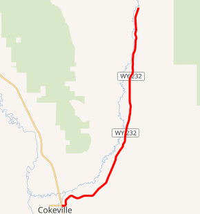
WYO 232 highlighted in red | ||||
| Route information | ||||
| Maintained by WYDOT | ||||
| Length | 12.22 mi[1] (19.67 km) | |||
| Major junctions | ||||
| West end | ||||
| East end | Smiths Fork Road[2] | |||
| Location | ||||
| Counties | Lincoln | |||
| Highway system | ||||
State highways in Wyoming
| ||||

Route description
WYO 232, locally named Smith Forks Road,[1] travels from an intersection with US Route 30/Wyoming Highway 89 and Wyoming Highway 231 in Cokeville northeast to the Button Flat. WYO 232 heads north toward the Commissary Ridge of the Bridger-Teton National Forest. The Cokeville city limits are at Milepost 0.09, and Highway 232 ends at Milepost 12.22 with local roadways near the National Forest.[1]
Major intersections
The entire route is in Lincoln County.
| Location | mi | km | Destinations | Notes | |
|---|---|---|---|---|---|
| Cokeville | 0.00 | 0.00 | Western terminus | ||
| | 12.22 | 19.67 | Smiths Fork Road in Button Flat | Eastern terminus | |
| 1.000 mi = 1.609 km; 1.000 km = 0.621 mi | |||||
References
- aaroads.com - Wyoming Routes 200-299
- Google (21 December 2016). "Wyoming Highway 232" (Map). Google Maps. Google. Retrieved 21 December 2016.
External links
| Wikimedia Commons has media related to Wyoming Highway 232. |
This article is issued from Wikipedia. The text is licensed under Creative Commons - Attribution - Sharealike. Additional terms may apply for the media files.