Woudrichem
Woudrichem (Dutch pronunciation: [ˈʋʌudriɣəm] (![]()
Woudrichem | |
|---|---|
City and former municipality | |
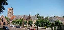 Martin Church and houses in 2015 | |
 Flag Coat of arms | |
.svg.png) Location in North Brabant | |
| Coordinates: 51°49′N 5°0′E | |
| Country | Netherlands |
| Province | North Brabant |
| Government | |
| • Body | Municipal council |
| • Mayor | Arie Noordergraaf (acting) (SGP) |
| Area | |
| • Total | 51.70 km2 (19.96 sq mi) |
| • Land | 49.34 km2 (19.05 sq mi) |
| • Water | 2.36 km2 (0.91 sq mi) |
| Elevation | 0 m (0 ft) |
| Demonym(s) | Woudrichemmer |
| Time zone | UTC+1 (CET) |
| • Summer (DST) | UTC+2 (CEST) |
| Postcode | 4280–4288 |
| Area code | 0183 |
| Website | www |
History
The city of Woudrichem was granted city rights in 1356.
Geography
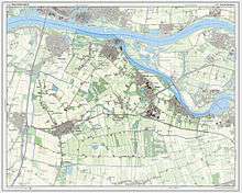
The municipality is located at 51°49′N 5°0′E in the north of North Brabant just south of the center of the Netherlands. It is part of the region of Land van Heusden en Altena.
The city of Woudrichem is the largest settlement in the municipality. It is situated on the southbank of where the rivers Waal and Afgedamde Maas join to form the Boven Merwede. The other population centres in the municipality were:
Gallery
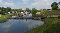 Historical port in Woudrichem
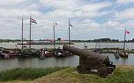 Historical port in Woudrichem
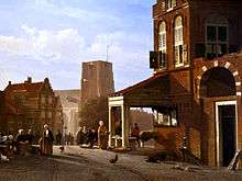
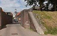 Street view in Woudrichem
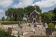 Reformed church in Giessen
Government
The municipal council of Woudrichem hax 15 members. The mayor was Arie Noordergraaf of the Reformed Political Party (SGP).[1] On January 1sth 2019 it joined Werkendam and Aalburg in the new municipality of Altena.
Notable people
- Louwrens Hanedoes (1822 in Woudrichem - 1905 in Woudrichem) landscape painter; in the Romantic style, later turning to Realism.
- Leendert Antonie Donker (1899 in Almkerk – 1956) politician.
- Hans van Helden (born 1948 in Almkerk) former speed skater
References
- "College van B&W" [Board of mayor and aldermen] (in Dutch). Gemeente Woudrichem. Retrieved 9 June 2014.
- "Kerncijfers wijken en buurten" [Key figures for neighbourhoods]. CBS Statline (in Dutch). CBS. 2 July 2013. Retrieved 12 March 2014.
- "Postcodetool for 4285CP". Actueel Hoogtebestand Nederland (in Dutch). Het Waterschapshuis. Retrieved 9 June 2014.
External links

- Official website
Places adjacent to Woudrichem | ||||||||||
|---|---|---|---|---|---|---|---|---|---|---|
| ||||||||||