Windeyer County

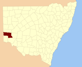
Windeyer County is one of the 141 Cadastral divisions of New South Wales. It is located between the Darling River and the border with South Australia. The Silver City Highway runs through it. Coombah Roadhouse is located there.

Windeyer
New South Wales
Location in New South Wales
Lands administrative divisions around Windeyer:
South Australia Menindee Livingstone
South Australia Windeyer Perry
Hamley (SA) Tara Wentworth

Windeyer County was named in honour of the barrister and politician Richard Windeyer (1806-1847).[1]

Parishes within this county

A full list of parishes found within this county; their current LGA and mapping coordinates to the approximate centre of each location is as follows:

ParishLGACoordinates
AbenaUnincorporated33°06′32″S 141°57′53″E
AntitaUnincorporated32°49′37″S 141°31′19″E
BadhamUnincorporated33°04′24″S 141°17′24″E
BarlowUnincorporated32°42′27″S 141°22′21″E
BarrawannaWentworth Shire33°17′36″S 142°07′56″E
BarryUnincorporated32°58′30″S 141°06′12″E
BingalongUnincorporated32°46′46″S 142°11′58″E
BingerryWentworth Shire33°17′40″S 141°58′54″E
BluebushUnincorporated32°49′31″S 141°05′23″E
BoreeWentworth Shire33°06′33″S 141°28′17″E
BuckalowUnincorporated32°57′40″S 141°26′57″E
CoombahUnincorporated32°53′24″S 141°37′58″E
CutheroUnincorporated33°03′21″S 142°12′23″E
EllerslieUnincorporated32°48′51″S 142°04′46″E
ErremanWentworth Shire33°27′09″S 142°15′32″E
IllawlaWentworth Shire33°21′24″S 141°58′00″E
KertneWentworth Shire33°26′23″S 142°06′02″E
KilonWentworth Shire33°20′19″S 142°20′19″E
KudgeeUnincorporated32°50′09″S 141°42′27″E
MallaraWentworth Shire33°26′37″S 142°28′49″E
MerooUnincorporated33°02′05″S 141°38′15″E
MilangUnincorporated32°58′14″S 141°32′05″E
MooleyUnincorporated32°54′23″S 142°17′28″E
MulgaUnincorporated32°44′36″S 141°05′40″E
MullojamaWentworth Shire33°24′28″S 142°29′23″E
LeichhardtUnincorporated33°03′35″S 142°03′05″E
NadbuckUnincorporated32°58′14″S 141°48′47″E
NalimUnincorporated32°53′46″S 141°43′08″E
OotoowaWentworth Shire33°25′47″S 141°54′42″E
OraraWentworth Shire33°25′38″S 142°22′07″E
PalinorWentworth Shire33°17′57″S 141°50′16″E
PearsonUnincorporated32°39′26″S 141°04′35″E
PoliaWentworth Shire33°16′07″S 142°18′45″E
PopiltaWentworth Shire33°08′20″S 141°46′18″E
PopioUnincorporated33°05′36″S 141°47′34″E
PowerUnincorporated32°57′27″S 142°03′06″E
RamlehUnincorporated32°45′17″S 141°50′19″E
SpinifexUnincorporated32°51′13″S 141°17′53″E
UrntahWentworth Shire33°12′02″S 142°05′48″E
WallaraUnincorporated32°46′01″S 141°57′55″E
WannebaUnincorporated32°43′17″S 141°42′25″E
WannellaUnincorporated32°55′07″S 141°56′27″E
WhurlieUnincorporated32°57′18″S 142°09′54″E
WillotiaUnincorporated32°51′41″S 142°18′26″E
YaltolkaUnincorporated33°00′25″S 142°17′13″E
YarlallaWentworth Shire33°09′29″S 141°56′05″E
YartlaWentworth Shire33°09′38″S 142°11′21″E

References

  1. "Windeyer". Geographical Names Register (GNR) of NSW. Geographical Names Board of New South Wales. Retrieved 11 August 2013.
This article is issued from Wikipedia. The text is licensed under Creative Commons - Attribution - Sharealike. Additional terms may apply for the media files.