Weißwurstäquator
The Weißwurstäquator (German pronunciation: [ˌvaɪsvʊɐ̯stɛˈkvaːtoːɐ̯] (![]()

The various definitions of the Weißwurstäquator: 1) The Speyer line (green), 2) the river Main line as the frontier of Prussian hegemony before 1871 (red), 3) the 49° latitude (black).
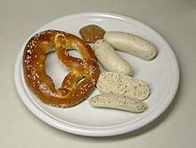
Weißwürste mit Brezn und süßem Senf (white sausages with Pretzels and sweet mustard)
It is named for the Weißwurst sausage of Bavaria, and has no precise definition. A popular one is the linguistic boundary known as the Speyer line separating Upper German from Central German dialects, roughly following the Main River; another is a line running further south, more or less along the Danube, or between the Main and the Danube, roughly along the 49th parallel north circle of latitude.[2]
See also
References
- "Der Weißwurstäquator". ESL Stories. Retrieved July 31, 2020.
- "Wo die Wurst zuhause ist". Die Münchner Wochenanzeiger (in German). Retrieved July 31, 2020.
- Duden Deutsches Universalwörterbuch, 6th edition, ISBN 3-411-05506-5 (in German)
External links
- definition on Indigo Magazine, p.57
- Interview with Oktoberfest innkeeper Wiggerl Hagn at Deutschlandradio Kultur (in German)
This article is issued from Wikipedia. The text is licensed under Creative Commons - Attribution - Sharealike. Additional terms may apply for the media files.