Wedgwood Peak
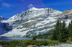
Wedgwood Peak is a 3,024-metre (9,921-foot) mountain summit located in Mount Assiniboine Provincial Park, in the Canadian Rockies of British Columbia, Canada. Its nearest higher peak is Mount Assiniboine, 2.0 km (1.2 mi) to the south.[1] The mountain is situated northwest of Lake Magog and 1.0 km (0.62 mi) south of Sunburst Peaks.
| Wedgwood Peak | |
|---|---|
 Wedgwood Peak | |
| Highest point | |
| Elevation | 3,024 m (9,921 ft) [1] |
| Prominence | 214 m (702 ft) [1] |
| Parent peak | Mount Assiniboine (3616 m)[1] |
| Coordinates | 50°53′21″N 115°39′36″W [2] |
| Geography | |
 Wedgwood Peak Location of Wedgwood Peak in British Columbia 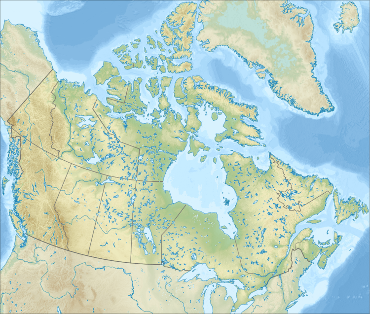 Wedgwood Peak Wedgwood Peak (Canada) | |
| Location | British Columbia, Canada |
| Parent range | Canadian Rockies |
| Topo map | NTS 82J13[2] |
| Geology | |
| Age of rock | Cambrian |
| Type of rock | sedimentary rock |
| Climbing | |
| First ascent | 1910 T.G. Longstaff, Katherine Longstaff, Rudolph Aemmer[1] |
History
The first ascent of Wedgwood Peak was made in 1910 by Katherine Longstaff and her brother Dr. Tom George Longstaff, with Rudolph Aemmer as their guide.[3]
The mountain was named in 1918 by Katherine Longstaff Wedgwood for Arthur Felix Wedgwood (1877–1917), her late husband who was killed in World War I.[3] Arthur Felix Wedgwood was also a fifth-generation descendant of Josiah Wedgwood.[4]
First recognized as Mount Wedgwood in 1924, the mountain's present name Wedgwood Peak became official on March 31, 1966 when approved by the Geographical Names Board of Canada.[2][5]
Geology
Wedgwood Peak is composed of sedimentary rock laid down during the Cambrian period. Formed in shallow seas, this sedimentary rock was pushed east and over the top of younger rock during the Laramide orogeny.[6]
Climate
Based on the Köppen climate classification, Wedgwood Peak is located in a subarctic climate with cold, snowy winters, and mild summers.[7] Temperatures can drop below −20 °C with wind chill factors below −30 °C. Precipitation runoff from Wedgwood Peak drains west into Wedgwood Creek which is a tributary of the Mitchell River, or east into Lake Magog .
References
- "Wedgewood Peak". Bivouac.com. Retrieved 2019-01-03.
- "Wedgwood Peak". Geographical Names Data Base. Natural Resources Canada. Retrieved 2019-01-03.
- Wedgwood PeakPeakFinder
- W., Boles, Glen (2006). Canadian mountain place names : the Rockies and Columbia Mountains. Laurilla, Roger W., 1959-, Putnam, William Lowell., Putnam, William Lowell. Place names of the Canadian Alps. Calgary, Alta.: Rocky Mountain Books. ISBN 9781894765794. OCLC 244770225.
- BC Geographical Names
- Gadd, Ben (2008). "Geology of the Rocky Mountains and Columbias". Cite journal requires
|journal=(help) - Peel, M. C.; Finlayson, B. L. & McMahon, T. A. (2007). "Updated world map of the Köppen−Geiger climate classification". Hydrol. Earth Syst. Sci. 11: 1633–1644. ISSN 1027-5606.