Vesterøya
Vesterøya (West Island) is one of two peninsulas outside Sandefjord, Norway.[2] It is primarily known for its many beaches and idyllic costal landscape, but there are also numerous trails used for hiking and biking.[3] During the Viking Age, ocean water levels were 3–4 meters higher than today. Vesterøya was therefore an island surrounded by waters, but became a peninsula as water levels decreased.[4] Vesterøya was previously known as Velløy, which derives from Vadill-øy.[5]

West Island lies between the Sandefjordsfjord and Mefjord, south-east of the city center. The landscape is dominated by hills, mountains, forests, beaches, sloping rocks, and farm fields. The peninsula has a length of 10 kilometers. It is home to a large number of vacation homes, beaches, campgrounds, and recreational areas. Sea water levels were 20–25 meters higher 5,000 years ago, which means Vesterøya consisted of a large island and 25-30 minor islets. Previous names for Vesterøya include Velløy, Vælløy, Valløy, Veløyene, and Vælløynni.[6]
There are 25 km (15 mi.) of hiking trails at Vesterøya, which is an extension of the 20 km (12 mi.) coastal path at Østerøya (East Island). Combined the 45 km (28 mi.) hiking trail is part of the international North Sea Trail.[7][3]
West Island is home to numerous preserved areas, including Holtan Plant Preserve, the only place in Vestfold og Telemark where the species Pipsissewa (Chimaphila umbellata) occurs.[8]
A rest area ("Thomas Numme rasteplass") at Langeby Beach is named after TV personality Thomas Numme, who grew up on Vesterøya.
Folehavna Fort
Folehavna Fort at West Island's southernmost point was constructed by the Germans in 1941 during the German occupation of Norway. The surrounding area came under German control on May 8, 1941, and the fortifications were raised the same month. By the end of the war, the fort was equipped with four Belgian canons and several anti-aircraft canons. The fort was in use by German occupation forces until January 1943. It was home to numerous tunnels, including the longest which was 120 meters (394 ft.). It was also equipped with bunkers, trenches, fencing, barracks, floodlights, battlements, and minefields.[9]
The Norwegian Armed Forces maintained control of the area until 1995 when it became a public recreation area. Bunkers, trenches, barracks, and tunnels can still be seen at Folehavna. At most about 200 German troops were stationed at Folehavna Fort. It is the southernmost point of Sandefjord which is located on the mainland (not including islands).[10][11]
German forces constructed three large tunnels at Folehavna, including a 120-meter tunnel. Four 15 cm cannons were also installed in concrete gun pits on the sloping rocks.[12][13]
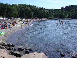
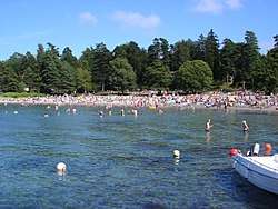
Beaches
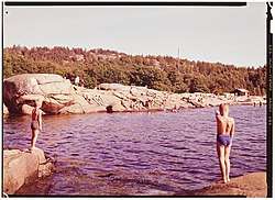
Some beaches at West Island:[14][15][16]
- Asnes
- Tangen
- Folehavna
- Sjøbakken
- Langeby
- Albertstranda
- Vøra
- Fruvika
- Grubesand
- Langestrand
- Ormestadvika
 Vøra
Vøra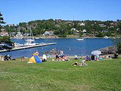 Tangen, north side
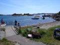 Tangen, south side
See also
- Østerøya (East Island)
References
- https://www.visitvestfold.com/en/see-and-do/activities/?TLp=166348&Vandring
- "Vesterøya". Snl.no. 22 February 2018. Retrieved 19 May 2018.
- Mšbius, Aaron and Michael (2014). Norwegen. DuMont Reiseverlag. Page 168. ISBN 9783770167326.
- Christensen, Arne Emil and Anne Stine Ingstad (1992). Osebergdronningens grav: vår arkeologiske nasjonalskatt i nytt lys. Schibsted. Page 29. ISBN 9788251614238.
- Christensen, Arne Emil and Anne Stine Ingstad (1992). Osebergdronningens grav: vår arkeologiske nasjonalskatt i nytt lys. Schibsted. Page 38. ISBN 9788251614238.
- Davidsen, Roger (2008). "Vesterøya". Et Sted i Sandefjord (in Norwegian Bokmål). Sandar Historielag. p. 65. ISBN 978-82-994567-5-3.
- "Sandefjord Brochure" (PDF). Sandefjord.kommune.no. Retrieved 19 May 2018.
- https://www.fylkesmannen.no/Vestfold/Miljo-og-klima/Verneomrader/Vestfolds-verneomrader/Holtan-plantefredningsomrade/
- Gjerseth, Simen (2016). Nye Sandefjord. Liv forlag. Page 71. ISBN 9788283301137.
- Jøranlid, Marianne (1996). 40 trivelige turer i Sandefjord og omegn. Vett Viten. Page 54. ISBN 9788241202841.
- Davidsen, Roger (2008). "Folehavna". Et Sted i Sandefjord (in Norwegian Bokmål). Sandar Historielag. pp. 20–21. ISBN 978-82-994567-5-3.
- Holskjær, Lars (2017). Kamper uten tall. Forlagshuset i Vestfold. Pages 121-122. ISBN 9788293407294.
- Larsen, Erlend (2010). På Tur i Vestfold del 1. E-forlag. Page 56. ISBN 9788293057130.
- "Badestrender i Sandefjord". Retrieved 19 May 2018.
- Archived 2018-04-18 at the Wayback Machine
- "Sandefjord - Badeplasser". Sandefjord.kommune.no. Retrieved 19 May 2018.