Vefsnfjord
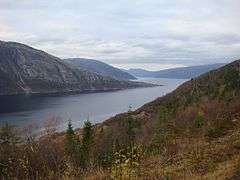
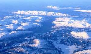
The Vefsnfjord or Vefsnfjorden is a fjord in the Helgeland traditional district of Nordland county, Norway. It is about 51 kilometres (32 mi) long, reaching a maximum depth of about 440 metres (1,440 ft) below sea level. The fjord flows through the municipalities of Alstahaug, Leirfjord, and Vefsn.
| Vefsnfjorden Vefsnfjord | |
|---|---|
 View of the fjord | |
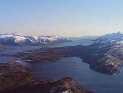
 Vefsnfjord Location of the fjord 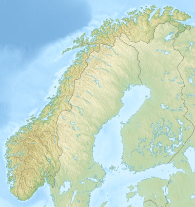 Vefsnfjord Vefsnfjord (Norway) | |
| Location | Nordland county, Norway |
| Coordinates | 65.9047°N 12.6106°E |
| Type | Fjord |
| Basin countries | Norway |
| Max. length | 51 kilometres (32 mi) |
| Max. depth | 440 metres (1,440 ft) |
| Settlements | Mosjøen |
The fjord begins at Tjøtta, south of the island of Alsten and meets the Leirfjord at the island of Sundøy before turning to the south as it proceeds inland to the town of Mosjøen. The outer part of the fjord is also called Sørfjord.[1]
Several large rivers run into the Vefsnfjord, including the Vefsna, Fusta, and Drevja. All three of the rivers are traditionally excellent salmon fishing rivers, although they now have been infected with the salmon parasite Gyrodactylus salaris.
A German prisoner ship was sunk here by British Aircraft during World War II with major loss of life. A memorial is located on a nearby island.
A powerline crosses Vefsnfjord near Overtroan with a 3.236-kilometre (2.011 mi) long span.