Uturuncu
Uturunku is a dormant 6,008 metres (19,711 ft) high volcano in Bolivia with two summit peaks. It consists of a complex of lava domes and lava flows with a total volume of 50–85 cubic kilometres (12–20 cu mi) and bears traces of a former glaciation, even though it does not currently carry glaciers. Volcanic activity took place during the Pleistocene and the last eruption was 250,000 years ago; since then Uturuncu has not erupted but active fumaroles occur in the summit region.
| Uturunku | |
|---|---|
 Uturunku in Bolivia, 16 November 2006 | |
| Highest point | |
| Elevation | 6,008 metres (19,711 ft) |
| Listing | List of mountains in Bolivia |
| Coordinates | 22°16′12″S 67°10′48″W [1] |
| Naming | |
| English translation | Jaguar |
| Language of name | Quechua |
| Geography | |
 Uturunku Location of Uturunku in Bolivia | |
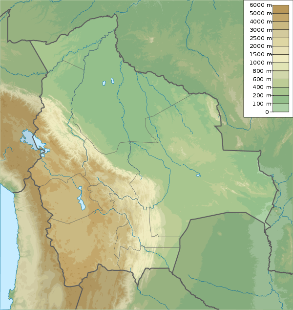
| Location | San Pablo de Lípez Municipality, Sur Lípez Province, Potosí Department, Bolivia |
| Parent range | Cordillera de Lípez |
| Geology | |
| Age of rock | Pleistocene |
| Mountain type | Stratovolcano |
| Volcanic field | Altiplano–Puna volcanic complex |
| Last eruption | 250,000 years ago. |
The volcano rises within the Altiplano-Puna volcanic complex, a larger province of large volcanoes and calderas which over the last few million years have emplaced about 10,000 cubic kilometres (2,400 cu mi) in sometimes very large eruptions. The volcano has two summits, with a fumarole field between them. Underneath it lies the so-called Altiplano-Puna magmatic body, a large sill formed by partially molten rocks.
Starting in 1992, satellite observations have indicated a large area of regional uplift centered on Uturunku, which has been interpreted as an indication of large-scale magma intrusion under the volcano. This might be a prelude to large-scale volcanic activity, including "supervolcanic" activity and caldera formation.
Geography and geomorphology
Uturuncu lies in the Sur Lípez[2] area of southern Bolivia,[3] southeast of the town of Quetena[1] and just northeast of the Eduardo Avaroa Andean Fauna National Reserve[4] in the Cordillera de Lípez.[5] A former sulfur mine is situated on the mountain, close to the summit,[6] and was considered to be one of the highest in the world;[7] a winding[5] road leads up on the mountain[8] and additional roads pass along the northern, eastern and southwestern foot of Uturuncu.[4] The region is almost uninhabited[9] and the volcano was little known until ongoing large-scale ground deformation was discovered in the early 21st century; since then scientific interest has increased, including a reconnaissance mission carried out by scientists in 2003.[1] Additionally, the volcano has been used to reconstruct the regional history of glaciation.[10] The term uturuncu means "jaguar" in the Quechua language.[11]
Structure
With 6,008 metres (19,711 ft) elevation, Uturuncu is the highest mountain in southwestern Bolivia[12][13] and dominates its geomorphology,[14] rising about 1,510–1,670 metres (4,950–5,480 ft) above the surrounding terrain[15][7] and giving a good view of the surrounding mountains from the summit.[16] The volcano has two summit peaks[15] 5,930 metres (19,460 ft) and 6,008 metres (19,711 ft) high,[17] about 1 kilometre (0.62 mi) apart[18] and separated by a 5,700 metres (18,700 ft) high saddle.[17] It is a stratovolcano[1] with remnants of a crater,[7] and consists of lava domes and lava flows erupted from a number of vents in the central part of the volcano.[19] About 105 lava flows[20] propagate outward from the central sector of the volcano,[19] reaching lengths of 15 kilometres (9.3 mi)[13] and featuring levees, flow ridges[19] and steep, blocky fronts over 10 metres (33 ft) thick.[13]
The northernmost lava flow is known as Lomo Escapa[21] and with a length of 9 kilometres (5.6 mi) it is also the largest lava flow at Uturuncu.[22] Five lava domes south, west and northwest of the summit form a northwest-southeast trending alignment that appears to be an older volcanic system;[23] the southern of these domes have volumes of about 1 cubic kilometre (0.24 cu mi)[24] and the western dome bears traces of a large collapse.[22]
The broad edifice[25] covers an area of about 400 square kilometres (150 sq mi) and a volume of 85 cubic kilometres (20 cu mi)[13]-50 cubic kilometres (12 cu mi).[26] It appears to consist entirely of lava flows and lava domes;[27] while the occurrence of pyroclastic flow deposits was reported at first[19] later research has not found any evidence of explosive eruptions.[15] Aside from volcanic deposits there are also traces of glaciation which has smoothened the slopes of Uturuncu,[13] as well as Pleistocene and Holocene alluvium and colluvium.[19]
Lakes and rivers
Several lakes surround Uturuncu. Mama Khumu lies on the eastern foot of Uturuncu[28][19] and is bordered by steep slopes,[29] while Laguna Celeste is located northeast,[28][19] Chojllas southeast and Loromayu south of Uturuncu respectively.[28] Beach terraces,[30] deposits of diatomaceous earth[31] and former shorelines are visible around the lakes.[32] The Rio Grande de Lipez flows along the western foot of the volcano and receives tributaries which originate close to Uturuncu's northeastern foot;[28] it eventually flows into the Salar de Uyuni.[33] These watercourses are usually confined between steep bedrock walls and are characterized by a gravelly beds, anastomosing channels and wetlands[32] which are used to keep llamas and sheep.[9]
Geology
Regional
The eastward subduction of the Nazca Plate beneath the South America Plate has generated three volcanic belts within the Andes,[34] including the Central Volcanic Zone[1] which spans parts of Peru, Chile, Bolivia and Argentina[20] and includes Uturuncu.[1] Aside from Uturuncu, it includes about 69 Holocene volcanoes in a high elevation region,[35] including the potentially active volcanoes Irruputuncu, Olca-Paruma, Aucanquilcha, Ollagüe, Azufre, San Pedro, Putana, Sairecabur, Licancabur, Guayaques, Colachi and Acamarachi.[36]
Local
Uturuncu has formed about 100 kilometres (62 mi) east of the main volcanic front in the Western Cordillera, in a terrain formed by various volcanic and sedimentary rocks of Miocene to Quaternary age.[36] The region is characterized by the Altiplano high plateau, which reaches an elevation of 4,000 metres (13,000 ft)[37] and in terms of dimension is only exceeded by Tibet.[38]
The 8.41 million years old Vilama and 5.65 million years old Guacha ignimbrites underlie the volcano[39] and crop out in the Quetena River valley,[40] while the 4 million years old Vilama lavas are found southwest of Uturuncu and are partly buried by the volcano.[15] The crust in the region is about 65 kilometres (40 mi) thick.[37]
Volcanic activity in the area occurred between 15 and 10 million years ago,[14] and Cerro San Antonio,[28] a heavily eroded 3 million years old[41] Miocene volcano with a westward-opening collapse scar, lies just north of Uturuncu.[19] Other volcanoes from east counterclockwise to west are the Cerro Panizos caldera, Cerro Lípez, Suni K'ira and Quetena volcanoes as well as many more minor volcanic centres. Many of them are formed along northwest-southeast trending lineaments[36] such as the Lipez-Coranzuli and Pastos Grandes-Cojina lineament that passes through Uturuncu.[42]
Geologic history and Altiplano-Puna volcanic complex
The geological history of the region is complex.[43] After subduction commenced in the Jurassic,[44] 26 million years ago the breakup of the Farallon Plate into the Cocos Plate and the Nazca Plate was accompanied by an increased subduction rate and the onset of the Andean Orogeny. This subduction process at first involved a relatively flat descend of the Nazca Plate until 12 million years ago, after which it steepened.[43] Beginning from 10 million years ago then the Altiplano-Puna volcanic complex formed,[43] with a "flare-up" occurring during the Miocene.[45]
It covers an area of 50,000 square kilometres (19,000 sq mi)[43]-70,000 square kilometres (27,000 sq mi)[34] of the Altiplano-Puna[46] in Argentina, Bolivia and Chile and consists of a number of calderas, composite volcanoes and about 10,000 cubic kilometres (2,400 cu mi) of ignimbrite.[47] Uturuncu lies at its centre[48] but unlike Uturuncu most surrounding volcanic systems have been characterized by explosive eruptions,[49] including several so-called "supereruptions" with volcanic explosivity indexes of 8 at Cerro Guacha, La Pacana, Pastos Grandes and Vilama.[38] Over 50 volcanoes in the region are potentially active.[46]
Within the last two million years, the Laguna Colorada, Tatio and Puripica Chico ignimbrites were erupted in the surrounding terrain.[50] The 4 million years old Atana and 3 million years old Pastos Grandes ignimbrites are other large ignimbrites in the area[51] while the 10.33 ± 0.64 million years old San Antonio ignimbrite is more sparse.[52]
The Altiplano-Puna volcanic complex is underpinned at about 20 kilometres (12 mi) depth by a wide[47] magmatic sill where rocks are partially molten, the Altiplano-Puna magmatic body.[47] Its existence has been established with various techniques;[48] it extends over an area of 50,000 square kilometres (19,000 sq mi) and has a volume of about 500,000 cubic kilometres (120,000 cu mi)[20] with a thickness variously estimated to be between 1–20 kilometres (0.62–12.43 mi);[39][34] it has been referred to as the largest reservoir of magma in the continental crust of Earth.[53] The Altiplano-Puna magmatic body is the source of magmas for many of the volcanoes in the Altiplano-Puna volcanic complex;[54] in addition, about 500,000 cubic kilometres (120,000 cu mi) of brine are contained in the rocks underneath Uturuncu.[55]
Composition and magma genesis
Uturuncu has erupted dacite[1] but also andesite in the form of inclusions within the dacite. Rocks are vesicular[56] or porphyric and contain phenocrysts of biotite, clinopyroxene, hornblende, ilmenite, magnetite, orthopyroxene, plagioclase and quartz[39][57] along with apatite, monazite and zircon within a rhyolite groundmass,[58] and define a potassium-rich calc-alkaline suite.[59] Xenoliths consisting of gneiss, igneous rocks and norites have also been found,[13] of which the first two appear to be derived from country rocks[60] while the third is a by-product of the magma generation process.[61] Additionally, the occurrence of cumulates, gabbros, hornfels, limestones and sandstones as xenolithic phases has been reported.[13]
Mixing processes involving hotter or more mafic magmas played a role in the genesis of Uturuncu rocks,[60] as did fractional crystallization processes[62] and contamination with crustal rocks.[22] The origin of these magmas appears to relate to the Altiplano-Puna magmatic body, which generates melts through differentiation of basaltic magmas first to andesites and then to dacites[61] before being transferred to the shallow crust below Uturuncu from where it was then erupted[63] through buoyancy-dependent processes.[64] Magma composition has been stable over the history of the volcano.[65][66]
Glaciation
Uturuncu currently features no glaciers;[3] however, perennial ice was reported in 1956,[33] the existence of sporadic snow fields in 1994,[2] and the summit area is occasionally ice-covered.[5] Conversely, evidence of past glaciation such as glacial striations, glacially eroded valleys,[26] both recessional and terminal moraines[67][26] and roches moutonnées[68] can be found on the northern, eastern and southern flanks of Uturuncu.[19] The past glaciation of Uturuncu was not very extensive, owing to its steep flanks.[69] One of these valleys on Uturuncu's southwestern flank has been subject to glaciology studies,[3] which identified a former glacier[68] originating both from the summit and from an area about 0.5 kilometres (0.31 mi) south of the summit.[70]
This only weakly erosive glacier[68] deposited five sets of up to 5 metres (16 ft) high moraines within the shallow valley; the lowest of these lies at 4,800–4,850 metres (15,750–15,910 ft) elevation[68] and appears to be a product of an early last glacial maximum between 65,000 and 37,000 years ago, earlier than the global last glacial maximum. Afterwards, not much retreat occurred until 18,000 years ago.[71]
Conversely, the uppermost of these moraines is about 16,000 – 14,000 years old and correlates to a glacial advance in the Altiplano that has been correlated to the maximum growth of the former Lake Tauca[72] north of Uturuncu[70] and a wet and cold climate associated with Heinrich event 1.[73] At this same time[30] 17,000 – 13,000 years ago, shorelines formed around the lakes that surround Uturuncu;[74] Lake Tauca may have been a source of moisture for Uturuncu.[75] After 14,000 the glacier receded at the same time as climate warmed during the Bolling-Allerod warming and the region became drier.[73]
Climate and vegetation
There is little information on local climatology, but mean annual precipitation is about 100–200 millimetres per year (3.9–7.9 in/year) or even less than that, most of it originating in the Amazon basin to the east[3] and falling during December, January and February.[76] This low amount of precipitation is not adequate to sustain glaciers even though the summit of Uturuncu lies above the freezing level,[3] but it is enough to generate a seasonal snowcap on the mountain.[77] Annual temperatures in the region range between 0–5 °C (32–41 °F).[78]
The regional vegetation is relatively sparse at high elevations[78] and gets classified as Puna grassland, with low biodiversity. Quinoa[79] woods and Polylepis trees[80] are found on the lower slopes of the volcano;[79][81] the trees reach 4 metres (13 ft) height.[16] Birds such as flamingoes make up much of the animal life in the area and are concentrated at open waterbodies. Andean mountain cats, southern viscachas and vicuñas form the rest of the animal life.[79]
Eruption history
Uturuncu was active during the Pleistocene,[1] with a lower unit emplaced during the lower and middle Pleistocene (890,000–549,000 years ago[82]) and which makes up most of the peripheral sectors of the volcano and an upper unit of middle to upper Pleistocene age (427,000–271,000 years ago[82]) which makes up its central sector[19] and is less extensive.[83] Several rocks have been dated through argon-argon dating and have yielded ages ranging from 1,050,000 ± 5,000 to 250,000 ± 5,000 years ago;[26] among these dates are 271,000 ± 26,000 years ago for rocks in the summit area,[19] 250,000 ± 5,000 for the youngest dated lava flow found just south-southeast of the summit[22] and 544,000 years for the Lomo Escapa lava flow, while the aligned lava domes have been dated to be between 549,000 ± 3,000 and 1,041,000 ± 12,000 years old.[84] Overall, Uturuncu was active for about 800,000 years.[26]
Volcanic eruptions at Uturuncu were effusive[54] and involved the emission of voluminous lava flows (0.1–10 cubic kilometres (0.024–2.399 cu mi))[63] between pauses lasting between 50,000 and 180,000 years, with a mean eruption rate of less than 0.00006 cubic kilometres per year (1.4×10⁻⁵ cu mi/a)[85]-0.00027 cubic kilometres per year (6.5×10⁻⁵ cu mi/a), much less than other rhyolitic volcanoes. There is no evidence of large ignimbrite eruptions[86] nor of large flank collapses[13] but some lavas may have interacted with water or ice as they were erupted[84] and were reportedly emplaced over moraines.[87]
Holocene and fumarolic activity
No large effusive eruptions have occurred since the 250,000 ± 5,000 eruption,[22] and Holocene[88] or recent eruptions have not been reported.[83] While it was at first proposed that postglacial lavas existed it is now known that the volcano has been dormant since 271,000 years ago[82] and glaciation has affected the youngest lava flows.[13][14] The volcano is considered to be dormant.[3]

Active fumaroles occur in two fields below the summit,[88] with a number of tiny vents located between the two summit peaks;[6] vapour emissions are visible from close distance.[89] The summit fumaroles have temperatures of less than 80 °C (176 °F)[88] and their gases contain large quantities of carbon dioxide, water and larger amounts of hydrogen sulfide than sulfur dioxide perhaps due to the latter being filtered out by a hydrothermal system.[6] The fumaroles have emplaced abundant sulfur[88] and silification has been observed.[90] Satellite images have observed[91] relatively invariant[89] temperature anomalies ("hot spots") on Uturuncu[91] between its two summit peaks;[18] these temperature anomalies of about 15 °C (27 °F) are among the largest fumarole fields visible to satellites.[92] The existence of intense fumarolic activity on the northwestern slope at 5,500 metres (18,000 ft) was already reported in 1956.[7]
Additionally, a spring on the northwestern flank produces water with temperatures of 20 °C (68 °F).[90] The presence of a weak[93] hydrothermal system is likely[94] at Uturuncu albeit probably at great depth, considering the low temperature and spread out nature of the fumarolic activity.[50] There may be a shallow magma chamber below the volcano[95] at 1–3 kilometres (0.62–1.86 mi) depth below sea level.[49]
Recent unrest and threats
InSAR imaging has discovered[96] that a region of about 1,000 square kilometres (390 sq mi) around Uturuncu is uplifting.[14] Between 1992 and 2006, the uplift amounted to 1–2 centimetres per year (0.39–0.79 in/year) in an area 70 kilometres (43 mi) wide[1] but with variations over time[82] such as a temporary acceleration after a 1998 earthquake,[97] a gradual slowdown[98] either continuing[99] or followed by an acceleration to about 9 millimetres per year (0.35 in/year) in the few years before 2017, along with seasonal variations.[98] Overall, the total volume change between 1992 and 2006 was about 1 cubic metre per second (35 cu ft/s), with a total volume change of about 0.4 cubic kilometres (0.096 cu mi);[97] such rates are typical for intrusions in the Altiplano-Puna volcanic complex and historical lava dome eruptions and might reflect a short-term rate.[86]
The deformation is centered on an area 5 kilometres (3.1 mi) west of the summit and is most likely of magmatic origin given the lack of a large hydrothermal system at the volcano[100] and the depth of the deformation.[97] The form of the deforming structure is not well known but it lies presumably at a depth of 15–20 kilometres (9.3–12.4 mi) below sea level.[37]
The uplifting area is surrounded by a ring-shaped area of subsidence,[48] which is occurring at a rate of 2 millimetres per year (0.079 in/year); the total width of deforming terrain is about 170 kilometres (110 mi)[37] although is it not clearly visible in all InSAR data.[101] This joint uplift-subsidence has been called a "sombrero pattern"[49] and the subsidence may reflect either a sideward or an upward migration of magma.[102] A second, shallow subsidence area has been found south of Uturuncu which may relate to changes in a hydrothermal system.[99]
The deformation it most likely caused by magma intruding into the crust[54] from the Altiplano-Puna magmatic body,[103] with the intrusion taking place at a level below that where magma accumulated prior to past eruptions of Uturuncu.[104] It has been described as an ascending diapir[46][105] or as a growing pluton[106] although an alternative theory holds the ascent of volatiles along a magma column reaching to the Altiplano-Puna magmatic body as responsible for the surface deformation; in that case the uplift might reverse over time.[101]
Such surface uplift has been observed at other volcanic centres in the Central Volcanic Zone[107] but on global scale it is unusual both for its long duration and its spatial extent,[108] and in the case of Uturuncu demonstrates the continuing activity of the Altiplano-Puna magmatic body.[109] In addition, there is no evidence for a net uplift in the geomorphology of the region,[50] and findings in the terrain around Uturuncu indicate that this uplift certainly began less than 1,000 years ago and likely also less than 100 years ago.[110] The uplift might be either a temporary deformation of the volcano that eventually deflates over time, or the current uplift might only be in its beginning stage.[111] The term "zombie volcano" has been coined to describe volcanoes like Uturuncu which have been inactive for a long time but are actively deforming.[112]
Seismicity
In addition, the volcano features persistent seismic activity with occasional bursts of higher activity;[59] about three or four earthquakes occur every day at the volcano, and seismic swarms lasting minutes to hours with up to 60 earthquakes occur several times per month. The intensities of the earthquakes reach ML3.7. Most of this seismic activity occurs below the summit of Uturuncu around sea level[113] and some earthquakes appear to relate to the northwest-southeast tectonic trend of the region[42] although swarms occur in several areal clusters.[114] Whether there are long-term trends in seismic activity is difficult to estimate as the detection and reconnaissance techniques of seismic activity at Uturuncu have changed over time.[115] This amount of seismic activity is large when compared to neighbouring volcanoes[116] and the seismic activity may be a consequence of the deformation, as intruding magma pressurizes and destabilizes local faults,[117][118] with further triggering possible by large earthquakes such as the 2010 Maule earthquake[94] which triggered an intense seismic swarm in February 2010.[113]
Tomographic studies
Magnetotelluric imaging of the volcano has found a number of high-conductivity anomalies below Uturuncu, including a wide, deep conductor that extends to the volcanic arc to the west and several shallower ones which ascend from the deep conductor[119] which appears to coincide with the Altiplano-Puna magmatic body. The shallow conductors appear to relate to local volcanoes such as the Laguna Colorada vent but also Uturuncu; the latter conductor lies between 2–6 kilometres (1.2–3.7 mi) depth, is less than 10 kilometres (6.2 mi) wide and may consists of molten rock with saline aqueous fluids.[105]
Seismic tomography has found a tooth-shaped anomaly that begins at 2 kilometres (1.2 mi) depth and continues to over 80 kilometres (50 mi) of depth.[120] Such structures have been found at other volcanoes and explained by the presence of magma. Seismic activity concentrates at the top of this anomaly.[121] Finally, tectonic stress patterns delineate a 40–80 kilometres (25–50 mi) wide ring surrounding the volcano that may be prone to fracturing; such a ring could constitute a future pathway for magma transport or the margin of a future caldera.[122]
Threats
Whether the ongoing unrest at Uturuncu is part of a benign process of pluton growth or the prelude of a new eruption or even a caldera-forming eruption is an open question; a large caldera-forming eruption could have catastrophic, globe-spanning consequences[86] as demonstrated by the 1815 eruption of Mount Tambora in Indonesia and the 1600 eruption of Huaynaputina in Peru;[45] this possibility has resulted in international media attention.[123][124] Evidence does not clearly indicate that a future "super-eruption"[122] such as past events in the region[125] is possible and there is no indication for a near-future eruption,[6] but there is certainly potential for a smaller eruption.[122]
References
- Sparks et al. 2008, p. 728.
- Schäbitz & Liebricht 1999, p. 109.
- Blard et al. 2014, p. 210.
- Servicio Nacional de Áreas Protegidas 2019, Mapa: Área protegida.
- Wilken 2017, p. 68.
- Pritchard et al. 2018, p. 976.
- Ahlfeld 1956, p. 131.
- "Stop 6: Volcán Uturuncu". Volcano World. Oregon State University. Retrieved 22 November 2019.
- Ahlfeld 1956, p. 129.
- Alcalá-Reygosa 2017, p. 661.
- Read, William A. (1952). "Indian Terms in Vázquez' Compendio". International Journal of American Linguistics. 18 (2): 82. doi:10.1086/464153. ISSN 0020-7071. JSTOR 1263293.
- "Uturuncu". Global Volcanism Program. Smithsonian Institution.
- Sparks et al. 2008, p. 737.
- Walter & Motagh 2014, p. 464.
- Muir et al. 2015, p. 60.
- Servicio Nacional de Áreas Protegidas 2019, Atractivos turísticos.
- Wilken 2017, p. 69.
- Pritchard et al. 2018, p. 972.
- Sparks et al. 2008, p. 731.
- McFarlin et al. 2018, p. 50.
- Muir et al. 2015, p. 61.
- Muir et al. 2015, p. 71.
- Muir et al. 2015, pp. 60–61.
- Muir et al. 2015, p. 70.
- Muir et al. 2015, p. 76.
- Muir et al. 2015, p. 65.
- Muir et al. 2014, p. 3.
- Perkins et al. 2016, p. 1081.
- Perkins et al. 2016, p. 1082.
- Perkins et al. 2016, p. 1086.
- Ahlfeld 1956, p. 135.
- Perkins et al. 2016, p. 1084.
- Ahlfeld 1956, p. 128.
- Muir et al. 2015, p. 59.
- Henderson & Pritchard 2013, p. 1358.
- Sparks et al. 2008, p. 729.
- Comeau, Unsworth & Cordell 2016, p. 1391.
- Salisbury et al. 2011, p. 822.
- Muir et al. 2014, p. 750.
- Salisbury et al. 2011, p. 832.
- Perkins et al. 2016, p. 1090.
- Jay et al. 2012, p. 829.
- Sparks et al. 2008, p. 730.
- Muir et al. 2014, p. 749.
- Kukarina et al. 2017, p. 1855.
- Lau, Tymofyeyeva & Fialko 2018, p. 43.
- Jay et al. 2012, p. 818.
- Comeau et al. 2015, p. 243.
- Maher & Kendall 2018, p. 39.
- Pritchard et al. 2018, p. 958.
- Comeau, Unsworth & Cordell 2016, p. 1394.
- Kern et al. 2016, p. 1058.
- Maher & Kendall 2018, p. 38.
- Muir et al. 2014, p. 2.
- Hovland, Martin; Rueslåtten, Håkon; Johnsen, Hans Konrad (1 April 2018). "Large salt accumulations as a consequence of hydrothermal processes associated with 'Wilson cycles': A review, Part 2: Application of a new salt-forming model on selected cases". Marine and Petroleum Geology. 92: 129. doi:10.1016/j.marpetgeo.2018.02.015. ISSN 0264-8172.CS1 maint: ref=harv (link)
- Sparks et al. 2008, p. 732.
- Sparks et al. 2008, p. 752.
- Muir et al. 2014, p. 5.
- Sparks et al. 2008, p. 749.
- Sparks et al. 2008, p. 760.
- Sparks et al. 2008, p. 763.
- Muir et al. 2014, p. 20.
- Sparks et al. 2008, p. 764.
- Muir et al. 2015, p. 80.
- Muir et al. 2014, p. 16.
- Muir et al. 2015, p. 74.
- Schäbitz & Liebricht 1999, p. 113.
- Blard et al. 2014, p. 211.
- Graf, K. (1991). "Ein Modell zur eiszeitlichen und heutigen Vergletscherung in der bolivianischen Westkordillere". Bamberger Geographische Schriften (in German). 11: 145. OCLC 165471239.
- Martin, Léo C. P.; Blard, Pierre-Henri; Lavé, Jérôme; Condom, Thomas; Prémaillon, Mélody; Jomelli, Vincent; Brunstein, Daniel; Lupker, Maarten; Charreau, Julien; Mariotti, Véronique; Tibari, Bouchaïb; Team, Aster; Davy, Emmanuel (1 August 2018). "Lake Tauca highstand (Heinrich Stadial 1a) driven by a southward shift of the Bolivian High". Science Advances. 4 (8): 2. Bibcode:2018SciA....4.2514M. doi:10.1126/sciadv.aar2514. ISSN 2375-2548. PMC 6114991. PMID 30167458.
- Alcalá-Reygosa 2017, p. 652.
- Blard et al. 2014, p. 216.
- Blard et al. 2014, p. 219.
- Perkins et al. 2016, p. 1088.
- Ward, Dylan J.; Cesta, Jason M.; Galewsky, Joseph; Sagredo, Esteban (15 November 2015). "Late Pleistocene glaciations of the arid subtropical Andes and new results from the Chajnantor Plateau, northern Chile". Quaternary Science Reviews. 128: 110. Bibcode:2015QSRv..128...98W. doi:10.1016/j.quascirev.2015.09.022. ISSN 0277-3791.
- Henderson & Pritchard 2017, p. 1843.
- Hargitai, Henrik I.; Gulick, Virginia C.; Glines, Natalie H. (November 2018). "Paleolakes of Northeast Hellas: Precipitation, Groundwater-Fed, and Fluvial Lakes in the Navua–Hadriacus–Ausonia Region, Mars". Astrobiology. 18 (11): 1435–1459. Bibcode:2018AsBio..18.1435H. doi:10.1089/ast.2018.1816. PMID 30289279 – via ResearchGate.
- Servicio Nacional de Áreas Protegidas 2019, Biodiversidad.
- "RN de Fauna Andina Eduardo Avaroa". Servicio Nacional de Areas Protegidas (in Spanish). Retrieved 13 June 2018.
- Solíz, Claudia; Villalba, Ricardo; Argollo, Jaime; Morales, Mariano S.; Christie, Duncan A.; Moya, Jorge; Pacajes, Jeanette (15 October 2009). "Spatio-temporal variations in Polylepis tarapacana radial growth across the Bolivian Altiplano during the 20th century". Palaeogeography, Palaeoclimatology, Palaeoecology. 281 (3): 298. Bibcode:2009PPP...281..296S. doi:10.1016/j.palaeo.2008.07.025. ISSN 0031-0182.
- Servicio Nacional de Áreas Protegidas 2019, Vegetación y Flora.
- Sparks et al. 2008, p. 740.
- Jay et al. 2012, p. 817.
- Muir et al. 2015, p. 62.
- Muir et al. 2015, p. 78.
- Sparks et al. 2008, p. 765.
- Kussmaul, S.; Hörmann, P. K.; Ploskonka, E.; Subieta, T. (1 April 1977). "Volcanism and structure of southwestern Bolivia". Journal of Volcanology and Geothermal Research. 2 (1): 87. Bibcode:1977JVGR....2...73K. doi:10.1016/0377-0273(77)90016-6. ISSN 0377-0273.
- Kukarina et al. 2017, p. 1856.
- Jay et al. 2013, p. 169.
- McNutt, S. R.; Pritchard, M. E. (2003). "Seismic and Geodetic Unrest at Uturuncu Volcano, Bolivia". AGU Fall Meeting Abstracts. 2003: V51J–0405. Bibcode:2003AGUFM.V51J0405M.
- Jay et al. 2013, p. 164.
- Pritchard et al. 2018, p. 971.
- Maher & Kendall 2018, p. 47.
- Jay et al. 2012, p. 835.
- Comeau, Unsworth & Cordell 2016, p. 1409.
- Perkins et al. 2016, p. 1078.
- Sparks et al. 2008, p. 745.
- Henderson & Pritchard 2017, p. 1834.
- Lau, Tymofyeyeva & Fialko 2018, p. 45.
- Sparks et al. 2008, p. 743.
- Lau, Tymofyeyeva & Fialko 2018, p. 46.
- Perkins et al. 2016, p. 1080.
- Henderson & Pritchard 2013, p. 1359.
- Muir et al. 2014, p. 765.
- Comeau et al. 2015, p. 245.
- Biggs, Juliet; Pritchard, Matthew E. (1 February 2017). "Global Volcano Monitoring: What Does It Mean When Volcanoes Deform?". Elements. 13 (1): 20. doi:10.2113/gselements.13.1.17. ISSN 1811-5209.
- Henderson & Pritchard 2013, p. 1363.
- Pritchard et al. 2018, p. 955.
- Kern et al. 2016, p. 1057.
- Perkins et al. 2016, p. 1089.
- Perkins et al. 2016, p. 1095.
- Pritchard et al. 2018, p. 969.
- Jay et al. 2012, p. 820.
- Jay et al. 2012, p. 821.
- Jay et al. 2012, p. 824.
- McFarlin et al. 2018, p. 52.
- Jay et al. 2012, p. 830.
- Henderson & Pritchard 2013, p. 1366.
- Comeau et al. 2015, p. 244.
- Kukarina et al. 2017, p. 1860.
- Kukarina et al. 2017, p. 1861.
- Kukarina et al. 2017, p. 1864.
- Friedman-Rudovsky, Jean (13 February 2012). "Growth Spurt at a Bolivian Volcano Is Fertile Ground for Study". The New York Times. Retrieved 27 August 2015.
- Axel Bojanowski (26 March 2012). "Anden: Forscher entdecken neuen Supervulkan". Spiegel Online Wissenschaft (in German). Hamburg. Der Spiegel. Retrieved 27 August 2015.
- Salisbury et al. 2011, p. 835.
Sources
- Ahlfeld, L.P. Von Friedrich (1956). "Sodaseen in Lipez (Bolivien)". Neues Jahrbuch für Mineralogie - Monatshefte (in German). 128.CS1 maint: ref=harv (link)
- Alcalá-Reygosa, J. (15 September 2017). "Last Local Glacial Maximum and deglaciation of the Andean Central Volcanic Zone: the case of Hualcahualca volcano and Patapampa Altiplano (Southern Peru)". Cuadernos de Investigación Geográfica. 43 (2): 649–666. doi:10.18172/cig.3231. ISSN 1697-9540.CS1 maint: ref=harv (link)
- Blard, Pierre-Henri; Lave, Jérôme; Farley, Kenneth A.; Ramirez, Victor; Jimenez, Nestor; Martin, Léo C. P.; Charreau, Julien; Tibari, Bouchaïb; Fornari, Michel (1 July 2014). "Progressive glacial retreat in the Southern Altiplano (Uturuncu volcano, 22°S) between 65 and 14ka constrained by cosmogenic 3He dating". Quaternary Research. 82 (1): 209–221. Bibcode:2014QuRes..82..209B. doi:10.1016/j.yqres.2014.02.002. ISSN 0033-5894.CS1 maint: ref=harv (link)
- Comeau, Matthew J.; Unsworth, Martyn J.; Cordell, Darcy (1 October 2016). "New constraints on the magma distribution and composition beneath Volcán Uturuncu and the southern Bolivian Altiplano from magnetotelluric data". Geosphere. 12 (5): 1391–1421. Bibcode:2016Geosp..12.1391C. doi:10.1130/GES01277.1.CS1 maint: ref=harv (link)
- Comeau, Matthew J.; Unsworth, Martyn J.; Ticona, Faustino; Sunagua, Mayel (1 March 2015). "Magnetotelluric images of magma distribution beneath Volcán Uturuncu, Bolivia: Implications for magma dynamics". Geology. 43 (3): 243–246. Bibcode:2015Geo....43..243C. doi:10.1130/G36258.1. ISSN 0091-7613.CS1 maint: ref=harv (link)
- Henderson, S. T.; Pritchard, M. E. (May 2013). "Decadal volcanic deformation in the Central Andes Volcanic Zone revealed by InSAR time series". Geochemistry, Geophysics, Geosystems. 14 (5): 1358–1374. Bibcode:2013GGG....14.1358H. doi:10.1002/ggge.20074.CS1 maint: ref=harv (link)
- Henderson, Scott T.; Pritchard, Matthew E. (1 December 2017). "Time-dependent deformation of Uturuncu volcano, Bolivia, constrained by GPS and InSAR measurements and implications for source models". Geosphere. 13 (6): 1834–1854. Bibcode:2017Geosp..13.1834H. doi:10.1130/GES01203.1.CS1 maint: ref=harv (link)
- Jay, Jennifer A.; Pritchard, Matthew E.; West, Michael E.; Christensen, Douglas; Haney, Matthew; Minaya, Estela; Sunagua, Mayel; McNutt, Stephen R.; Zabala, Mario (1 May 2012). "Shallow seismicity, triggered seismicity, and ambient noise tomography at the long-dormant Uturuncu Volcano, Bolivia". Bulletin of Volcanology. 74 (4): 817–837. Bibcode:2012BVol...74..817J. doi:10.1007/s00445-011-0568-7. ISSN 1432-0819.CS1 maint: ref=harv (link)
- Jay, J. A.; Welch, M.; Pritchard, M. E.; Mares, P. J.; Mnich, M. E.; Melkonian, A. K.; Aguilera, F.; Naranjo, J. A.; Sunagua, M.; Clavero, J. (1 January 2013). "Volcanic hotspots of the central and southern Andes as seen from space by ASTER and MODVOLC between the years 2000 and 2010". Geological Society, London, Special Publications. 380 (1): 161–185. Bibcode:2013GSLSP.380..161J. doi:10.1144/SP380.1. ISSN 0305-8719.CS1 maint: ref=harv (link)
- Schäbitz, F.; Liebricht, H. (1999). "Zur Landschaftsgeschichte der Halbinsel Copacabana im peruanisch-bolivianischem Grenzbereich des Titicacagebietes". Beiträge zur quartären Landschaftsentwicklung Südamerikas. Festschrift zum 65. Geburtstag von Professor Dr. Karsten Garleff. Bamberger geographische Schriften (in German). Bamberg. OCLC 602709757.CS1 maint: ref=harv (link)
- Kern, Jamie M.; Silva, Shanaka L. de; Schmitt, Axel K.; Kaiser, Jason F.; Iriarte, A. Rodrigo; Economos, Rita (1 August 2016). "Geochronological imaging of an episodically constructed subvolcanic batholith: U-Pb in zircon chronochemistry of the Altiplano-Puna Volcanic Complex of the Central Andes". Geosphere. 12 (4): 1054–1077. Bibcode:2016Geosp..12.1054K. doi:10.1130/GES01258.1.CS1 maint: ref=harv (link)
- Kukarina, Ekaterina; West, Michael; Keyson, Laura Hutchinson; Koulakov, Ivan; Tsibizov, Leonid; Smirnov, Sergey (1 December 2017). "Focused magmatism beneath Uturuncu volcano, Bolivia: Insights from seismic tomography and deformation modeling". Geosphere. 13 (6): 1855–1866. Bibcode:2017Geosp..13.1855K. doi:10.1130/GES01403.1.CS1 maint: ref=harv (link)
- Lau, Nicholas; Tymofyeyeva, Ekaterina; Fialko, Yuri (1 June 2018). "Variations in the long-term uplift rate due to the Altiplano–Puna magma body observed with Sentinel-1 interferometry". Earth and Planetary Science Letters. 491: 43–47. Bibcode:2018E&PSL.491...43L. doi:10.1016/j.epsl.2018.03.026. ISSN 0012-821X.CS1 maint: ref=harv (link)
- Maher, Sean; Kendall, J. -Michael (1 August 2018). "Crustal anisotropy and state of stress at Uturuncu Volcano, Bolivia, from shear-wave splitting measurements and magnitude–frequency distributions in seismicity". Earth and Planetary Science Letters. 495: 38–49. Bibcode:2018E&PSL.495...38M. doi:10.1016/j.epsl.2018.04.060. ISSN 0012-821X.CS1 maint: ref=harv (link)
- McFarlin, Heather; Christensen, Douglas; McNutt, Stephen R.; Ward, Kevin M.; Ryan, Jamie; Zandt, George; Thompson, Glenn (2 February 2018). "Receiver function analyses of Uturuncu volcano, Bolivia and vicinity". Geosphere. 14 (1): 50–64. Bibcode:2018Geosp..14...50M. doi:10.1130/GES01560.1.CS1 maint: ref=harv (link)
- Muir, D. D.; Barfod, D. N.; Blundy, J. D.; Rust, A. C.; Sparks, R. S. J.; Clarke, K. M. (1 January 2015). "The temporal record of magmatism at Cerro Uturuncu, Bolivian Altiplano". Geological Society, London, Special Publications. 422 (1): 57–83. Bibcode:2015GSLSP.422...57M. doi:10.1144/SP422.1. ISSN 0305-8719.CS1 maint: ref=harv (link)
- Muir, Duncan D.; Blundy, Jon D.; Hutchinson, Michael C.; Rust, Alison C. (20 February 2014). "Petrological imaging of an active pluton beneath Cerro Uturuncu, Bolivia". Contributions to Mineralogy and Petrology. 167 (3): 980. Bibcode:2014CoMP..167..980M. doi:10.1007/s00410-014-0980-z. ISSN 1432-0967.CS1 maint: ref=harv (link)
- Muir, Duncan D.; Blundy, Jon D.; Rust, Alison C.; Hickey, James (1 April 2014). "Experimental Constraints on Dacite Pre-eruptive Magma Storage Conditions beneath Uturuncu Volcano". Journal of Petrology. 55 (4): 749–767. Bibcode:2014JPet...55..749M. doi:10.1093/petrology/egu005. ISSN 0022-3530.CS1 maint: ref=harv (link)
- Perkins, Jonathan P.; Finnegan, Noah J.; Henderson, Scott T.; Rittenour, Tammy M. (1 August 2016). "Topographic constraints on magma accumulation below the actively uplifting Uturuncu and Lazufre volcanic centers in the Central Andes". Geosphere. 12 (4): 1078–1096. Bibcode:2016Geosp..12.1078P. doi:10.1130/GES01278.1.CS1 maint: ref=harv (link)
- Pritchard, M. E.; Silva, S. L. de; Michelfelder, G.; Zandt, G.; McNutt, S. R.; Gottsmann, J.; West, M. E.; Blundy, J.; Christensen, D. H.; Finnegan, N. J.; Minaya, E.; Sparks, R. S. J.; Sunagua, M.; Unsworth, M. J.; Alvizuri, C.; Comeau, M. J.; Potro, R. del; Díaz, D.; Diez, M.; Farrell, A.; Henderson, S. T.; Jay, J. A.; Lopez, T.; Legrand, D.; Naranjo, J. A.; McFarlin, H.; Muir, D.; Perkins, J. P.; Spica, Z.; Wilder, A.; Ward, K. M. (1 June 2018). "Synthesis: PLUTONS: Investigating the relationship between pluton growth and volcanism in the Central Andes". Geosphere. 14 (3): 954–982. Bibcode:2018Geosp..14..954P. doi:10.1130/GES01578.1.CS1 maint: ref=harv (link)
- "RESERVA NACIONAL DE FAUNA ANDINA EDUARDO AVAROA". Servicio Nacional de Áreas Protegidas. Retrieved 22 November 2019.
- Salisbury, Morgan J.; Jicha, Brian R.; Silva, Shanaka L. de; Singer, Brad S.; Jiménez, Néstor C.; Ort, Michael H. (1 May 2011). "40Ar/39Ar chronostratigraphy of Altiplano-Puna volcanic complex ignimbrites reveals the development of a major magmatic province". GSA Bulletin. 123 (5–6): 821–840. Bibcode:2011GSAB..123..821S. doi:10.1130/B30280.1. ISSN 0016-7606.CS1 maint: ref=harv (link)
- Sparks, R. Stephen J.; Folkes, Chris B.; Humphreys, Madeleine C. S.; Barfod, Daniel N.; Clavero, Jorge; Sunagua, Mayel C.; McNutt, Stephen R.; Pritchard, Matthew E. (1 June 2008). "Uturuncu volcano, Bolivia: Volcanic unrest due to mid-crustal magma intrusion" (PDF). American Journal of Science. 308 (6): 727–769. Bibcode:2008AmJS..308..727S. doi:10.2475/06.2008.01. ISSN 0002-9599.CS1 maint: ref=harv (link)
- Walter, Thomas R.; Motagh, Mahdi (1 July 2014). "Deflation and inflation of a large magma body beneath Uturuncu volcano, Bolivia? Insights from InSAR data, surface lineaments and stress modelling". Geophysical Journal International. 198 (1): 462–473. Bibcode:2014GeoJI.198..462W. doi:10.1093/gji/ggu080. ISSN 0956-540X.CS1 maint: ref=harv (link)
- Wilken, Thomas (2017). Bolivien: Die schönsten Wanderungen und Trekkingrouten. 52 Touren (in German). Bergverlag Rother GmbH. ISBN 978-3-7633-4365-2.CS1 maint: ref=harv (link)