U.S. Route 67 in Illinois
In the U.S. state of Illinois, U.S. Route 67 (US 67) is a north–south highway through the western portions of the state. It runs from the Clark Bridge in Alton north to the Rock Island Centennial Bridge in Rock Island. It is the most direct route between St. Louis and the Quad Cities. This is a distance of 213.99 miles (344.38 km).[1]
| ||||
|---|---|---|---|---|

US highlighted in red | ||||
| Route information | ||||
| Maintained by IDOT | ||||
| Length | 213.99 mi[1] (344.38 km) | |||
| Existed | 1931[2]–present | |||
| Major junctions | ||||
| South end | ||||
| ||||
| North end | ||||
| Location | ||||
| Counties | Madison, Jersey, Greene, Scott, Morgan, Cass, Schuyler, McDonough, Warren, Mercer, Rock Island | |||
| Highway system | ||||
| ||||

U.S. 67 is the major north–south corridor for western Illinois, and the only major Illinois north–south highway route from 1918 that was never upgraded to the Interstate highway system.
Route description
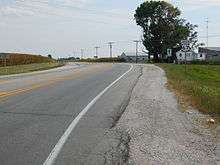
US 67 enters Illinois from Iowa by way of the Centennial Bridge that cross the Mississippi River. It is mostly two-lane highway from Rock Island to Monmouth where 67 intersects US 34. From Monmouth, US 67 is interplexed with US 34 until US 34 exits to run west toward Burlington, Iowa. From Monmouth to Macomb, US 67 is a "Super Four" 65 mph (105 km/h), four-lane highway. The Roseville Bypass was one of the last bypasses for this section and was completed in 2002. There is a section at Good Hope where the highway runs through town with signals and an at-grade rail crossing.
In Macomb, US 67 runs through town as a four-lane arterial road which has an at-grade railroad crossing and several signals. Exiting Macomb, US 67 is a two-lane highway until it reaches just west of Chapin. From west of Chapin to just north of Roodhouse, US 67 is a "Super Four" 65 mph (105 km/h), four-lane highway. The portion that passes to the west of Jacksonville is limited access. The limited access section runs for approximately 7 mi (11 km). From where the four-lane highway ends north of Roodhouse to 7 mi (11 km) south of Jerseyville (just south of the future Delhi Bypass) US 67 is a two-lane highway.
Construction of a new partial-access, divided four-lane expressway route for US 67 between Jacksonville and Alton will follow the US 67 corridor through White Hall, Carrollton, and Jerseyville.[3] Once complete, the new US 67 expressway will end in the north St. Louis suburb of Godfrey and travel on as IL 255, with US 67 leaving the roadway via an exit and flyover ramp—constructed during the final segment of IL 255 in 2014—and proceeding south on Godfrey Road to reach Clark Bridge via the current US 67 alignment (Martin Luther King Jr. Drive) through Alton. The first segment of the four-lane expressway north of IL 255—5.2 miles from south of the Delhi Bypass to IL 255—was completed in 2013 at a cost of $45.6 million.[4] The Illinois Department of Transportation’s 2019-2024 multi-year program (MYP) contains $24.4 million to construct the next 3.2 miles of four-lane expressway, including the Delhi Bypass.[5]
US 67 is an urban roadway through Godfrey and Alton, shifting between two and four lanes, until it exits Illinois by way of the Clark Bridge across the Mississippi River into St. Charles County, Missouri.
History
In 1918, the Illinois State Legislature established State Bond Issue (SBI) for the establishment of a state road system.[6] The route for Illinois 3 went from Cairo Junction to Morrison via Rock Island.
With the completion of highway bridges over the Mississippi River, Route 67 was extended from St. Louis to Godfrey and replaced the original Illinois 3 to Rock Island.
The original northern terminus of US 67 was in Missouri under the US highway enumeration scheme of 1926, likely due to limited bridge crossings over the Mississippi and Missouri Rivers. By 1932, with a Mississippi River crossing route determined, US 67 was extended north along Illinois Route 3 to Rock Island.
Even though the Old Clark Bridge had been opened to traffic across the Mississippi River at Alton in 1928, US 67 originally crossed the Mississippi River with U.S. Route 66 via the McKinley Bridge from St. Louis to Venice. From Venice, US 67 headed north along what had been Illinois 3 via Alton to Rock Island. The original route of IL 3 from Alton to Jacksonville that became US 67 went through East Newbern, Jerseyville, and Carrollton.
In 1926, the northern terminus of U.S. Route 67 was at Alt. US 61 near Fredericktown, Missouri. The route was extended north on Illinois Route 3 (through western Illinois) to its northern terminus in Rock Island, Illinois by 1932. Sometime after 1940, US 67 was routed into Madison County. Then, it was co-signed with Route 66 as both routes went across the McKinley Bridge.
By the mid-1940s, US 67 had been rerouted from St. Louis to Alton via the Lewis Bridge over the Missouri River and the Clark Bridge (formerly the Old Clark Bridge) over the Mississippi River. The Alton to Jerseyville section now passed through Godfrey and Delhi. By the mid-1950s, a more direct route for US 67 from Godfrey towards Jacksonville via Greenfield had opened. Heading north from downtown Alton, US 67 was rerouted via an abandoned railroad grade to the northern end of town.
Between Fort Bellefontaine, Missouri (near Lewis Bridge) and south of St. Louis, US-67 followed two different routes. Route 67 originally followed Lewis and Clark Blvd. south to St. Louis, while Alternate US-67 turned west on Lindbergh Blvd. through Florissant past Lambert/St. Louis Int'l airport. Alt 67 was reposted as Route 267 along Lindbergh Blvd. In the late 1960s these routes were "flipped" with US-67 proceeding through Florissant and Hazelwood.
In 1962 another reroute took place, due to the completion of a new river bridge over the Illinois River at Beardstown. A new direct route was constructed from this bridge at Beardstown to Rushville, eliminating the earlier US-67 eastern route northeast along current IL-100 to Frederick then turning north to Rushville. A western bypass of downtown Rushville was completed a couple of years later.
In 1964, Route 3 replaced US 67A as St. Louis started to eliminate highways such as 67A. A new four-lane Route 3 opened a few years later.
In 1968, US-67 was rerouted on a more western route between Jacksonville and Beardstown. The route was the existing IL-104 (Jacksonville to near Merodosia) and IL-100 (near Merodosia to Beardstown). The original US-67 road passed through Virginia on what is now IL-78 (Jacksonville to Virginia) and then on IL-125 (Virginia to Beardstown), which follows the historic Beardstown Post Road and Ohio & Mississippi Railroad right-of-way (later part of Baltimore and Ohio Railroad (B&O) system before abandonment) between Beardstown and Springfield.
Before 1994, US 67 passed through Alton on Belle Street. After 1994, US 67 got a new bridge as well as a new route through Alton. In the summer of 1994, parts of the road were demolished in a span of 8–10 weeks. Today, the road now runs from Godfrey to Jerseyville to Jacksonville using what used to be IL 267. The old IL 67 that ran through Brighton, IL to Jacksonville is now IL 267.
Proposed Freeway (FAP 413)
In the late 1960s and early 1970s, a major supplemental freeway system plan was proposed, with the goal of providing Illinois residents access to freeways within 30 minutes or less. One of the proposed routes, FAP 413, was a route that would have extended from the Quad Cities to Interstate 270 in the East St. Louis area, largely along the current U.S 67 alignment.[7] However, the vast majority of the freeway was never built, due to lack of funding.
Future
While most of the above-mentioned freeway was never built, some portions were. The very southern portion between I-270 and Alton, signed as Illinois Route 255, was completed in 2012. A small bypass to the west of Jacksonville was completed in 1998. A bypass around Jerseyville is planned.
The rest of the original FAP 413 corridor is under study for construction as an expressway.[8]
Alternate routes
Alternate U.S. Route 67
There were two Alt US 67's in Madison County. The first started south of Alton, the second, north. When US 67 was switched to the Clark Bridge sometime before the mid-1940s, the earlier route of US 67 from St. Louis to Alton became Alt US 67. In the mid-1940s, Alt US 67 was switched from the McKinley Bridge to the MacArthur Bridge. By 1965, the Alt US 67 designation had been dropped and the IL 3 designation had returned to this route. The original IL 3 roadway had been replaced by new alignments in places over the years, however. When US 67 was shifted to a more direct route north of Alton between Godfrey and Jacksonville by the mid-1950s, the old route via Jerseyville and Carrollton became Alt US 67. This designation lasted until around 1965 when the route became IL 267.
Illinois Route 267
Illinois Route 267 was once Alt US 67 from the mid-1950s to 1965 as it went from Godfrey through Jerseyville on its way to meet up with US 67 about ten miles (16 km) south of Jacksonville. This route, despite being one of the most dangerous in central Illinois, has remained unchanged over the years.
In 2001, IDOT rerouted US-67 back onto the original (1940) routing (western route) north of Alton to Murrayville and IL-267 was put onto the newer alignment (eastern route) from near Murrayville through Greenfield to Medora. South of Medora to Godfrey the road retained only IL-111, a second number on this section. The rerouting was to accommodate a future "Corridor 67" expressway that will be built within the next decade or so. IDOT construction began in 2004 near Jacksonville. The new expressway is supposed to follow the corridor through White Hall, Carrollton, and Jerseyville and will end in Godfrey.
Major intersections
| County | Location | mi[9] | km | Destinations | Notes | |||
|---|---|---|---|---|---|---|---|---|
| Mississippi River | 0.0 | 0.0 | Continuation into Missouri | |||||
| Clark Bridge | ||||||||
| Madison | Alton | 0.6 | 0.97 | Southern end of Great River Road overlap | ||||
| 1.4 | 2.3 | Northern end of Great River Road overlap | ||||||
| Godfrey | 5.0 | 8.0 | Southern end of IL 111 overlap | |||||
| 7.4 | 11.9 | Northern end of IL 111 overlap | ||||||
| 7.9 | 12.7 | Southbound exit and northbound entrance | ||||||
| Jersey | Jerseyville | 20.0 | 32.2 | |||||
| 20.2 | 32.5 | |||||||
| Greene | Carrollton | 34.0 | 54.7 | |||||
| White Hall | 44.0 | 70.8 | ||||||
| Scott |
No major junctions | |||||||
| Morgan | | 62.4 | 100.4 | Interchange; southern end of I-72 Bus. overlap | ||||
| Jacksonville | 65.1 | 104.8 | Interchange; northern end of I-72 Bus. overlap | |||||
| 67.1 | 108.0 | Interchange; southern end of IL 104 overlap | ||||||
| | 71.5 | 115.1 | Concord-Arenzville Road – Concord, Arenzville | Diamond interchange | ||||
| | 79.8 | 128.4 | Southern end of IL 100 overlap | |||||
| | 80.7 | 129.9 | Northern end of IL 104 overlap | |||||
| Cass | Beardstown | 94.1 | 151.4 | |||||
| Illinois River | 95.0 | 152.9 | Beardstown Bridge | |||||
| Schuyler | | 96.1 | 154.7 | Northern end of IL 100 overlap | ||||
| Rushville | 105.0 | 169.0 | ||||||
| | 113.3 | 182.3 | ||||||
| McDonough | | 129.4 | 208.2 | Southern end of US 136 overlap | ||||
| Macomb | 132.4 | 213.1 | Northern end of US 136 overlap; southern end of IL 110 overlap | |||||
| Good Hope | 138.6 | 223.1 | ||||||
| Warren | | 149.9 | 241.2 | |||||
| Roseville | 151.4 | 243.7 | ||||||
| | 153.8 | 247.5 | ||||||
| | 162.8 | 262.0 | Southern end of US 34 overlap | |||||
| Monmouth | 164.3 | 264.4 | Southern end of IL 164 overlap | |||||
| 165.8 | 266.8 | Northern end of US 34, IL 110, & IL 164 overlaps | ||||||
| | 175.8 | 282.9 | Southern end of IL 135 overlap | |||||
| Mercer | | 177.5 | 285.7 | Northern end of IL 135 overlap | ||||
| Viola | 187.0 | 300.9 | ||||||
| Rock Island | Coyne Center | 200.3 | 322.4 | |||||
| Milan | 204.6 | 329.3 | ||||||
| Rock Island | 206.0 | 331.5 | ||||||
| 213.8 | 344.1 | |||||||
| Mississippi River | 213.99 | 344.38 | Rock Island Centennial Bridge | |||||
| Continuation into Iowa | ||||||||
1.000 mi = 1.609 km; 1.000 km = 0.621 mi
| ||||||||
References
- Illinois Technology Transfer Center (2006). "T2 GIS Data". Retrieved 2007-11-08.
- Illinois Secretary of State (1931). Official Illinois Highway Map (Map). [c. 1:950,000 and c. 1:1,110,000]. Springfield: Illinois Secretary of State – via Illinois Digital Archives.
- "US 67 Corridor". www.idot.illinois.gov. Retrieved 2018-12-02.
- User, Super. "Rail developers join push to complete U.S. 67". www.ibjonline.com. Retrieved 2018-12-02.
- "2019-2024 IDOT Multi-Year Plan" (PDF). Illinois Department of Transportation. December 2, 2018. Retrieved December 2, 2018.
- Office of Illinois Secretary of State
- Priority Primary Routes (PDF) (Map). Illinois Department of Transportation. April 12, 1978. Retrieved March 23, 2010.
- "US 67 Corridor". Illinois Department of Transportation. Retrieved 14 October 2014.
- Google (March 21, 2017). "Overview Map of US 67" (Map). Google Maps. Google. Retrieved March 21, 2017.
External links

| Previous state: Missouri |
Illinois | Next state: Iowa |