Touch (river)
The Touch (French: le Touch, Occitan: Toish) is a 74.5 km (46.3 mi) long river in southwestern France, left tributary of the Garonne. Its source is in the département of Haute-Garonne, near Lilhac.
| Touch | |
|---|---|
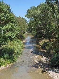 The Touch at Plaisance-du-Touch | |
 | |
| Location | |
| Country | France |
| Physical characteristics | |
| Source | |
| • location | Plateau de Lannemezan |
| • coordinates | 43°17′01″N 0°48′45″E |
| • elevation | 350 m (1,150 ft) |
| Mouth | |
• location | Garonne |
• coordinates | 43°37′22″N 01°24′01″E |
• elevation | 130 m (430 ft) |
| Length | 74.5 km (46.3 mi) |
| Basin size | 515 km2 (199 sq mi) |
| Discharge | |
| • average | 3.92 m3/s (138 cu ft/s) |
| Basin features | |
| Progression | Garonne→ Gironde estuary→ Atlantic Ocean |
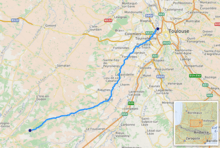
It flows through the following départements and towns:
- Haute-Garonne: Bérat, Lherm, Plaisance-du-Touch, Tournefeuille, Blagnac, Toulouse.
Notes
- This article is based on the equivalent article from the French Wikipedia, consulted on 19 January 2009.
References
This article is issued from Wikipedia. The text is licensed under Creative Commons - Attribution - Sharealike. Additional terms may apply for the media files.